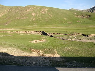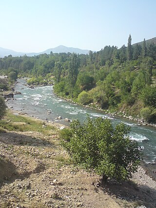
Alpine tundra is a type of natural region or biome that does not contain trees because it is at high elevation, with an associated harsh climate. As the latitude of a location approaches the poles, the threshold elevation for alpine tundra gets lower until it reaches sea level, and alpine tundra merges with polar tundra.

The South Saharan steppe and woodlands, also known as the South Sahara desert, is a deserts and xeric shrublands ecoregion of northern Africa. This band is a transitional region between the Sahara's very arid center to the north, and the wetter Sahelian Acacia savanna ecoregion to the south. In pre-modern times, the grasslands were grazed by migratory gazelles and other ungulates after the rainfalls. More recently, over-grazing by domestic livestock have degraded the territory. Despite the name of the ecoregion, there are few 'woodlands' in the area; those that exist are generally acacia and shrubs along rivers and in wadis.

The Altai alpine meadow and tundra ecoregion is a terrestrial ecoregion covering the higher elevation of the Altai Mountains at the center of the "X" formed by the borders separating Russia, Kazakhstan, China, and Mongolia. The mountain peaks are the farthest north in Central Asia, separating the plains of Siberia to the north from the hot, dry deserts to the south. Altitudes above 2,400 meters display characteristics of tundra, with patches of alpine meadows and some trees immediately below the treeline. The ecoregion is in the montane grasslands and shrublands biome, and the Palearctic realm, with a humid continental climate. It covers an area of 90,132 square kilometres (34,800 sq mi).

The Pamir alpine desert and tundra ecoregion covers the high plateau of the Pamir Mountains, at the central meeting of the great mountain ranges of Central Asia: Himalaya, Karakoram, Hindu Kush, Kunlun, and Tian Shan. It is a region of relatively high biodiversity due to its central location and high elevation differentials, but it also acts as a barrier between the climate and habitats of north and south Asia.

The Changbai Mountains mixed forests ecoregion covers the Changbai Mountains and surrounding foothills in China and North Korea. The region features extensive and naturally preserved deciduous and conifer forests. The region exhibits high biodiversity due to its relative isolation, temperate climate with high rainfall, and centrality to central Chinese, Siberian, and European floral communities. In 1979, a significant portion of the ecoregion was designated the Changbaishan Biosphere Reserve by UNESCO.

The Central Tibetan Plateau alpine steppe ecoregion covers the high alpine plateau that stretches over 1,600 kilometres (1,000 mi) across the Tibetan Plateau to Qinghai Lake in China. Because of the high altitude—much it over 5,000 metres (16,000 ft)—the region is a cold, arid desert that is only 20% covered with steppe and meadow vegetation. The area has been relatively free from human development due to the hostile climate and unsuitability for agriculture. The ecosystem is relatively intact, and supports herds of wild antelope, sheep, deer, and gazelles.

The Qilian Mountains subalpine meadows ecoregion covers the high meadows and shrubland of the Qilian Mountains, on the northeastern edge of the Tibetan Plateau in central China. These mountains form a divide between the dry regions of the Gobi Desert to the north, and the Qaidam Basin and the Tibetan Plateau to the south. While the habitat supports populations of marmots, grouse and some rare mammal species, the grasslands of the region are under pressure from over-grazing by domestic livestock.

The North Tibetan Plateau-Kunlun Mountains alpine desert ecoregion covers a long stretch of mostly treeless alpine terrain across the northern edge of the Tibet Plateau. A variety of cold, dry habitats are found, including alpine meadows, steppe, desert, and cushion plant floral areas.

The Tibetan Plateau alpine shrublands and meadows ecoregion covers the middle transition zone between the northern and southern regions of the Tibetan Plateau. The region supports both cold alpine steppe and meadows across a broad expanse of the plateau. Wild deer, antelope, and sheep roam the grasslands, but the habitat is increasingly being used to graze domestic livestock.

The Gissaro-Alai open woodlands ecoregion covers the western foothills winding around two western offshoots of the Tian Shan Mountains in western Tajikistan, and parts of eastern Uzbekistan and western Kyrgyzstan, in Central Asia. The woodlands are typically of Juniper trees and shrubs, fitting the altitude zone situated between the desert valley floor, and the tree line, above which the mountain ridges are glaciated and barren.

The East Afghan montane conifer forests ecoregion covers a series of unconnected conifer forests along the border between Afghanistan and Pakistan, at elevations of 2,000 metres (6,600 ft) to 3,400 metres (11,200 ft) above sea level. The ecoregion supports the near-threatened Markhor (Capra falconeri chiltanensis), known as the Screw-horned goat, the national animal of Pakistan. The forests of the ecoregion have been heavily thinned for timber.

The Afghan Mountains semi-desert ecoregion covers three disconnected interior valleys in the north of the mountains of Afghanistan. These valleys are arid, and covered mostly in thorny shrubs. Overgrazing by livestock has put pressure on the grasses and the wild animals dependent on them.

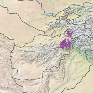
The Ghorat-Hazarajat alpine meadow ecoregion covers the high mountainous elevations of central Afghanistan. The ecoregion fans out to the west from the capital city of Kabul at the eastern point. Vegetation is thornbush meadows and alpine grassland. The region is the home of the critically endangered Afghan brook salamander, which depends on the cold waters of the high streams of the ecoregion.

The Kuh Rud and Eastern Iran montane woodlands ecoregion covers hills and mountains in central and eastern Iran. The habitat is wetter and cooler than the surrounding desert of the Iranian Plateau, supporting the vulnerable goitered gazelle and small populations of the cheetah. The ecoregion is under conservation threat from overgrazing and conversion of steep slopes to cultivation.

The Central Persian desert basins ecoregion covers the arid steppe and desert basins of central Iran, stretching into northwestern Afghanistan. The ecoregion extends over the Central Iranian Plateau, which is surrounded by mountain ranges and has no outlets to the sea. Much of the terrain is hot sand-and-gravel desert and large salt flats. The vegetation includes many specialized species of halophytes (salt-tolerant), xerophytes (drought-tolerant), and psammophile (sand-loving) plants.

The Central Afghan Mountains xeric woodlands ecoregion covers the xeric (dry) eastern and southern slopes of the central mountain range of Afghanistan, between the sandy desert to the south and the alpine meadows in the higher, wetter region to the north. Despite the 'woodlands' in the ecoregion name, very little of the territory is forested – less than 1% – but is instead sparse vegetation or herbaceous cover.

The Paropamisus xeric woodlands ecoregion covers the portion of northeastern Afghanistan north of the central mountain range and the Hindu Kush Mountains. The name is derived from the Old Persian name for the region, Parupraesanna. While there are low canopy woodlands in the northeast of the ecorgegion, most of the territory is desert or xeric (dry) scrubland.

The Baluchistan xeric woodlands ecoregion covers the middle elevations of a series of mountain ranges of western Pakistan and northeastern Afghanistan, reaching 1,200 kilometres (750 mi) from the Arabian Sea in the south to the Hindu Kush Mountains and the Himalayas in the north. The characteristic vegetation is xeric (dry) woodlands of shrubs and herbaceous cover. The region has rich biodiversity but relatively few endemic species.

The Sulaiman Range alpine meadows ecoregion covers a series of higher altitude mountain ranges along the crest of the Sulaiman Mountains, a southerly extension of the Hindu Kush Mountains along the Afghanistan-Pakistan border. The area is relatively undeveloped, with about a third of the terrain either forested or in 'alpine steppe' shrub or herbaceous cover.

The Davis Highlands tundra ecoregion covers the Baffin Mountains on the northeast coast of Baffin Island and Bylot Island, facing Baffin Bay in Nunavut, northern Canada. The terrain is extremely rugged, heavily glaciated, with many deep fjords, and very cold. About half of the territory is moss and lichen tundra, the other half bare rock and ice. The region is wetter than the much drier regions to the southwest of the Baffin Islands.


