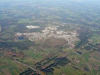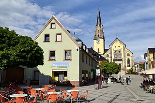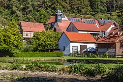
Penzberg is a city in the Weilheim-Schongau district, in Bavaria, Germany. It is located about 50 km south of Münich, and had a population of around 17,000 in 2020. A historic coal mining town, Penzberg today is known for its pharmaceutical industries.

Oberhaching is a municipality in Bavaria, Germany, with 13,638 inhabitants (2020) on an area of 26.6 km2 (10.3 sq mi). It is located 15 km (9.3 mi) south of Munich city centre and has a 1,250 year history.

Warngau is a municipality in the Miesbach District of Bavaria, Germany. It is located at 47°50′N11°44′E and has a population of 3,489. During the Nazi period, Warngau was falsely proclaimed to be the birthplace of Heinrich Himmler in order to obtain more support from rural voters; Himmler was actually born just outside Munich.

Selb is a town in the district of Wunsiedel, in Upper Franconia, Bavaria, Germany. It is situated in the Fichtelgebirge, on the border with the Czech Republic, 20 km northwest of Cheb and 23 km southeast of Hof.

Dietramszell is a municipality in the district of Bad Tölz-Wolfratshausen in Bavaria, Germany. The community of 5,282 (2005) residents sits 685 meters above sea level.

Marktredwitz is a town in the district of Wunsiedel, in Bavaria, Germany, close to the Czech border. It is situated 22 km west of Cheb, 50 km east of Bayreuth and 50 km south of Hof/Saale. Marktredwitz station is at the junction of the Nuremberg–Cheb railway and the Munich–Hof railway.

Haßfurt is a town in Bavaria, Germany, capital of the Haßberge district. It is situated on the river Main, 20 km east of Schweinfurt and 30 km northwest of Bamberg. In 1852, Ludwig's Western Railway reached the town and between 1892 and 1995, which also had a branch line to Hofheim. The 1867 Hassfurt Bridge, thought to be the first Cantilever bridge built, was also there.

Hauzenberg is a municipality in the district of Passau, in Bavaria, Germany. It is situated 15 kilometres northeast of Passau.

Geisenfeld is a town in the district of Pfaffenhofen, in Bavaria, Germany. It is situated on the river Ilm, 16 km (9.94 mi) southeast of Ingolstadt. The town grew up around Geisenfeld Abbey, a convent founded in 1037.

Schwarzenbach an der Saale is a town in the district of Hof, in Bavaria, Germany. It is situated on the river Saale, 11 km south of Hof. Within the town is the Gedenkstätte Langer Gang, a memorial to the Nazi victims of the Helmbrechts concentration camp, which was near Schwarzenbach an der Saale, and particularly of the victims of the death march from Helmbrechts concentration camp to Volary.

Stadtsteinach is a town in the district of Kulmbach, in Bavaria, Germany. It is situated in the Frankenwald, 8 km northeast of Kulmbach.

Tüßling is a town in the district of Altötting in Bavaria in Germany.

Teugn is a municipality in the district of Kelheim in Bavaria in Germany.

Haag in Oberbayern is a municipality in the district of Mühldorf in Bavaria in Germany, in December 2013 the municipality had a population of 6359.

Höchberg is a municipality in the district of Würzburg in Bavaria, Germany. Höchberg borders, in the east, directly on the city of Würzburg. Höchberg consists of two main urban areas: Altort and Hexenbruch. Residential construction areas have been added in recent years, for example "Mehle" and " Mehle II".

Amerdingen is a municipality in the district of Donau-Ries in Bavaria in Germany.

Wegscheid is a municipality in the district of Passau in Bavaria in Germany.

Neubeuern is a municipality in the district of Rosenheim in Bavaria in Germany. It lies on the river Inn.

Staudach-Egerndach is a municipality in the district of Traunstein in Bavaria, Germany.

Frickenhausen am Main is a municipality in the district of Würzburg in Bavaria, Germany. It lies on the river Main. Frickenhausen is one of the oldest towns of Mainfranken with a beautiful town center.


