
Kensington is an area of London in the Royal Borough of Kensington and Chelsea, around 2.9 miles (4.6 km) west of Central London.

Shepherd's Bush is a suburb of West London, England, within the London Borough of Hammersmith and Fulham 4.9 miles (7.9 km) west of Charing Cross, and identified as a major metropolitan centre in the London Plan.

Portsea Island is a flat and low-lying natural island 24.5 square kilometres in area, just off the southern coast of Hampshire in England. Portsea Island contains the majority of the city of Portsmouth.
Holland Park is an area of Kensington, on the western edge of Central London, that lies within the Royal Borough of Kensington and Chelsea and largely surrounds its namesake park, Holland Park.

Southfields is a district of inner London located within the London Borough of Wandsworth, England, 5.6 miles (9 km) south-west of Charing Cross. Southfields is mainly residential, historically a part of Wandsworth itself, and is divided between the SW18 and SW19 postcode areas.

In landscaping, an avenue, alameda, or allée, is traditionally a straight path or road with a line of trees or large shrubs running along each side, which is used, as its Latin source venire indicates, to emphasize the "coming to," or arrival at a landscape or architectural feature. In most cases, the trees planted in an avenue will be all of the same species or cultivar, so as to give uniform appearance along the full length of the avenue.

Raynes Park is a residential suburb, railway station and local centre near Wimbledon, London, and is within the London Borough of Merton. It is situated southwest of Wimbledon Common, to the northwest of Wimbledon Chase and to the east of New Malden, in South West London. It is 7.8 miles (12.5 km) southwest of Charing Cross. Towards the north and west, either side of the borough boundary with the Royal Borough of Kingston upon Thames are the areas of Copse Hill and Coombe with their large detached houses, golf courses and gated lands. Raynes Park had a population of 19,619 in 2011, which refers to the populations of the wards of Raynes Park and West Barnes.
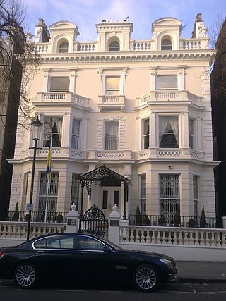
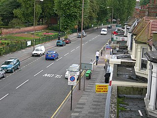
Holland Road is a road in Kensington, London, which connects Kensington High Street with the Holland Park roundabout. The southernmost section is one-way and forms part of the Kensington/Earl's Court one-way system.

Bathurst Street is a main north–south thoroughfare in Toronto, Ontario, Canada. It begins at an intersection of the Queens Quay roadway, just north of the Lake Ontario shoreline. It continues north through Toronto to the Toronto boundary at Steeles Avenue. It is a four-lane thoroughfare throughout Toronto. The roadway continues north into York Region where it is known as York Regional Road 38.

Keele Street is a north–south road in Toronto, Vaughan and King in Ontario, Canada. It stretches 47 kilometres (29 mi), running from Bloor Street in Toronto to the Holland Marsh. South of Bloor Street, the roadway is today known as Parkside Drive, but was originally part of Keele Street. It was renamed in 1921 by the City of Toronto.

West Kensington, formerly North End, is an area in the ancient parish of Fulham, in the London Borough of Hammersmith and Fulham, England, 3.4 miles (5.5 km) west of Charing Cross. It covers most of the London postal area of W14, including the area around Barons Court tube station, and is defined as the area between Lillie Road and Hammersmith Road to the west, Fulham Palace Road to the south, Hammersmith to the north and West Brompton and Earl's Court to the east. The area is bisected by the major London artery the A4, locally known as the Talgarth Road. Its main local thoroughfare is the North End Road.
Cornell is a neighbourhood in northeast Markham, Ontario and bounded by Highway 407, 16th Avenue, Ninth Line, and the Donald Cousens Parkway. The 2011 population of this area was 9,880. Adding Cornell North's 2,178 it has 12,058 residents.

Scott Circle is an area in the northwest quadrant of Washington, D.C. that is centred on the junction of Massachusetts Avenue, Rhode Island Avenue, and 16th Street, N.W. Originally a neighborhood recreational area like nearby Dupont Circle, Scott has lost all social uses except as the location for public memorials.

Shepherd's Bush Green is an approximately 8-acre (3.2 ha) triangular area of open grass surrounded by trees and roads with shops in Shepherd's Bush, an area of west London which takes its name from the Green. The Green is also a ward of the London Borough of Hammersmith and Fulham. The population of the ward at the 2011 Census was 12,175.

Brook Green is an affluent sub-neighbourhood of Hammersmith in the London Borough of Hammersmith and Fulham. Located approximately 3.6 miles (5.8 km) west of Charing Cross, it is bordered by Kensington, Holland Park, Shepherd's Bush, Hammersmith and Brackenbury Village.

The Avenues is an area of high status Victorian housing located in the north-west of Kingston upon Hull, England. It is formed by four main tree-lined straight avenues running west off the north-north-east/south-south-west running Princes Avenue.
Sutton Common is the name of former common land and a district and neighbourhood located in Sutton, London. The area is mostly located within the London Borough of Sutton, with some of the streets to the north and west of Sutton Common Park adjoining Lower Morden and Morden within the London Borough of Merton. Much of the area is taken up by the large Kimpton Park commercial and industrial estate, adjoining the A217. It is served by Sutton Common railway station. The area to the south and east of Oldfields Road uses an SM1 postcode and the area to the north and west uses SM3.
Well Hall is a place to the north of Eltham in the Royal Borough of Greenwich in southeast London, England, with no present formal boundaries and located 13.5 km (8.4 mi) east-southeast of Charing Cross. In the past Well Hall was the grounds of a manor house, and then a hamlet. Today it is a largely residential suburb and housing estate absorbed by the development of Eltham and London. It is centred on the main road between Eltham and Woolwich, on which many shops and businesses are located. Several major A roads including the South Circular Road and A2 road pass through the area, as does a railway line, serving Eltham station which is located in Well Hall. The Postcode that covers Well Hall and most of the Eltham area is SE9, and the 020 dialing covers the entire Royal Borough of Greenwich. Well Hall is split across two electoral wards, Eltham West on the west side of Well Hall Road, and Eltham North on the east side of Well Hall Road. In 2015 the population of these two wards combined was recorded as 24,621, although the wards cover a larger area than just Well Hall.

Elm Grove is a mainly residential area of Brighton, part of the English coastal city of Brighton and Hove. The densely populated district lies on a steep hill northeast of the city centre and developed in the second half of the 19th century after the laying out of a major west–east road, also called Elm Grove. Terraced houses, small shops and architecturally impressive public buildings characterise the streetscape: within the area are a major hospital, two churches and a former board school, as well as Brighton's oldest council houses and an interwar council estate.


