Hollandale, Mississippi

Last updated
Hollandale, Mississippi
Hollandale MS Welcome Sign.jpg
Washington County Mississippi Incorporated and Unincorporated areas Hollandale Highlighted.svg
Location of Hollandale, Mississippi
Usa edcp location map.svg
Red pog.svg
Hollandale, Mississippi
Location in the United States
Coordinates: 33°10′24″N90°51′19″W / 33.17333°N 90.85528°W / 33.17333; -90.85528 Coordinates: 33°10′24″N90°51′19″W / 33.17333°N 90.85528°W / 33.17333; -90.85528
Country United States
State Mississippi
County Washington
Area
[1]
  Total2.22 sq mi (5.74 km2)
  Land2.22 sq mi (5.74 km2)
  Water0.00 sq mi (0.00 km2)
Elevation
115 ft (35 m)
Population
 (2020)
  Total2,323
  Density1,048.29/sq mi (404.83/km2)
Time zone UTC-6 (Central (CST))
  Summer (DST) UTC-5 (CDT)
ZIP code
38748
Area code 662
FIPS code 28-32900
GNIS feature ID0671293

Hollandale is a city in Washington County, Mississippi, United States. The population was 2,323 at the 2020 census. [2]

Contents

Deer Creek flows through Hollandale, and the Leroy Percy State Park is west of the city along Mississippi Highway 12. The Hollandale Municipal Airport is northeast of the city.

A 2008 study by the University of North Carolina described Hollandale as "a small community that has been mired in poverty for decades." [3]

History

Hollandale was named for Dr. Holland, the original owner of the town site. [4]

Hollandale was incorporated in 1890, and almost completely destroyed by fire in 1904. [5]

A one-room school house in Hollandale was founded by Emory Peter "E.P." Simmons in 1891. One of the first schools for African-American children in the area, it was used until 1923, when financial support from the Rosenwald Fund enabled the construction of a larger brick school. Simmons worked as an educator and administrator for 52 years, and Simmons High School in Hollandale is named in his honor. [6]

Thomas Roosevelt "T.R." Sanders was a noted community leader. Sanders was principal of Simmons High School for 33 years, and the first superintendent of the Hollandale Colored School District. Sanders developed 'Sanders Estates', the town's first subdivision, and organized an association which provided running water to neighboring Sharkey County. Sanders was the first African-American in Mississippi to receive a master's degree in educational administration. [6] [7]

During the Civil Rights Movement, Hollandale was noted for having passed an ordinance forbidding white civil rights workers from living with black citizens. [8]

A marker on the Mississippi Blues Trail dedicated to musician Sam Chatmon is located in Hollandale, as is a marker on the Mississippi Country Music Trail dedicated to Ben Peters.

Hollandale resident Capt. Kermit O. Evans was recognized by the U.S. Congress in 2007 after losing his life in Operation Iraqi Freedom. [9]

The Farm Fresh Catfish processing plant was located in Hollandale until it closed in 2004, laying off 240 workers. The Delta & Pine Land Company of Mississippi, a cotton and soybean producer owned by Monsanto, continues to be a major employer. [3]

Geography

According to the United States Census Bureau, the city has a total area of 2.2 square miles (5.7 km2), all of it land.

Demographics

Historical population
CensusPop.Note
1900 325
1910 48148.0%
1920 79966.1%
1930 1,21151.6%
1940 1,60632.6%
1950 2,34646.1%
1960 2,64612.8%
1970 3,26023.2%
1980 4,33633.0%
1990 3,576−17.5%
2000 3,437−3.9%
2010 2,702−21.4%
2020 2,323−14.0%
U.S. Decennial Census [10]

2020 census

Hollandale Racial Composition [11]
RaceNum.Perc.
White 1928.27%
Black or African American 2,06889.02%
Other/Mixed 482.07%
Hispanic or Latino 150.65%

As of the 2020 United States Census, there were 2,323 people, 802 households, and 513 families residing in the city.

2013 ACS

As of the 2013 American Community Survey, there were 2,695 people living in the city. 87.0% were African American, 12.9% White and 0.1% Native American.

2000 census

As of the census [12] of 2000, there were 3,437 people, 1,104 households, and 803 families living in the city. The population density was 1,536.3 inhabitants per square mile (593.2/km2). There were 1,156 housing units at an average density of 516.7 per square mile (199.5/km2). The racial makeup of the city was 16.06% White, 83.21% African American, 0.09% Asian, and 0.64% from two or more races. Hispanic or Latino of any race were 0.76% of the population.

There were 1,104 households, out of which 37.1% had children under the age of 18 living with them, 34.9% were married couples living together, 32.6% had a female householder with no husband present, and 27.2% were non-families. 24.7% of all households were made up of individuals, and 13.0% had someone living alone who was 65 years of age or older. The average household size was 3.10 and the average family size was 3.72.[ citation needed ]

In the city, the population was spread out, with 35.4% under the age of 18, 10.8% from 18 to 24, 24.9% from 25 to 44, 18.0% from 45 to 64, and 11.0% who were 65 years of age or older. The median age was 28 years. For every 100 females, there were 80.5 males. For every 100 females age 18 and over, there were 69.9 males.[ citation needed ]

The median income for a household in the city was $20,135, and the median income for a family was $25,313. Males had a median income of $23,194 versus $17,353 for females. The per capita income for the city was $9,251. About 28.4% of families and 38.6% of the population were below the poverty line, including 52.7% of those under age 18 and 24.9% of those age 65 or over.[ citation needed ]

Education

The City of Hollandale is served by the Hollandale School District.

Notable people

Related Research Articles

<span class="mw-page-title-main">Yazoo County, Mississippi</span> County in Mississippi, United States

Yazoo County is a county located in the U.S. state of Mississippi. As of the 2020 census, the population was 26,743. The county seat is Yazoo City. It is named for the Yazoo River, which forms its western border. Its name is said to come from a Choctaw language word meaning "River of Death."

<span class="mw-page-title-main">Washington County, Mississippi</span> County in Mississippi, United States

Washington County is a county located in the U.S. state of Mississippi. As of the 2020 census, the population was 44,922. Its county seat is Greenville. The county is named in honor of the first president of the United States, George Washington. It is located to the Arkansas border.

<span class="mw-page-title-main">Sharkey County, Mississippi</span> County in Mississippi, United States

Sharkey County is a county located in the U.S. state of Mississippi. Part of the eastern border is formed by the Yazoo River. According to the 2020 census, the population was 3,800, making it the second-least populous county in Mississippi, after Issaquena County. Its county seat is Rolling Fork. The county is named after William L. Sharkey, the provisional Governor of Mississippi in 1865.

<span class="mw-page-title-main">Carroll County, Mississippi</span> County in Mississippi, United States

Carroll County is a county in the U.S. state of Mississippi. As of the 2020 census, the population was 9,998. Its county seats are Carrollton and Vaiden. The county is named for Charles Carroll of Carrollton, the last surviving signatory of the Declaration of Independence.

<span class="mw-page-title-main">Cuthbert, Georgia</span> City in Georgia, United States

Cuthbert is a city in, and the county seat of, Randolph County, Georgia, United States. The population was 3,520 in 2019.

<span class="mw-page-title-main">Hollandale, Minnesota</span> City in Minnesota, United States

Hollandale is a city on State Highway 251 in Freeborn County, Minnesota, United States. The population was 303 at the 2010 census.

<span class="mw-page-title-main">Shelby, Mississippi</span> City in Mississippi, United States

Shelby is a city in Bolivar County, Mississippi, United States. The population was 2,229 at the 2010 census, down from 2,926 in 2000. The town of Shelby was established in 1853 by Tom Shelby, who had purchased a block of land there from the federal government.

<span class="mw-page-title-main">Bruce, Mississippi</span> Town in Mississippi, United States

Bruce is a town situated along the Skuna River in Calhoun County, Mississippi, United States. As of the 2010 census, it had a population of 1,939.

<span class="mw-page-title-main">Coahoma, Mississippi</span> Town in Mississippi, United States

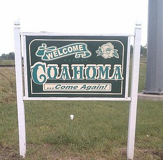
Coahoma is a town in Coahoma County, Mississippi, United States. Per the 2020 census, the population was 229.

<span class="mw-page-title-main">Hernando, Mississippi</span> City in Mississippi, United States

Hernando is a city in, and the county seat of, DeSoto County, which is on the northwestern border of Mississippi, United States. The population was 17,138 according to the 2020 census records. DeSoto County is the second-most-populous county in the Memphis metropolitan area, which includes counties in Tennessee, Arkansas and Mississippi.

<span class="mw-page-title-main">Bolton, Mississippi</span> Town in Mississippi, United States

Bolton is a town in Hinds County, Mississippi, United States. The population was 567 at the 2010 census, down from 629 at the 2000 census. It is part of the Jackson Metropolitan Statistical Area.

<span class="mw-page-title-main">Sandersville, Mississippi</span> Town in Mississippi, United States

Sandersville is a town in Jones County, Mississippi, United States. The population was 636 at the 2020 census, down from 731 at the 2010 census. It is part of the Laurel micropolitan area.

<span class="mw-page-title-main">Saltillo, Mississippi</span> City in Mississippi, United States

Saltillo is a city in Lee County, Mississippi, located in the northern part of the Tupelo micropolitan area. The population was 4,922 at the 2020 Census.

<span class="mw-page-title-main">Madison, Mississippi</span> City in Mississippi, United States

Madison is a city in Madison County, Mississippi, United States. The population was 27,747 at the 2020 census. It is part of the Jackson Metropolitan Statistical Area.

<span class="mw-page-title-main">Forest, Mississippi</span> City in Mississippi, United States

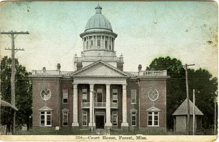
Forest is a city and the county seat of Scott County, Mississippi, United States. The population was 5,684 at the 2010 census and the population is a minority-majority.

<span class="mw-page-title-main">Rolling Fork, Mississippi</span> City and county seat in Mississippi, United States

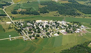
Rolling Fork is a city and county seat of Sharkey County, Mississippi, United States. As of the 2020 census, the population of the town was 1,883.

<span class="mw-page-title-main">Arcola, Mississippi</span> Town in Mississippi, United States

Arcola is a town in Washington County, Mississippi. The population was 361 at the 2010 census.

<span class="mw-page-title-main">Hollandale, Wisconsin</span> Village in Wisconsin, United States

Hollandale is a village in Iowa County, Wisconsin, United States. The population was 306 at the 2020 census. It is part of the Madison Metropolitan Statistical Area.

<span class="mw-page-title-main">Helena–West Helena, Arkansas</span> Place in Arkansas, United States

Helena–West Helena is the county seat of and the largest city within Phillips County, Arkansas, United States. The current city was consolidated, effective January 1, 2006, from the two Arkansas cities of Helena and West Helena. Helena is sited on lowlands between the Mississippi River and the eastern side of Crowley's Ridge. West Helena is located on the western side of Crowley's Ridge, a geographic anomaly in the typically flat Arkansas Delta. The Helena Bridge, one of Arkansas' four Mississippi River bridges, carries U.S. Route 49 across to Mississippi. The combined population of the two cities was 15,012 at the 2000 census and at the 2010 census, the official population was 12,282.

<span class="mw-page-title-main">Eupora, Mississippi</span> City in Mississippi, United States

Eupora is the largest city in Webster County, central Mississippi. The population was 2,197 at the 2010 census.

References

  1. "2020 U.S. Gazetteer Files". United States Census Bureau. Retrieved July 24, 2022.
  2. "United States Census Bureau" . Retrieved 2022-07-18.
  3. 1 2 Lambe, Will (Dec 2008). "Small Towns, Big Ideas" (PDF). School of Government, University of North Carolina at Chapel Hill. Archived from the original (PDF) on 2014-01-14. Retrieved 2013-09-06.
  4. Gannett, Henry (1905). The Origin of Certain Place Names in the United States. Govt. Print. Off. pp.  158.
  5. "Blues Locations – Mississippi – Hollandale – Welcome to Earlyblues.com – History Section" . Retrieved 2020-08-25.
  6. 1 2 "Landmarks, Legends and Lyrics" (PDF). Greenville and Washington County Convention and Visitors Bureau. Retrieved Sep 6, 2013.[ permanent dead link ]
  7. "Death's Elsewhere". Baltimore Sun. Sep 2, 1998.
  8. Rucker, Walter C. (2007). Encyclopedia of American Race Riots. Greenwood Press. ISBN   9780313333019.
  9. Congressional Record, V. 153, PT. 3, February 5, 2007 to February 16, 2007. U.S. Government. 2007. ISBN   9780160869754.
  10. "Census of Population and Housing". Census.gov. Retrieved June 4, 2015.
  11. "Explore Census Data". data.census.gov. Retrieved 2021-12-07.
  12. "U.S. Census website". United States Census Bureau . Retrieved 2008-01-31.
  13. "Ruby Andrews". Soulwalking. Retrieved Sep 6, 2013.
  14. "Sam Chatmon - Hollandale". Mississippi Blues Commission. Retrieved Sep 6, 2013.
  15. Congressional Record: Senate: Vol. 155 Part 5. U.S. Government. 2009.
  16. Peck, Peggy (June 18, 2005). "AMA President-Elect Initially Just Sought Steady Work". CNN.
  17. "PATRICIA COATS JESSAMY". Maryland State Archives. Retrieved Sep 6, 2013.
  18. Coy, Steve (27 March 2012). "How I Started MFJ and Its Very Early Days" . Retrieved 19 May 2016.
  19. "Ben Peters - Hollandale". Mississippi Country Music Trail. Retrieved Sep 6, 2013.
  20. "Johnny Rembert". Sports Reference. Retrieved Sep 6, 2013.
  21. Bays, Kenneth (Sep 2012). "Soulful Sounds" (PDF). Memorial.
  22. "Ulis Williams". Sports Reference. Archived from the original on October 22, 2012. Retrieved Sep 6, 2013.