Wayside, Mississippi | |
|---|---|
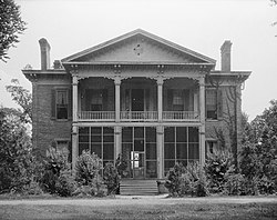 Belmont Plantation in Wayside is listed on the National Register of Historic Places | |
 Wayside, Mississippi | |
| Coordinates: Mississippi#USA 33°16′08″N91°02′01″W / 33.26889°N 91.03361°W | |
| Country | United States |
| State | Mississippi |
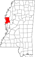
| County | Washington |
| Elevation | 121 ft (37 m) |
| Time zone | UTC-6 (Central (CST)) |
| • Summer (DST) | UTC-5 (CDT) |
| ZIP code | 38780 |
| Area code | 662 |
| GNIS feature ID | 679401 [1] |
Wayside is an unincorporated community in Washington County, Mississippi, United States.
Contents
The settlement has a post office and water tower. Wayside is located on Mississippi Highway 1 approximately 8 mi (13 km) south of Greenville. [2]