
Liberty County is a county located in the state of Florida, part of the Big Bend region. As of the 2020 census, the population was 7,974, making it the least populous county in Florida. Its county seat is Bristol. Torreya State Park and the Apalachicola National Forest are located within the county. The Apalachicola River runs through the county as well. Liberty County is the only dry county in Florida as Lafayette County prohibits bars, but not retail sale of beer.

Murray County is a county in the Northwest region of the U.S. state of Georgia. As of the 2020 census, the population was 39,973. The county seat is Chatsworth. Murray County is part of the Dalton, GA Metropolitan Statistical Area, which is also included in the Chattanooga-Cleveland-Dalton, TN-GA-AL Combined Statistical Area.

La Veta is a statutory town in Huerfano County, Colorado, United States. La Veta sits at the base of the Spanish Peaks on the Highway of Legends National Scenic Byway. The town population was 862 as of the 2020 United States Census.

Milton is a city and county seat of Santa Rosa County, Florida. It is located within the Pensacola Metropolitan Area. The city was first Incorporated in 1844, however certain areas such as East Milton, Point Baker, and Bagdad remain unincorporated. Milton is located in the geographic center of Santa Rosa County, and it is bordered by Pace to the west, and Navarre to the south. As of 2020, the population of the city of Milton was 10,197, up from 8,826 at the 2010 census.

Carrollton is a city in and the county seat of Carroll County, Georgia, United States. It is within western Georgia, about 45 miles (72 km) west of Atlanta near the Alabama state line, and is included in the Atlanta metropolitan area. It is the home of the University of West Georgia and West Georgia Technical College. In 2020, the city had a population of 26,738.

Carrier Mills, formerly Carrier's Mills and Morrilsville, also known as Catskin, is a village in Saline County, Illinois, United States. The population was 1,672 at the 2020 census. Carrier Mills was named after George Washington Carrier's saw and grist mills, and was one of the early Cairo and Vincennes Railroad boomtowns. Founded as a mill town and then a coal mining community, Carrier Mills has slowly lost 44% of its population since the 1920 census high of 3,000, due to the decline of the local coal industry. The village has primarily become a bedroom community, located seven miles (11 km) southwest of Harrisburg, which is the village's main source of employment, entertainment, and shopping. It is the third largest community in the Harrisburg Micropolitan Statistical Area outside of Eldorado and Harrisburg, and included in the Illinois-Indiana-Kentucky Tri-State Area. Carrier Mills also has a large African American population at 15%, compared to its neighbors, due to migration from the nearby community of Lakeview, the oldest African American settlement in the state of Illinois.

Harrisburg is a city in and the county seat of Saline County, Illinois, United States. It is located about 55 miles southwest of Evansville, Indiana, and 111 mi (179 km) southeast of St. Louis, Missouri. Its 2020 population was 8,219, and the surrounding Harrisburg Township had a population of 10,037, including the city residents. Harrisburg is included in the Illinois–Indiana–Kentucky tri-state area and is the principal city in the Harrisburg micropolitan statistical area with a combined population of 24,913.

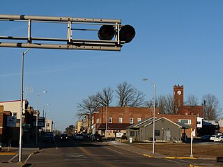
Mayfield is a home rule–class city and the county seat of Graves County, Kentucky, United States. The population was 9,623 as of the 2024 United States Census.

Magee is a city in Simpson County, Mississippi, United States. It is part of the Jackson metropolitan area.

Chappaqua is a hamlet and census-designated place in the town of New Castle, in northern Westchester County, New York. It is approximately 30 miles (50 km) north of New York City. The hamlet is served by the Chappaqua station of the Metro-North Railroad's Harlem Line. In the New York State Legislature it is within the New York State Assembly's 93rd district and the New York Senate's 40th district. In Congress the village is in New York's 17th District.

Elmsford is a village in Westchester County, New York, United States. It is part of the New York metropolitan area. Roughly one square mile, the village is fully contained within the borders of the town of Greenburgh. As of the 2010 census, the population of Elmsford was 4,664.

Shinnston is a city and former coal town in Harrison County, West Virginia, United States, along the West Fork River. In 1778, Levi Shinn constructed his log home along what is now Route 19; today it is the oldest standing structure in north-central West Virginia. As of the 2020 census, Shinnston had a population of 2,332.
Stanley is a city in Chippewa and Clark counties in the U.S. state of Wisconsin. The population was 3,804 at the 2020 census. Of this, 3,804 were in Chippewa County, and none were in Clark County.

Stamford is a city on the border of Jones and Haskell counties in west-central Texas, United States. The population was 2,907 at the 2020 census. Henry McHarg, president of the Texas Central Railroad, named the site in 1900 for his hometown of Stamford, Connecticut. The city is home to the Texas Cowboy Reunion.
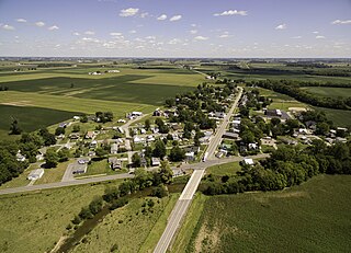
Vaughnsville is an unincorporated community and census-designated place in southern Sugar Creek Township, Putnam County, Ohio, United States. It has a post office with the ZIP code 45893. It lies along State Route 115 at its intersection with State Routes 12 and 189. The population was 278 at the 2020 census.

Liberty Mills is an unincorporated community on the Eel River in Chester Township, Wabash County, in the U.S. state of Indiana. Proprietor John Comstock (1802–1879) platted the town June 24, 1837. The name Liberty Mills comes from the number of mills the town once operated, including a saw mill, a carding mill, and a distillery, with one of the mills coming from the ‘Liberty’ brand. Its ZIP code is 46946.
Myakka City is an unincorporated community in southeastern Manatee County, Florida, United States. It lies along State Road 70 near the city of Bradenton, the county seat of Manatee County. Its elevation is 43 feet (13 m), and it is located at 27°20′59″N82°9′41″W. Although Myakka is unincorporated, it has a post office, with the ZIP code of 34251; the ZCTA for ZIP code 34251 had a population of 6,351 at the 2010 census. up from 4,239 in 2000.
Alcolu is an unincorporated community and census-designated place (CDP) in Clarendon County, South Carolina, United States. As of the 2010 census, its population was 429. Alcolu has a post office with ZIP code 29001, which opened on August 17, 1888. It developed as a lumber and mill town.

Fleming is an unincorporated community in Liberty County, Georgia, United States. The community is 10.2 miles (16.4 km) east-northeast of Hinesville. A post office at Fleming was established in 1869 and remained in operation until March 9, 2013; it still has its ZIP code, 31309. As of the United States Census 2010, the population of the 31309 ZIP Code Tabulation Area was 1,210.

Robert Flournoy Hosford was an American politician. He was a member of the Democratic Party. Born in Georgia, he served in both the Florida Senate and the Florida House of Representatives.


