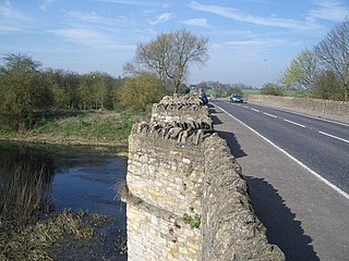
The Oxford Canal is a 78-mile (126 km) narrowboat canal in southern central England linking the City of Oxford with the Coventry Canal at Hawkesbury via Banbury and Rugby. Completed in 1790, it connects to the River Thames at Oxford, and links with the Grand Union Canal, which it is combined with for 5 miles (8 km) between to the villages of Braunston and Napton-on-the-Hill.

Rugby is a market town in eastern Warwickshire, England, close to the River Avon. At the 2021 census, its population was 78,117, making it the second-largest town in Warwickshire. It is the main settlement within the larger Borough of Rugby, which had a population of 114,400 in 2021.

Daventry is a market town and civil parish in the West Northamptonshire unitary authority area of Northamptonshire, England, close to the border with Warwickshire. At the 2021 Census, Daventry had a population of 28,123, making it the sixth-largest town in Northamptonshire.
Nuneaton is a market town in the borough of Nuneaton and Bedworth in northern Warwickshire, England, located adjacent to the county border with Leicestershire to the north-east. Nuneaton's population at the 2021 census was 88,813, making it the largest town in Warwickshire. Nuneaton's larger urban area, which also includes the large adjoining villages of Bulkington and Hartshill had a population of 99,372 in the 2021 census.
Lutterworth is a market town and civil parish in the Harborough district of Leicestershire, England. The town is located in southern Leicestershire, close to the borders with Warwickshire and Northamptonshire. It is located 6.4 miles north of Rugby, Warwickshire and 12 miles south of Leicester.

Atherstone is a market town and civil parish in the North Warwickshire district of Warwickshire, England. Located in the far north of the county, Atherstone is on the A5 national route, and is adjacent to the border with Leicestershire which is here formed by the River Anker. It is situated between the towns of Tamworth and Nuneaton. Atherstone is the administrative centre of the North Warwickshire district, with the offices of North Warwickshire Borough Council located in the town.

Warwickshire is a ceremonial county in the West Midlands of England. It is bordered by Staffordshire and Leicestershire to the north, Northamptonshire to the east, Oxfordshire and Gloucestershire to the south, and Worcestershire and the West Midlands county to the west. The largest settlement is Nuneaton and the county town is Warwick.

Rugby railway station serves the market town of Rugby in Warwickshire, England. The current station dates from 1885; two previous stations dating from 1838 and 1840 respectively, existed at locations to the west of the current one. It has been Rugby's only station, since the closure of the former Rugby Central station in 1969, on the now-abandoned Great Central Main Line route through the town. Between 1950 and 1970, the station was known as Rugby Midland before reverting to its original title. The station underwent an extensive remodelling between 2006 and 2008; new platforms were added and a new ticket office and entrance building were constructed. The original Victorian part of the station was retained in the upgrade.

Crick is a village in West Northamptonshire in England. It is close to the border with Warwickshire, six miles east of Rugby and 14 miles (23 km) northwest of Northampton. The villages of Crick and West Haddon were by-passed by the A428 main road from Rugby to Northampton when the Daventry International Rail Freight Terminal (DIRFT) was built in 1996. The terminal is a short distance east of junction 18 of the M1 motorway, which is next to Crick. Crick's population in the 2001 census was 1,460, increasing to 1,886 at the 2011 census.

Rugby Radio Station was a large British government radio transmission facility just east of the Hillmorton area of the town of Rugby, Warwickshire in England. The site straddled the A5 trunk road, with most of it in Warwickshire, and part on the other side of the A5 in Northamptonshire. First opened in 1926, at its height in the 1950s it was the largest radio transmitting station in the world, with a total of 57 radio transmitters, covering an area of 1,600 acres (650 ha). Traffic slowly dwindled from the 1980s onwards, and the site was closed between 2003 and 2007.
Hillmorton is a suburb of Rugby, Warwickshire, England, around 2 miles (3.2 km) south-east of Rugby town centre, forming much of the eastern half of the town. It is also a ward of the Borough of Rugby. Hillmorton was historically a village in its own right, but was incorporated into Rugby in 1932. Hillmorton also encompasses the Paddox housing estate to the west of the old village, which is shown on many maps as 'Hillmorton Paddox', this area however is part of a separate ward called 'Paddox'.

The Northampton loop is a railway line serving the town of Northampton. It is a branch of the West Coast Main Line, deviating from the faster direct main line which runs to the west. The WCML is a four track line up to either end of the Loop: the 'up' and 'down' fast tracks take the direct route while the 'up' and 'down' slow tracks are diverted via Northampton railway station. Generally, fast express trains run via the direct line, while freight and slower passenger services run via the loop line.
Brownsover is a residential and commercial area of Rugby, Warwickshire in England, about 1+1⁄2 miles north of the town centre. The area is named after the original hamlet of Brownsover. Since 1960, the area has been subsumed by the expansion of Rugby, with the construction of a number of housing estates, industrial estates and retail parks.
The A428 road is a major road in central and eastern England. It runs between the cities of Coventry and Cambridge by way of the county towns of Northampton and Bedford. Together with the A421,, the eastern section of the A428 forms the route between Cambridge and Oxford. The A428 was formerly part of the main route from Birmingham to Felixstowe before the A14 was fully opened in 1993.

Ashlawn School, is a large partially selective secondary school located in the Hillmorton area of Rugby, Warwickshire, England that specialises in science, computing and leadership. It is one of only five bilateral schools in England for students aged 11–18. Ashlawn is a member of the Transforming Lives Educational Trust (TLET) family of schools.
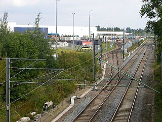
Daventry International Rail Freight Terminal (DIRFT) is a rail-road intermodal freight terminal with an associated warehousing estate in Northamptonshire, England. The facility is located at the junctions between the M1 motorway, A5 and A428 roads, 4 miles (6 km) east of Rugby and 6 miles (10 km) north of Daventry; it has a rail connection from the Northampton loop of the West Coast Main Line.

This is about the history of the town of Rugby, Warwickshire, England.

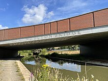
Clifton-upon-Dunsmore is a village and civil parish in the Rugby borough of Warwickshire in England on the north-eastern outskirts of Rugby, approximately 2 miles (3.2 km) from Rugby town centre. The population of the parish taken at the 2011 census was 1,304, increasing to 2,991 at the 2021 census. Clifton is counted as being part of the Rugby built-up area, but is considered separate from the town. The parish also includes the new development of Houlton to the south of the old village, which may account for the large population increase since 2011.

Rugby Parkway is a proposed railway station on the eastern outskirts of Rugby, promoted by Warwickshire County Council. It was the subject of a high level feasibility study which recommended the station to be located on the Northampton Loop Line, near the Hillmorton area of Rugby, and close to new housing in Houlton and DIRFT.
Houlton School is a co-educational secondary school and sixth form located in Houlton, Warwickshire, England. The school's buildings have been developed on the historic site of the Rugby Radio Station. Designed to serve 1100 students, the school opened on 1 September 2021 with its first cohort of 180 year 7 students.