Borough of Rugby

Last updated

Borough of Rugby
Regent Street, Rugby.jpg
Rugby, the largest settlement and administrative centre of the borough
Rugby UK locator map.svg
Shown within Warwickshire
Sovereign state United Kingdom
Constituent country England
Region West Midlands
Administrative county Warwickshire
Admin. HQ Rugby
Government
  Type Non-metropolitan borough
   MPs: Mark Pawsey (Rugby)
Jeremy Wright (Kenilworth and Southam)
Area
  Total135.6 sq mi (351.1 km2)
  Rank 101st
Population
 (2021)
  Total114,829
  Rank Ranked 210th
  Density850/sq mi (330/km2)
Ethnicity (2021)
[1]
   Ethnic groups
List
Religion (2021)
[1]
   Religion
List
Time zone UTC+0 (Greenwich Mean Time)
  Summer (DST) UTC+1 (British Summer Time)
ONS code 44UD (ONS)
E07000220 (GSS)

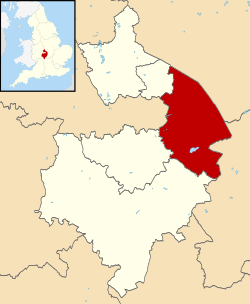
The Borough of Rugby is a local government district with borough status in Warwickshire, England. The borough comprises the town of Rugby where the council has its headquarters, and the rural areas surrounding the town. At the 2021 census the borough had a population of 114,400, of which 78,125 lived in the built-up area of Rugby itself and the remainder were in the surrounding areas.

Contents

Aside from Rugby itself, more notable settlements include Binley Woods, Brinklow. Dunchurch, Long Lawford, Monks Kirby, Wolston, Wolvey and the new large development of Houlton. It includes a large area of the West Midlands Green Belt in the mostly rural area between Rugby and Coventry.

Between 2011 and 2021, the population of Rugby borough saw a 14.3% increase in population from around 100,100 in to 114,400, meaning it has had the largest percentage increase of any local authority area in the West Midlands region since 2011. [2]

The borough extends from Coventry in the west to the borders with Leicestershire and Northamptonshire in the east, it borders the Warwickshire districts of Nuneaton and Bedworth to the north-west, Stratford-on-Avon to the south, and Warwick to the south-west. The Leicestershire districts of Hinckley and Bosworth, Blaby and Harborough are bordered to the north and north-east, whilst West Northamptonshire is bordered to the south-east.

History

The town of Rugby had been a local board district from 1849. [3] Such districts became urban districts in 1894. [4] At the same time the Rugby Rural District was created covering the surrounding rural parishes. [5] The urban and rural districts had separate councils, both based in Rugby. In 1932, Rugby Urban District was upgraded to become a municipal borough, and its boundaries were expanded to include most of Bilton, Brownsover, Hillmorton and Newbold-on-Avon. [6]

The present borough was created on 1 April 1974 by the Local Government Act 1972. It was created by a merger of the municipal borough of Rugby (which covered the town of Rugby) and the Rugby Rural District. [7] The new district was named Rugby after its largest settlement. [8] The district was awarded borough status from its creation, allowing the chair of the council to take the title of mayor, continuing Rugby's series of mayors dating back to 1932. [9]

Governance

Rugby Borough Council
Rugby Borough Council logo.svg
Type
Type
Leadership
Maggie O'Rourke,
Labour
since 18 May 2023
Derek Poole,
Conservative
since 18 May 2023
Mannie Ketley
since March 2020 [10]
Structure
Seats42 councillors
Political groups
Administration (20)
  Conservative (20)
Other parties (22)
  Labour (12)
  Liberal Democrats (10)
Length of term
4 years
Elections
First past the post
Last election
4 May 2023
Next election
2 May 2024
Meeting place
Rugby town hall.jpg
Town Hall, Evreux Way, Rugby, CV21 2RR
Website
www.rugby.gov.uk

Rugby Borough Council provides district-level services. County-level services are provided by Warwickshire County Council. [11] Much of the borough is also covered by civil parishes, which form a third tier of local government for their areas. [12]

Political control

The council has been under no overall control since the 2023 election, being led by a Conservative minority administration. [13]

Political control of the council since the 1974 reforms has been as follows [14]

Party in controlYears
No overall control 1974–1976
Conservative 1976–1979
No overall control 1979–1987
Conservative 1987–1990
No overall control 1990–2007
Conservative 2007–2016
No overall control 2016–2018
Conservative 2018–2023
No overall control 2023–present

Leadership

The role of mayor is largely ceremonial in Rugby. Political leadership is instead provided by the leader of the council. The leaders since 2002 have been: [15]

CouncillorPartyFromTo
Craig Humphrey [16] Conservative 200231 Aug 2014
Michael Stokes [17] Conservative 23 Sep 201416 May 2019
Seb Lowe Conservative 16 May 20197 May 2023
Derek Poole Conservative 18 May 2023

Composition

Following the 2023 election and by-elections in December 2023, the composition of the council was: [18] [19]

PartyCouncillors
Conservative 20
Labour 12
Liberal Democrats 10
Total42

The next election is due in 2024.

Elections

Since the last full review of boundaries in 2012 the council has comprised 42 councillors representing sixteen wards, with each ward electing either one or three councillors. Elections are held three years out of every four, with a third of the council being elected each time for a four-year term of office. Warwickshire County Council elections are held in the fourth year of the cycle when there are no borough council elections. [20] [21] [22]

Premises

The council is based at Rugby Town Hall on Evreux Way in the town centre, which was purpose-built for the old borough council and opened in 1961. [23]

Parishes

The borough of Rugby has 41 civil parishes mainly covering the rural areas of the borough. Rugby town is an unparished area and so does not have a separate town council. [24]

Here is a list of parishes in the borough, some of which contain several settlements. Where a parish contains more than one settlement these are listed in brackets:

Places of interest

Places of interest in Rugby town include:

Places of interest around Rugby include:

See also

Related Research Articles

<span class="mw-page-title-main">Rugby, Warwickshire</span> Town in Warwickshire, England

Rugby is a market town in eastern Warwickshire, England, close to the River Avon. At the 2021 census, its population was 78,117, making it the second-largest town in Warwickshire. It is the main settlement within the larger Borough of Rugby, which had a population of 114,400 in 2021.

<span class="mw-page-title-main">Nuneaton and Bedworth</span> Borough & Non-metropolitan district in England

}}

<span class="mw-page-title-main">North Warwickshire</span> Borough and non-metropolitan district in England

North Warwickshire is a local government district with borough status in Warwickshire, England. The borough includes the two towns of Atherstone and Coleshill, and the large villages of Polesworth, Kingsbury, Hartshill and Water Orton along with smaller villages and surrounding rural areas.

<span class="mw-page-title-main">Stratford-on-Avon District</span> Non-metropolitan district in Warwickshire, England

Stratford-on-Avon is a local government district in Warwickshire, England. The district is named after its largest town of Stratford-upon-Avon, but with a change of preposition; the town uses "upon" and the district uses "on". The council is based in Stratford-upon-Avon and the district, which is predominantly rural, also includes the towns of Alcester, Shipston-on-Stour and Southam, and the large villages of Bidford-on-Avon, Studley and Wellesbourne, plus numerous other smaller villages and hamlets and surrounding rural areas. The district covers the more sparsely populated southern part of Warwickshire, and contains nearly half the county's area. The district includes part of the Cotswolds, a designated Area of Outstanding Natural Beauty.

<span class="mw-page-title-main">Binley Woods</span> Village and civil parish in Warwickshire, England

Binley Woods is a suburban village and civil parish in Warwickshire, England. The village lies marginally beyond the eastern outskirts of Coventry, outside the formal city boundaries. Binley Woods is within the Borough of Rugby, although the town of Rugby is around 7 miles (11 km) to the east. In the 2021 census the parish had a population of 2,568.

<span class="mw-page-title-main">Wolston</span> Human settlement in England

Wolston is a village and civil parish in the Rugby borough of Warwickshire, England. The village is located approximately midway between Rugby and Coventry, with a population of 2,692 at the 2021 census. It is close to the A45 road and the Roman road the Fosse Way.

<span class="mw-page-title-main">Princethorpe</span> Human settlement in England

Princethorpe is a village and civil parish in the Rugby district of Warwickshire, England. In the 2011 census the parish had a population 376, increasing to 429 at the 2021 census.

<span class="mw-page-title-main">Rugby and Kenilworth (UK Parliament constituency)</span> Parliamentary constituency in the United Kingdom, 1983–2010

Rugby and Kenilworth was a county constituency in Warwickshire, England. It returned one Member of Parliament to the House of Commons of the Parliament of the United Kingdom. It existed from 1983 to 2010.

The Rugby Rural District was a former rural district in Warwickshire, England. The district covered the rural areas surrounding the town of Rugby, where the district council was based, but did not include Rugby itself which was administered separately.

<span class="mw-page-title-main">Stretton-on-Dunsmore</span> Human settlement in England

Stretton-on-Dunsmore is a village and civil parish in the English county of Warwickshire. Its population in the 2001 Census was recorded as 1,143, rising slightly to 1,159 at the 2011 Census. In the 19th century the population was 634. The village is situated just south of the A45 road, approximately midway between Rugby and Coventry. Administratively, Stretton is part of the borough of Rugby. Stretton means "settlement on a Roman Road". In this case the road is Fosse Way. This site is referred to in the Domesday Book.

<span class="mw-page-title-main">Kites Hardwick</span>

Kites Hardwick is a hamlet in east Warwickshire, England, in the Leam Valley ward of Rugby Borough and in the civil parish of Leamington Hastings The village straddles the A426 Rugby to Southam road two miles (3 km) south of Dunchurch. It lies in the valley of the River Leam which passes under the A426 at Thurlaston Bridge, just north of Kites Hardwick. This spot was the location of frequent flooding of the road until in 2001 the Environment Agency constructed a gauging station immediately west of the bridge with associated works to ease the flow of the river.

<span class="mw-page-title-main">Bourton-on-Dunsmore</span> Human settlement in England

Bourton-on-Dunsmore is a small village in Warwickshire, England. It is within the civil parish of Bourton and Draycote, along with the nearby hamlet of Draycote.

<span class="mw-page-title-main">Kenilworth and Southam (UK Parliament constituency)</span> Parliamentary constituency in the United Kingdom, 2010 onwards

Kenilworth and Southam is a constituency in Warwickshire, England represented in the House of Commons of the UK Parliament since 2010 by Jeremy Wright, a Conservative who served as Culture Secretary until 24 July 2019, having previously served as Attorney General for England and Wales from 2014 to 2018.

<span class="mw-page-title-main">Rugby (UK Parliament constituency)</span>

Rugby is a constituency represented in the House of Commons of the UK Parliament since its 2010 recreation by Mark Pawsey, a Conservative.

<span class="mw-page-title-main">Borough of Warrington</span> Unitary authority area in Cheshire, England

The Borough of Warrington is a unitary authority area with borough status in the ceremonial county of Cheshire, England. The borough is centred around the town of Warrington, and extends out into outlying villages of Lymm and Great Sankey and the town of Birchwood.

<span class="mw-page-title-main">2012 Rugby Borough Council election</span>

Elections to Rugby Borough Council took place on Thursday 3 May 2012.

References

  1. 1 2 UK Census (2021). "2021 Census Area Profile – Rugby Local Authority (E07000220)". Nomis. Office for National Statistics . Retrieved 5 January 2024.
  2. "How the population changed in Rugby: Census 2021". Office for National Statistics. Retrieved 10 November 2022.
  3. "No. 21020". The London Gazette . 18 September 1849. p. 2853.
  4. Local Government Act 1894
  5. "Rugby RD Local Government District". Vision of Britain. Retrieved 20 October 2018.
  6. "Rugby MB/UD Local Government District". Vision of Britain. Retrieved 20 October 2018.
  7. "The English Non-metropolitan District (Definition) Order 1972", legislation.gov.uk , The National Archives, SI 1972/2039, retrieved 17 November 2023
  8. "The English Non-metropolitan Districts (Names) Order 1973", legislation.gov.uk , The National Archives, SI 1973/551, retrieved 3 January 2024
  9. "District Councils and Boroughs". Parliamentary Debates (Hansard) . 28 March 1974. Retrieved 4 December 2021.
  10. "Rugby Council director named a 'local hero'". Rugby Observer. 12 June 2020. Retrieved 21 January 2024.
  11. "Local Government Act 1972", legislation.gov.uk , The National Archives, 1972 c. 70, retrieved 31 May 2023
  12. "Election Maps". Ordnance Survey. Retrieved 9 January 2023.
  13. "Rugby Borough Council elects new leader". Rugby Observer. 18 May 2023. Retrieved 21 January 2024.
  14. "Compositions calculator". The Elections Centre. Retrieved 10 August 2022.
  15. "Council minutes". Rugby Borough Council. Retrieved 9 September 2022.
  16. "Humphrey defends new role after 'jobs for the boys' claim". Rugby Observer. 13 August 2014. Retrieved 9 September 2022.
  17. Morris, Andy (8 May 2019). "Rugby council leader to step down due to work commitments". Rugby Observer. Retrieved 9 September 2022.
  18. "Local elections 2023: live council results for England". The Guardian.
  19. "Councillors". Rugby Borough Council. Retrieved 22 January 2024.
  20. "The Rugby (Electoral Changes) Order 2012", legislation.gov.uk , The National Archives, SI 2012/4, retrieved 21 January 2024
  21. "RUGBY District Wards". City Population. Retrieved 20 October 2018.
  22. "The Council". Rugby Borough Council. Retrieved 20 October 2018.
  23. "Rugby history timeline". Rugby Local History Group. Retrieved 28 August 2020.
  24. "RUGBY District Parishes". City Population. Retrieved 20 October 2018.

52°22′31″N1°15′49″W / 52.3752°N 1.2637°W / 52.3752; -1.2637