
Royal Leamington Spa, commonly known as Leamington Spa or simply Leamington, is a spa town and civil parish in Warwickshire, England. Originally a small village called Leamington Priors, it grew into a spa town in the 18th century following the popularisation of its water which was reputed to have medicinal qualities. In the 19th century, the town experienced one of the most rapid expansions in England. It is named after the River Leam, which flows through the town.

Southam is a market town and civil parish in the Stratford-on-Avon district of Warwickshire, England. Southam is situated on the River Stowe, which flows from Napton-on-the-Hill and joins Warwickshire's River Itchen at Stoneythorpe, just outside the town.

Warwickshire is a county in the West Midlands region of England. The county town is Warwick, and the largest town is Nuneaton. The county is famous for being the birthplace of William Shakespeare at Stratford-upon-Avon and Victorian novelist George Eliot,, at Nuneaton. Other significant towns include Rugby, Leamington Spa, Bedworth, Kenilworth and Atherstone. The county offers a mix of historic towns and large rural areas. It is a popular destination for international and domestic tourists to explore both medieval and more recent history.
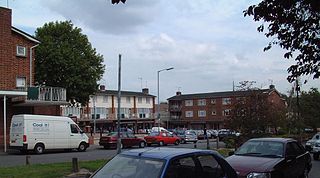
Whitnash is a town and civil parish located southeast of, and contiguous with Leamington Spa and Warwick in Warwickshire, England. In 2001, it had a population of 7,629 which increased to 9,129 in the 2011 census.

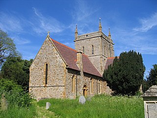
Kineton is a village and civil parish on the River Dene in south-east Warwickshire, England. The village is part of Stratford-on-Avon district, and in the 2001 census it had a population of 2,278, increasing to 2,337 at the 2011 Census.
Wormleighton is a village in Warwickshire on top of Wormleighton Hill overlooking the River Cherwell, England. The population taken at the 2011 census was 183.

Broadwell is a village in Warwickshire, England in the civil parish of Leamington Hastings roughly midway between Dunchurch and Southam on the A426 road.

Staverton is a village and civil parish in the south-west of Northamptonshire, England. It is 2.3 miles west of Daventry, 7.9 miles east of Southam and 15.3 miles east of Leamington Spa. It straddles the A425 road from Daventry to Leamington. The Jurassic Way long-distance footpath between Banbury and Stamford passes through the village.
Lillington is a suburb of Leamington Spa, in the civil parish of Royal Leamington Spa, in the Warwick District in the county of Warwickshire, England. Historically a village which existed before the time of the Domesday Book (1086), it was incorporated into the borough of Leamington in 1890. Lillington is a ward of Warwick District Council and Royal Leamington Spa Town Council.
Alderminster is a village and civil parish on the River Stour about 4 miles (6.4 km) south of Stratford-upon-Avon in Warwickshire, England. The village is on the A3400 road between Stratford-upon-Avon and Shipston-on-Stour. The 2011 Census recorded the parish's population as 491.
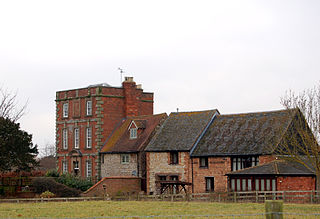
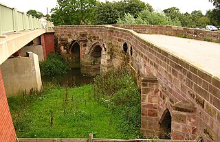
Kites Hardwick is a hamlet in east Warwickshire, England, in the Leam Valley ward of Rugby Borough and in the civil parish of Leamington Hastings The village straddles the A426 Rugby to Southam road two miles (3 km) south of Dunchurch. It lies in the valley of the River Leam which passes under the A426 at Thurlaston Bridge, just north of Kites Hardwick. This spot was the location of frequent flooding of the road until in 2001 the Environment Agency constructed a gauging station immediately west of the bridge with associated works to ease the flow of the river.

Grandborough is a small village and civil parish in Warwickshire, England. The parish includes the hamlets of Calcutt, Grandborough Fields and Woolscott. The population of the civil parish at the 2011 census was 424. Grandborough is in a rural area of eastern Warwickshire, around six miles (10 km) south of Rugby and six miles northwest of Daventry, Northamptonshire. The village is part of the borough of Rugby. Grandborough is about two miles from the nearest main roads and can be reached by country lanes from the A45 to the east, and the A426 to the west.
Blackdown is a hamlet and civil parish in the Warwick district of Warwickshire, England. Blackdown is about two miles north of Leamington Spa, between Leamington/Warwick and Kenilworth. It is named Blakedon in William Dudgale's Antiquities of Warwickshire in 1656 as a district within the parish of Lillington, and as having a mill on the River Avon. Blackdown Mill on Wooton Road is Grade II listed. According to the 2001 Census it had a population of 128. From the 2011 Census population details are included with Old Milverton. Blackdown Manor is a Grade II listed house on Kenilworth Road: built in the 17th century, it was remodelled in the 19th century. Just outside the village is Quarry Park Disc Golf Club which is one of only 17 courses in the United Kingdom, and was the venue for the 2008 UK championships as well as being due to host the 2009 championships. Old Leamingtonians, the town's rugby union and Leamington Royals also play home games on the edge of the village.

Harbury is a village and civil parish in the Stratford-on-Avon district of Warwickshire, England. It is about 3 miles (5 km) west-southwest of Southam and about 5 miles (8 km) southeast of Royal Leamington Spa. The parish includes the hamlet of Deppers Bridge. The 2011 Census recorded the parish's population as 2,420. The village is on a ridge of lias up to 390 feet (119 m) high that runs roughly northeast – southwest. The parish covers 3,397 acres (1,375 ha). It is bounded by the River Itchen to the east, Fosse Way to the northwest, a minor road to the south and field boundaries on its other sides. Adjoining parishes are Bishop's Itchington, Bishop's Tachbrook, Chesterton, Ladbroke and Southam. The A425 road and the Chiltern Main Line pass through the parish just north of Harbury village. Junction 12 on the M40 motorway is about 3 miles (5 km) south of the village.
Marton is a village and civil parish in Warwickshire, England. The parish is within the Borough of Rugby and in the 2011 Census' had a population of 484. The hamlet of Marton Moor lies south of the village.

Old Milverton is a hamlet east of Warwick and north west of Leamington Spa in Warwickshire, England, and situated in a bend of the River Avon. The population as taken at the 2011 census was 319.
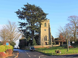
Offchurch is a village and civil parish on the River Leam, 3 miles (4.8 km) east of Leamington Spa in Warwickshire. The population of the civil parish at the 2011 census was 250.

Cubbington is a village and civil parish with a population of 3,929, adjoining the north-eastern outskirts of Leamington Spa, Warwickshire, England, approximately 3 miles from the town centre. Welsh Road, running through the village crossroads, was an old sheep drovers' route connecting London and Wales. Since the 1950s when the village expanded there have been two parts to the village: Cubbington proper which was the old village core, and New Cubbington which is to the west, although both are referred to as Cubbington. Topographically the highest point of the village sits about 100 metres (330 ft) above sea level while its lowest is about 60 metres (200 ft). For many years the electorate for Cubbington was represented in government by the MP for Warwick and Leamington but for the 2010 UK Elections it moved to the new Kenilworth & Southam constituency.
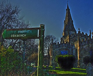
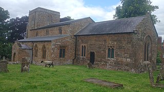
Horsley is a small village roughly 5 miles north of the City of Derby, England, with a population of 973 at the 2011 Census.

Lighthorne is a village and civil parish in Warwickshire, England. It is about 6 miles (9.7 km) south of Leamington Spa. The population taken at the 2011 census was 361. Lighthorne is a small village in a valley and is near Moreton Morrell, Kineton and Wellesbourne. The first mention of a post office in the village is in October 1849, when a type of postmark known as an undated circle was issued. The parish church of St. Lawrence stands in a valley west of the village. It is built of stone in the late-13th century style but the west tower was rebuilt in 1771 and the remainder of the church in 1875–6. In October 2008, Lighthorne Parish council bought the telephone box in the village from the BT Group.

