Broadwell, Warwickshire

Last updated

Broadwell
BroadwellStorm.jpg
Broadwell village green
Warwickshire UK location map.svg
Red pog.svg
Broadwell
Location within Warwickshire
OS grid reference SP 451 657
Civil parish
District
Shire county
Region
Country England
Sovereign state United Kingdom
Post town Rugby
Postcode district CV23
Police Warwickshire
Fire Warwickshire
Ambulance West Midlands
UK Parliament
List of places
UK
England
Warwickshire
52°17′20″N1°20′14″W / 52.28891°N 01.33731°W / 52.28891; -01.33731 Coordinates: 52°17′20″N1°20′14″W / 52.28891°N 01.33731°W / 52.28891; -01.33731

Broadwell is a village in Warwickshire, England in the civil parish of Leamington Hastings roughly midway between Dunchurch and Southam on the A426 road.

Contents

History

The old forge on the village green at Broadwell BroadwellForge.jpg
The old forge on the village green at Broadwell
The Row, a terrace of cottages at Broadwell BroadwellRow.jpg
The Row, a terrace of cottages at Broadwell
The new village hall at Broadwell BroadwellVillageHallwarwickshire.jpg
The new village hall at Broadwell
The former village hall at Broadwell Broadwell Warwickshire old village hall-by-David-Stowell.jpg
The former village hall at Broadwell

In 1086, the Domesday Book records that the chief estate of Leamington was held by Hasculf Musard. Broadwell (like the neighbouring villages of Leamington Hastings, Hill and Kites Hardwick) was once a manor in its own right. Joan Hastang (of the family whose name is borne by Leamington Hastings) was allotted Broadwell in 1375. According to Prof. Louis Salzman's History of the County of Warwick , the ...last mention of Bradwell (sic) as a separate manor is in the inquisition post mortem on Humphrey Stafford in 1545. Broadwell is one of three villages of that name in central England. The other two are in Gloucestershire – one between the towns of Moreton-in-Marsh and Stow-on-the-Wold, the other a few miles west of Lechlade on the upper River Thames.

The villages in Leamington Hastings parish are farming settlements. Today, there is a mix of sheep and arable. However, Louis Salzman records that much of arable land had once been pasture. This is borne out in Mr Sponges's Sporting Tour written in 1853 by R.S. Surtees which refers to: ... the wide-stretching grazing grounds of Southam and Dunchurch. Today, Broadwell compromises roughly 70 households. There are four farms in the village itself (Home Farm, Croftlands Farm, Broadwell House Farm and Hospital Farm) and several smallholdings. Other farms border the village. Broadwell is in the broad flat valley of the River Leam. The valley is bounded to the north by the Rugby ridge and Lawford Heath, to the south by a low range of upland which forms part of the Northamptonshire & Warwickshire ironstone hills. The village sits on fossil-rich Blue Lias clay, hence the proximity of several cement works, all now closed.

Architecturally, Broadwell is somewhat unprepossessing. The village green is surrounded by 18th and 19th century cottages, post-World War II council houses, 1970s bungalows and 1990s large detached houses. The mixture on Main Street and Hayway Lane (formerly known as Green Lane and Elm Road) is similar although there is no Local Authority housing. Since the late '80s/early 90s, two bungalows and nine detached houses have been built as infill. The village has an old forge, a 17th-century blacksmith shop, which is a Grade II listed building. The building, although derelict and structurally unsafe (with an Acrow prop supporting the roof), cannot be demolished, because of the protection order, and would be unviable to restore.

Historically, farming has always been the principal activity, although in the 20th century some residents worked in the Charles Nelson Company's cement works in neighbouring Stockton. Today, many residents are retired: the rest work away from the village with a considerable number commuting everyday: the A426 road is just outside the village and the M40, M1 and M6 all within a 15-mile radius. Until the 1960s, there was a railway station (Napton & Stockton on the Leamington to Weedon line) a mile from the village. Today, there is a bus service to neighbouring towns. However, most families in Broadwell have at least one car.

Amenities

There is no shop or public house in Broadwell. In part, the lack of a pub is due to the village's nonconformist tradition; Broadwell has a substantial Methodist chapel. The village also has a small Church of England chapel, the Church of the Good Shepherd, which is in the parish of Leamington Hastings. Services are held monthly in the Church of the Good Shepherd. Previously, however, the village did have a small post office selling stamps and a small range of what might be classed as 'essential items.' It was based at the rear of a private bungalow. But when the Post Office insisted the elderly postmistress would have to install a computer for electronic transactions, she (politely) told them what to do with their computer – and retired! The nearest Post Office (and shop) is at Stockton, some 3 miles away.

Communal life centres on the village hall. Until December 2007, this was a corrugated iron sheet building. This structure was dismantled and a larger brick-built hall was erected during January and February 2008. Principal users of the hall are the Trustees of the village green, the Flower Show Committee and local art groups. Demographically, Broadwell is home to a fairly typical rural Midlands population. There is little ethnic diversity or multiculturalism and the age range is weighted towards the late middle-aged. However, there are more than a dozen families with school-age children and in 2013 at least four 'Broadwell babies' were due to be born.

Business

There are several established businesses in Broadwell including Home Farm, Cedar Associates, Discovery CE and Raymont-Osman Product Design. The latter are both engineering consultants and are gathered in converted barns on Broadwell House Farm on the edge of Broadwell.

Related Research Articles

<span class="mw-page-title-main">Leamington Spa</span> Spa town in Warwickshire, England

Royal Leamington Spa, commonly known as Leamington Spa or simply Leamington, is a spa town and civil parish in Warwickshire, England. Originally a small village called Leamington Priors, it grew into a spa town in the 18th century following the popularisation of its water which was reputed to have medicinal qualities. In the 19th century, the town experienced one of the most rapid expansions in England. It is named after the River Leam, which flows through the town.

<span class="mw-page-title-main">Southam</span> Human settlement in England

Southam is a market town and civil parish in the Stratford-on-Avon district of Warwickshire, England. Southam is situated on the River Stowe, which flows from Napton-on-the-Hill and joins Warwickshire's River Itchen at Stoneythorpe, just outside the town.

<span class="mw-page-title-main">Warwickshire</span> County of England

Warwickshire is a county in the West Midlands region of England. The county town is Warwick, and the largest town is Nuneaton. The county is famous for being the birthplace of William Shakespeare at Stratford-upon-Avon and Victorian novelist George Eliot,, at Nuneaton. Other significant towns include Rugby, Leamington Spa, Bedworth, Kenilworth and Atherstone. The county offers a mix of historic towns and large rural areas. It is a popular destination for international and domestic tourists to explore both medieval and more recent history.

<span class="mw-page-title-main">Staverton, Northamptonshire</span> Human settlement in England

Staverton is a village and civil parish in the south-west of Northamptonshire, England. It is 2.3 miles west of Daventry, 7.9 miles east of Southam and 15.3 miles east of Leamington Spa. It straddles the A425 road from Daventry to Leamington. The Jurassic Way long-distance footpath between Banbury and Stamford passes through the village.

<span class="mw-page-title-main">River Itchen, Warwickshire</span> River in east Warwickshire, England

The River Itchen flows through east Warwickshire in England. It is a small river, about 18 miles (29 km) long, and its general course is from south to north.

<span class="mw-page-title-main">Willoughby, Warwickshire</span> Human settlement in England

Willoughby is a village and civil parish about 5 miles (8 km) south of Rugby, Warwickshire, England. The village is about 4.5 miles (7 km) northwest of Daventry in neighbouring Northamptonshire and the eastern boundary of the parish forms part of the county boundary.

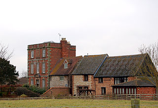
Radford Semele is a village and civil parish in Warwickshire, England, situated close to the Regency spa town of Leamington Spa. According to the 2001 Census, Radford Semele parish has a population of 2,448, according to 2021 census. It lies on the A425 between Leamington and Southam. It has a 16th-century pub with a priest hole. The local school is the Radford Semele Church of England School. This is a primary school and most senior pupils go to school in either Southam, Leamington Spa or Warwick which are close by. As well as the parish church of St Nicholas the village also has a second church built in 1874, the Radford Semele Baptist Church.

<span class="mw-page-title-main">Rugby and Kenilworth (UK Parliament constituency)</span> Parliamentary constituency in the United Kingdom, 1983–2010

Rugby and Kenilworth was a county constituency in Warwickshire, England. It returned one Member of Parliament to the House of Commons of the Parliament of the United Kingdom. It existed from 1983 to 2010.

<span class="mw-page-title-main">Kites Hardwick</span>

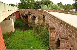
Kites Hardwick is a hamlet in east Warwickshire, England, in the Leam Valley ward of Rugby Borough and in the civil parish of Leamington Hastings The village straddles the A426 Rugby to Southam road two miles (3 km) south of Dunchurch. It lies in the valley of the River Leam which passes under the A426 at Thurlaston Bridge, just north of Kites Hardwick. This spot was the location of frequent flooding of the road until in 2001 the Environment Agency constructed a gauging station immediately west of the bridge with associated works to ease the flow of the river.

<span class="mw-page-title-main">Leamington Hastings</span> Human settlement in England

Leamington Hastings is a small village and larger civil parish in Warwickshire, England. The civil parish covers Leamington Hastings itself, plus the nearby hamlets of Broadwell, Hill and Kites Hardwick. Its population in the 2011 census was 440, increasing slightly to 466 at the 2021 census.

<span class="mw-page-title-main">Marton, Warwickshire</span> Village and civil parish in Warwickshire, England

Marton is a village and civil parish in Warwickshire, England. The parish is within the Borough of Rugby and in the 2011 Census' had a population of 484. The hamlet of Marton Moor lies south of the village.

<span class="mw-page-title-main">Stockton, Warwickshire</span> Human settlement in England

Stockton is a village and civil parish, in the Stratford-on-Avon district of Warwickshire, England. In the 2001 Census it had a population of 1,391, falling to 1,347 at the 2011 Census, then rising to 1,505 at the 2021 Census. The village is located just to the east of the A426 road two miles north-east of Southam, and eight miles south-west of Rugby. Stockton's name was first recorded in 1272, the name meaning 'a fenced enclosure'. During the 19th century, it developed as an industrial village.

<span class="mw-page-title-main">Kenilworth and Southam (UK Parliament constituency)</span> Parliamentary constituency in the United Kingdom, 2010 onwards

Kenilworth and Southam is a constituency in Warwickshire, England represented in the House of Commons of the UK Parliament since 2010 by Jeremy Wright, a Conservative who served as Culture Secretary until 24 July 2019, having previously served as Attorney General for England and Wales from 2014 to 2018.

<span class="mw-page-title-main">Cubbington</span> Human settlement in England

Cubbington is a village and civil parish with a population of 3,929, adjoining the north-eastern outskirts of Leamington Spa, Warwickshire, England, approximately 3 miles from the town centre. Welsh Road, running through the village crossroads, was an old sheep drovers' route connecting London and Wales. Since the 1950s when the village expanded there have been two parts to the village: Cubbington proper which was the old village core, and New Cubbington which is to the west, although both are referred to as Cubbington. Topographically the highest point of the village sits about 100 metres (330 ft) above sea level while its lowest is about 60 metres (200 ft). For many years the electorate for Cubbington was represented in government by the MP for Warwick and Leamington but for the 2010 UK Elections it moved to the new Kenilworth & Southam constituency.

<span class="mw-page-title-main">Hunningham</span>

Hunningham is a small village and civil parish in Warwickshire, England. It is 3 miles to the north-east of Leamington Spa, within the Radford Semele ward. In 2005 the village population was 198. Hunningham village is part of the Manor of Hunningham. The history of the Manor of Hunningham is of great interest because it has been documented continuously for a thousand years, from the time of the Domesday Book, written in 1086, to the present day. The village public house is the Red Lion, which was refurbished in 2007 after flooding by the River Leam. There is local nature reserve where endangered species live. It also has a cricket club.

<span class="mw-page-title-main">Rugby–Leamington line</span> Disused railway in Warwickshire, England

The Rugby to Leamington Line was a railway line running from Rugby to Leamington Spa. It was a 15-mile (24 km) branch line built by the London and North Western Railway (LNWR) and opened in 1851. The branch connected Leamington with the mainline from London to Birmingham which had been opened in 1838 by the LNWR's predecessor, the London and Birmingham Railway (L&BR).

The Weedon–Marton Junction line was a rural branch line in England that ran from the West Coast Main Line at Weedon, via Daventry to Marton Junction, where it joined the Rugby–Leamington line and thus connected to Leamington Spa.

References

Commons-logo.svg Media related to Broadwell, Warwickshire at Wikimedia Commons