The Hownsgill Viaduct (in some sources called Hownes Gill Viaduct and locally called the Gill bridge) is a former railway bridge located west of Consett in County Durham, England. It is currently used as a footpath and cycleway.

The Hownsgill Viaduct (in some sources called Hownes Gill Viaduct and locally called the Gill bridge) is a former railway bridge located west of Consett in County Durham, England. It is currently used as a footpath and cycleway.
From July 1832 to May 1834, Robert Stephenson was consulting engineer to the industrial Stanhope and Tyne Railway (S&TR), built to transport limestone from Stanhope to Consett, and then with coal onwards to Tyne Dock in South Shields. However, the company was unable to afford a bridge over the 49-metre (161 ft) deep and 244-metre (801 ft) wide dry valley, Hown's Gill. The company hence authorised Stephenson to construct two steep rope-worked inclines, one at 1:2.5 and a second at 1:3. To enable wagons to be transported from Waskerley to Consett and onwards to Annfield Plain, single wagons were carried sideways in cradles worked by a single stationary steam engine located at the bottom of the gorge. [1] On 15 May 1834, the first 15.25-mile (24.54 km) section from Stanhope to Annfield opened. [2]
After the S&TR sold its assets in 1842, while the northern section from Annfield became part of the Pontop and South Shields Railway, the now abandoned southern section was bought by the Derwent Iron Company. [2]
After the West Durham Railway constructed a line to Crook, the Stockton and Darlington Railway (S&DR) began construction of the Weardale Extension Railway to Crook, which opened on 8 November 1843 from a junction on its leased Weardale Railway. [2]
As a result, the DIC proposed an extension from Crook to the foot of the Meeting Slacks incline, which later became Waskerley, to provide a southern shipping route for their lime and iron products. Having obtained an extension of their right of way from the Bishop of Durham, the DIC submitted the planes to the S&DR, who agreed to the extension as long as the DIC leased the entire southern section of the former S&TR to them. The Stanhope to Carrhouse section passed into the possession of the S&DR on 1 January 1845, with the completed 10-mile (16 km) Weardale Extension Railway from the Wear Valley Junction to Waskerley opening on 16 May 1845. [2]
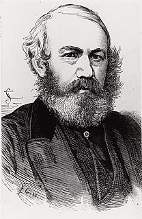
Having taken over the line, the S&DR proposed to bypass Hown's Gill through construction of a suitable bridge. They commissioned Thomas Bouch to design and supervise the construction of such a structure. [1] Bouch's design was submitted to Stephenson, who recommended the use of inverted arches under the five central piers to reduce ground loading. [3] [4]

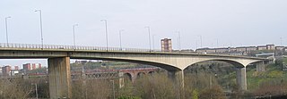
The construction tender was won by John Anderson, [3] who started works in 1857, with Rowley created to enable the workers to access the site. Three million white firebricks were used in the structure, with sandstone Ashlar dressings, and iron railings along the platform. The completed single-track bridge opened in 1858, 700 feet (210 m) long and at maximum 150 feet (46 m) high, spanned by twelve 50-foot (15 m) wide arches on slender triple-tiered piers, with arched recesses in three layers on each side. [1] [5]

The railway was closed to regular passenger services on 23 May 1955. [6] The line was fully closed in the early 1980s, [7] with the tracks lifted by 1985. [8]
The viaduct is now part of the Sustrans national foot and cycle path network as part of the Sea to Sea Cycle Route, which crosses from Whitehaven/Workington on the west coast to Sunderland/Tynemouth on the east coast.
The viaduct can also be reached from the A692 road between Consett and Castleside using a footpath southward from outside the "Stanefordham Inn" (now called The Dam Inn) to the east of "The Grove" housing estate. The viaduct is about .5 miles (0.80 km) walk.
In 2012 anti-suicide fences were fitted to the bridge: there had been one suicide from the bridge every two weeks in the first half of 2011 and five between January and August 2012. [9] Despite this, in August 2017 a woman fell to her death from the "wrong" side of the anti-suicide fence. [10]

Sir Thomas Bouch was a British railway engineer. He was born in Thursby, near Carlisle, Cumberland, and lived in Edinburgh. As manager of the Edinburgh and Northern Railway he introduced the first roll-on/roll-off train ferry service in the world. Subsequently as a consulting engineer, he helped develop the caisson and popularised the use of lattice girders in railway bridges. He was knighted after the successful completion of the first Tay Railway Bridge, but his reputation was destroyed by the subsequent Tay Bridge disaster, in which 75 people are believed to have died as a result of defects in design, construction and maintenance, for all of which Bouch was held responsible. He died within 18 months of being knighted.

The Stockton and Darlington Railway (S&DR) was a railway company that operated in north-east England from 1825 to 1863. The world's first public railway to use steam locomotives, its first line connected collieries near Shildon with Darlington and Stockton-on-Tees in County Durham, and was officially opened on 27 September 1825. The movement of coal to ships rapidly became a lucrative business, and the line was soon extended to a new port at Middlesbrough. While coal waggons were hauled by steam locomotives from the start, passengers were carried in coaches drawn by horses until carriages hauled by steam locomotives were introduced in 1833.
The Coast to Coast or Sea to Sea Cycle Route (C2C) is a 140 miles (230 km) cycle route opened in 1994. Combining sections of National Cycle Route 7, 14, 71 and 72; it runs from Whitehaven or Workington on the west coast of Cumbria, and then crosses the Lake District and the Pennines in the north of England by using a variety of both on and off-road trails, ending on the north-east coast in Tyne and Wear at Sunderland or Tynemouth. Sustrans state that it is the UK's most popular challenge cycle route, it is designed for the whole range of cyclists, from families to cycling club riders. Although a challenge with some hard climbs—the highest point being over 609 m (1,998 ft)—the C2C is completed by an average of between 12,800 and 15,000 cyclists every year.

The Weardale Railway is an independently owned British single-track branch line heritage railway between Bishop Auckland, Witton-le-Wear, Wolsingham, Frosterley and Stanhope. Weardale Railway began services on 23 May 2010, but decided to run special trains rather than a scheduled service for the 2013 season. The line was purchased by The Auckland Project in 2020 with a view to re-starting passenger services. In 2021, a bid was submitted to the 'Restoring Your Railways fund. In October 2021 The UK Department for Transport allocated funding for the development of a Business Case

Waskerley is a village in County Durham, England. It is situated six miles to the southwest of Consett and three miles southwest of Castleside and the A68. Stanhope in the Durham Dales is a further six miles to the southwest and the Derwent Reservoir and the village of Edmundbyers is approximately five miles to the north. The village of Muggleswick is three miles to the north.

Bishop Auckland is a railway station that serves the market town of Bishop Auckland in County Durham, North East England, 11 miles 77 chains (19.3 km) north-west of Darlington. The station is the Western terminus of the Tees Valley Line, which links it to Saltburn via Darlington. It is owned by Network Rail and managed by Northern Trains.

The Redheugh Bridge is a road bridge spanning the River Tyne west of Newcastle upon Tyne city centre on the north bank and Gateshead town centre on the south bank, in North East England. It currently carries the A189 road.

The South Durham & Lancashire Union Railway (SD&LUR) built a railway line linking the Stockton & Darlington Railway near Bishop Auckland with the Lancaster and Carlisle Railway at Tebay, via Barnard Castle, Stainmore Summit and Kirkby Stephen. The line opened in 1861 and became known as the Stainmore Line.

The Consett Iron Company Ltd was an industrial business based in the Consett area of County Durham in the United Kingdom. The company owned coal mines and limestone quarries, and manufactured iron and steel. It was registered on 4 April 1864 as successor to the Derwent & Consett Iron Company Ltd. This in turn was the successor to the Derwent Iron Company, founded in 1840.
The Stanhope and Tyne Railway was an early British mineral railway, that ran from Stanhope in County Durham, to South Shields at the mouth of the River Tyne. The object was to convey limestone from Stanhope and coal from West Consett and elsewhere to the Tyne, and to local consumers. Passengers were later carried on parts of the line.

The River Wear in North East England rises in the Pennines and flows eastwards, mostly through County Durham to the North Sea in the City of Sunderland. At 60 mi (97 km) long, it is one of the region's longest rivers, wends in a steep valley through the cathedral city of Durham and gives its name to Weardale in its upper reach and Wearside by its mouth.
The Derwent Valley Railway was a branch railway in County Durham, England. Built by the North Eastern Railway, it ran from Swalwell to Blackhill via five intermediate stations, and onwards to Consett.
West Stanley railway station was a railway station on the North Eastern Railway, in County Durham.
The Lanchester Valley Railway was an English railway line that was developed by the North Eastern Railway to run between Durham to Consett. Extending 12 miles (19 km) along the valley of the River Browney, it opened on 1 September 1862. Closed under the Beeching Axe, it has been redeveloped by Durham County Council as a foot and cycle path as the Lanchester Valley Railway Path.
Crook railway station served the town of Crook, County Durham, England. It was located on the Bishop Auckland and Weardale Railway line from Bishop Auckland to Blackhill between Wear Valley Junction and Tow Law, 17 miles (27 km) north west of Darlington.

Blackhill railway station served the village of Blackhill, County Durham, England from 1867 to 1955 on the Derwent Valley Line.
Wear Valley Junction railway station primarily served as an interchange between the Wear Valley Line and the Weardale Extension Railway (WXR) between 1847 and 1935. It was the closest railway station to the village of High Grange in County Durham, North East England.

Etherley railway station served the village of Witton Park in County Durham, North East England, from 1847 to 1965 on the Wear Valley line. It was briefly reopened during the summers of 1991 and 1992 as Witton Park.
Hownes Gill railway station served the town of Consett, County Durham, England, from 1845 to 1858 on the Stanhope and Tyne Railway.
Coordinates: 54°50′8.16″N1°51′9.1″W / 54.8356000°N 1.852528°W