
Clay County is a county located in the U.S. state of Kansas. Its county seat and most populous city is Clay Center. As of the 2020 census, the county population was 8,117. The county was named for Henry Clay, an influential U.S. Senator from Kentucky.

Rice County is a county located in the U.S. state of Kansas. Its county seat and largest city is Lyons. As of the 2020 census, the county population was 9,427. The county was named in memory of Samuel Allen Rice, Brigadier-General, United States volunteers, killed April 30, 1864, at Jenkins Ferry, Arkansas.

Morris County is a county located in the U.S. state of Kansas. Its county seat and largest city is Council Grove. As of the 2020 census, the county population was 5,386. The county was named for Thomas Morris, a U.S. Senator from Ohio and anti-slavery advocate.

Marion County is a county located in the U.S. state of Kansas. Its county seat is Marion and its most populous city is Hillsboro. As of the 2020 census, the county population was 11,823. The county was named in honor of Francis Marion, a brigadier general of the American Revolutionary War, known as the "Swamp Fox".

Jewell County is a county located in the U.S. state of Kansas. Its county seat and most populous city is Mankato. As of the 2020 census, the county population was 2,932. The county was named for Lewis Jewell, a lieutenant colonel of the 6th Regiment Kansas Volunteer Cavalry.

Cloud County is a county located in the U.S. state of Kansas. Its county seat and most populous city is Concordia. As of the 2020 census, the county population was 9,032. The county was named after William Cloud, an officer in the American Civil War.

Chase County is a county located in the U.S. state of Kansas. Its county seat and most populous city is Cottonwood Falls. As of the 2020 census, the county population was 2,572. The county was named for Salmon Chase, a U.S. Senator from Ohio that was a Kansas statehood advocate.

Strong City is a city in Chase County, Kansas, United States. Originally known as Cottonwood Station, in 1881 it was renamed Strong City after William Barstow Strong, then vice-president and general manager, and later president of the Atchison, Topeka and Santa Fe Railway. As of the 2020 census, the population of the city was 386. It is located along U.S. Route 50 highway.
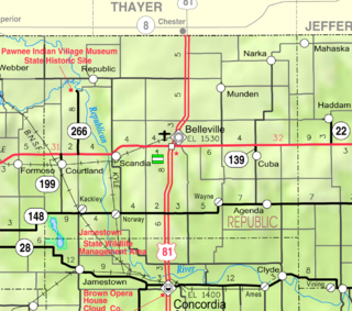
Kackley is an unincorporated community in Republic County, Kansas, United States. It is located southeast of Courtland at Co Rd 5 and K-148 highway.
Brazilton is an unincorporated community in Crawford County, Kansas, United States. It located along highway K-3.

Burdick is a census-designated place (CDP) in Morris County, Kansas, United States. It was named after Miss Burdick, the sweetheart of a Santa Fe Railroad official in 1887. As of the 2020 census, the population was 62. It is located southeast of Herington, about 5.6 miles (9.0 km) east of the intersection of U.S. Route 77 highway and 340th Street, or about 6.5 miles (10.5 km) east of Lost Springs.
Anness is an unincorporated community in Sedgwick County, Kansas, United States, about 4.75 miles west of Viola, between W 111th St S and W 119th St S, and between S 327th St W and S 343rd St W.
Buxton is an unincorporated community in Wilson County, Kansas, United States.
Darlow is an unincorporated community in Lincoln Township, Reno County, Kansas, United States. It is located several miles west of Yoder along Red Rock Road.
Dundee is an unincorporated community in Barton County, Kansas, United States.
Jarbalo is an unincorporated community in Leavenworth County, Kansas, United States. It is part of the Kansas City metropolitan area.
Monrovia is an unincorporated community in Atchison County, Kansas, United States. Monrovia is located at 39°31′27″N95°20′46″W.

Oursler is a ghost town in Marion County, Kansas, United States. It is currently a ghost town that was located approximately 3.5 miles southeast of Marion next to a former railroad. No buildings remain of this former community.
Homewood is a unincorporated community in Homewood Township, Franklin County, Kansas, United States. In the 19th century it had a post office and a stop on the Atchison, Topeka, and Santa Fe Railway.
Vine Creek is a ghost town in Ottawa County, Kansas, United States.

