
Walworth County is a county located in the U.S. state of Wisconsin. As of the 2010 census, the population was 102,228. Its county seat is Elkhorn. The county was created in 1836 from Wisconsin Territory and organized in 1839. It is named for Reuben H. Walworth.

Kenosha County is a county in the southeastern corner of the U.S. state of Wisconsin. Its population in 2017 was estimated to be 168,065, making it the eighth most populous county in Wisconsin. The county is named after the county seat, Kenosha, the fourth largest city in Wisconsin.

Bohners Lake is a census-designated place (CDP) in Racine County, Wisconsin, United States. Its first syllable is pronounced as in "bone". The population of the CDP was 2,444 at the 2010 census. It is politically part of the Town of Burlington, together with Browns Lake, Wisconsin. There has been discussion of incorporating Bohners Lake as a village to prevent annexation by the City of Burlington. It was named for Antony Bohner, a French immigrant who established a resort on the lake of the same name.

Eagle Lake is a census-designated place (CDP) in the town of Dover, Racine County, Wisconsin, United States. The population was 1,192 at the 2010 census.

Elmwood Park is a village in Racine County, Wisconsin, United States. The population was 497 at the 2010 census.

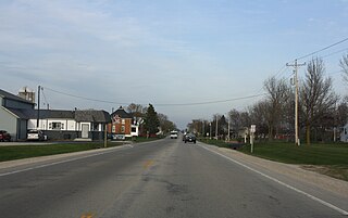
Franksville is a former census-designated place (CDP) in Racine County, Wisconsin, United States. The population was 1,789 at the 2000 census.

Racine is a city in and the county seat of Racine County, Wisconsin, United States. It is located on the shore of Lake Michigan at the mouth of the Root River. Racine is located 22 miles south of Milwaukee. As of the 2010 U.S. census, the city had a population of 78,860, making it the fifth-largest city in Wisconsin. Its median home price of $103,625 makes it one of the most affordable cities in Wisconsin to buy a home. In January 2017, it was rated "the most affordable place to live in the world" by the Demographia International Housing Affordability survey.

Raymond is a town in Racine County, Wisconsin, United States. The population was 3,516 at the 2000 census. The unincorporated communities of Kneeland and Raymond are located in the town, as was the ghost town of Raymond Center. The unincorporated communities of North Cape and Union Church are also located partially in the town.

Sturtevant is a village in Racine County, Wisconsin, United States. The population was 6,970 at the 2010 census.

Union Grove is a village in Racine County, Wisconsin, United States. The population was 4,322 at the 2000 census and 4,915 at the 2010 census.

Wind Point is a village in Racine County, Wisconsin, United States. The population was 1,723 at the 2010 census.

Elkhorn is a city in Walworth County, Wisconsin, United States. It is located 40 miles southwest of Milwaukee. The population was 10,084 at the 2010 census. It is the county seat.

Burlington is a city in Racine and Walworth counties in the U.S. state of Wisconsin, with the majority of the city located in Racine County. The population of the portion of the city inside Racine County was 10,464 as of the 2010 census.

The Root River is a 43.7-mile-long (70.3 km) river that flows to Lake Michigan at the city of Racine in southeastern Wisconsin in the United States. Racine and Racine County are named for the river, as racine is the French word for root.

Three Harbors Council is a local council of the Boy Scouts of America serving three southeastern Wisconsin counties: Milwaukee County, Racine County, and Kenosha County. Its name and logo refer to the three major port cities of Milwaukee, Racine, and Kenosha on Lake Michigan.
Walhain is an unincorporated community in Kewaunee County, Wisconsin, United States, within the town of Luxemburg. The community is located at the intersection of Walhain Road and Wisconsin Highway 54 about 1 mile east of Luxemburg. It is located at 44.545 latitude and -87.754 longitude at elevation is 784 feet above mean sea level.

Poland is an unincorporated community in the Town of Eaton, Brown County, Wisconsin, United States. It is located at the intersection of County Highway T and Wisconsin Highway 29 several miles east of Green Bay. It is located at latitude 44-26-37N and longitude 87-49-34W.

Denmark is an unincorporated community in the southwest portion of Marion Township, Owen County, in the U.S. state of Indiana. It lies near the intersection of County Road 1400 West and County Road 150 South, which is a community about fifteen miles west of the city of Spencer, the county seat of Owen County. Its elevation is 722 feet, and it is located at 39°16′11″N87°1′33″W.


