Eagle Lake, Wisconsin

Last updated
Eagle Lake, Wisconsin
CDP
WIMap-doton-Eagle Lake.png
Location of Eagle Lake, Wisconsin
Coordinates: 42°41′51″N88°8′1″W / 42.69750°N 88.13361°W / 42.69750; -88.13361 Coordinates: 42°41′51″N88°8′1″W / 42.69750°N 88.13361°W / 42.69750; -88.13361
Country United States
State Wisconsin
County Racine
Area
  Total3.0 sq mi (7.8 km2)
  Land2.2 sq mi (5.7 km2)
  Water0.8 sq mi (2.1 km2)
Elevation
[1]
801 ft (244 m)
Population
 (2010)
  Total1,192
  Density400/sq mi (150/km2)
Time zone UTC-6 (Central (CST))
  Summer (DST) UTC-5 (CDT)
Area code(s) 262
FIPS code 55-21525 [2]
GNIS feature ID1867656 [1]

Eagle Lake is a census-designated place (CDP) in the town of Dover, Racine County, Wisconsin, United States. The population was 1,192 at the 2010 census.

Contents

Geography

Eagle Lake is located at 42°41′51″N88°8′1″W / 42.69750°N 88.13361°W / 42.69750; -88.13361 (42.697369, -88.133741). [3]

According to the United States Census Bureau, the CDP has a total area of 3.0 square miles (7.8 km2), of which, 2.2 square miles (5.7 km2) of it is land and 0.8 square miles (2.1 km2) of it (27.00%) is water

Racine County's Eagle Lake Park is located on the north side of the lake. The park's entrance is found on Church Road, approximately one quarter of a mile west of Wisconsin State Highway 75. Eagle Lake Park includes green space, a public boat launch, a baseball/softball diamond, several picnic areas (including a covered partitioned pavilion), restrooms, as well as playground equipment. [4]

Demographics

As of the census [2] of 2000, there were 1,320 people, 483 households, and 351 families residing in the CDP. The population density was 603.2 people per square mile (232.7/km2). There were 619 housing units at an average density of 282.9/sq mi (109.1/km2). The racial makeup of the CDP was 95.68% White, 0.38% African American, 0.83% Native American, 1.06% Asian, 1.14% from other races, and 0.91% from two or more races. Hispanic or Latino of any race were 5.61% of the population.

There were 483 households, out of which 41.4% had children under the age of 18 living with them, 59.2% were married couples living together, 9.1% had a female householder with no husband present, and 27.3% were non-families. 20.1% of all households were made up of individuals, and 5.6% had someone living alone who was 65 years of age or older. The average household size was 2.73 and the average family size was 3.19.

In the CDP, the population was spread out, with 29.5% under the age of 18, 7.0% from 18 to 24, 34.8% from 25 to 44, 21.4% from 45 to 64, and 7.3% who were 65 years of age or older. The median age was 35 years. For every 100 females, there were 99.7 males. For every 100 females age 18 and over, there were 101.1 males.

The median income for a household in the CDP was $47,650, and the median income for a family was $47,800. Males had a median income of $38,542 versus $29,554 for females. The per capita income for the CDP was $23,540. About 2.9% of families and 5.3% of the population were below the poverty line, including 6.3% of those under age 18 and none of those age 65 or over.

Related Research Articles

Channel Lake, Illinois Census-designated place in Illinois, United States

Channel Lake is an unincorporated community and census-designated place (CDP) in Antioch Township, Lake County, Illinois, United States. Per the 2020 census, the population was 1,581.

Lake Catherine is an unincorporated community and census-designated place (CDP) in Lake County, Illinois, United States. Per the 2020 census, the population was 1,279.

Beaverdale, Pennsylvania Census-designated place in Pennsylvania, United States

Beaverdale is an unincorporated community and census-designated place (CDP) in Cambria County, Pennsylvania, United States. The population was 1,035 at the 2010 census. Prior to that time, the CDP was known as Beaverdale-Lloydell.

Lake Koshkonong, Wisconsin Census-designated place in Wisconsin, United States

Lake Koshkonong is a census-designated place (CDP) in the town of Sumner, Jefferson County, Wisconsin, United States. The population was 1,204 at the 2010 census. Lake Koshkonong is in the area.

Lake Lac La Belle, Wisconsin Former Census-designated place in Wisconsin, United States

Lake Lac La Belle is a former census-designated place (CDP) in Jefferson County, Wisconsin, United States. The population was 833 at the 2000 census.

Lake Ripley, Wisconsin Census-designated place in Wisconsin, United States

Lake Ripley is a census-designated place (CDP), in the town of Oakland, Jefferson County, Wisconsin, United States. The population was 1,779 at the 2010 census.

Rome is a census-designated place (CDP) in the town of Sullivan, Jefferson County, Wisconsin, along the Bark River. The population was 689 at the 2010 census.

Camp Lake, Wisconsin Former CDP in Wisconsin, United States

Camp Lake is a neighborhood and former census-designated place in the village of Salem Lakes, Kenosha County, Wisconsin, United States. The population of the Camp Lake was 3,665 at the 2010 census. Upon incorporation of the village of Salem Lakes in 2017, the census statistical boundaries for the neighborhood ceased to exist.

Lake Shangrila, Wisconsin Former CDP in Wisconsin, United States

Lake Shangrila was a census-designated place (CDP) in the town of Salem, Kenosha County, Wisconsin, United States. The population was 861 at the 2010 census. The core area of the CDP was annexed into the village of Bristol on March 15, 2011, at the same time that the CDP was deleted.

Bohners Lake, Wisconsin CDP in Wisconsin, United States

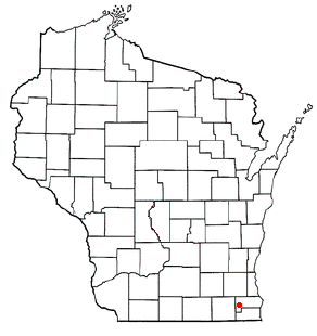
Bohners Lake is a census-designated place (CDP) in Racine County, Wisconsin, United States. Its first syllable is pronounced as in "bone". The population of the CDP was 2,444 at the 2010 census. It is politically part of the Town of Burlington, together with Browns Lake, Wisconsin. There has been discussion of incorporating Bohners Lake as a village to prevent annexation by the City of Burlington. It was named for Antony Bohner, a French immigrant who established a resort on the lake of the same name.
Browns Lake, Wisconsin CDP in Wisconsin, United States

Browns Lake is a census-designated place (CDP) in Racine County, Wisconsin around a lake of the same name. The population was 2,039 at the 2010 census. It is politically a part of the town of Burlington, along with Bohners Lake.
Dover, Racine County, Wisconsin Town in Wisconsin, United States

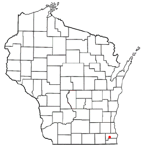
Dover is a town in Racine County, Wisconsin, United States. The population was 3,908 at the 2000 census. The unincorporated communities of Beaumont, Eagle Lake Manor, Eagle Lake Terrace, Kansasville, and Rosewood are located in the town. The census-designated place of Eagle lake is also located in the town.

Tichigan, Wisconsin Census-designated place in Wisconsin, United States

Tichigan is a census-designated place (CDP) in Racine County, Wisconsin, United States. The population was 5,133 at the 2010 census.

Wind Lake, Wisconsin CDP in Wisconsin, United States

Wind Lake is a census-designated place (CDP) in Racine County, Wisconsin, United States. The population was 5,342 at the 2010 census. Wind Lake is in the town of Norway.

Como, Wisconsin CDP in Wisconsin, United States

Como is a census-designated place (CDP), in the town of Geneva, Walworth County, Wisconsin, United States. The population was 2,631 at the 2010 census.
Delavan Lake, Wisconsin CDP in Wisconsin, United States

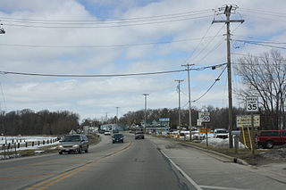
Delavan Lake is a census-designated place (CDP) in Walworth County, Wisconsin, United States. The population was 2,649 at the 2010 census. It is located near the shore of Delavan Lake.

Potter Lake, Wisconsin CDP in Wisconsin, United States

Potter Lake is a census-designated place (CDP) in the town of Troy, Walworth County, Wisconsin, United States. The population was 1,107 at the 2010 census.

Lynnwood-Pricedale is a census-designated place (CDP) in Fayette and Westmoreland counties in the commonwealth of Pennsylvania, United States. The population was 2,031 at the 2010 census, down from 2,168 at the 2000 census. The community of Lynwood is located in Fayette County's Washington Township, while Pricedale is part of Westmoreland County's Rostraver Township.

Powers Lake, Wisconsin Census-designated place in Wisconsin, United States

Powers Lake is a census-designated place (CDP) in the towns of Randall and Wheatland, in Kenosha County in the U.S. state of Wisconsin. As of the 2010 census, the CDP had a population of 1,615. Part of the Powers Lake CDP was in Walworth County, but on December 20, 2011, it became part of the village of Bloomfield.
Hebron (CDP), Wisconsin Census-designated place in Wisconsin, United States

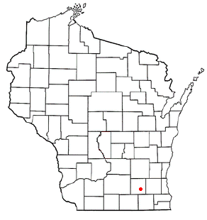
Hebron is a census-designated place (CDP) in the town of Hebron, Jefferson County, Wisconsin, United States. The population was 224 at the 2010 census. It is located on the Bark River.

References

  1. 1 2 "US Board on Geographic Names". United States Geological Survey. 2007-10-25. Retrieved 2008-01-31.
  2. 1 2 "U.S. Census website". United States Census Bureau . Retrieved 2008-01-31.
  3. "US Gazetteer files: 2010, 2000, and 1990". United States Census Bureau. 2011-02-12. Retrieved 2011-04-23.
  4. "Racine County Parks". Archived from the original on 2008-09-08. Retrieved 2009-01-30.