Hyssington
| |
|---|---|
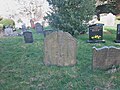
 Hyssington Church, Montgomeryshire | |
 Hyssington Location within Powys | |
| OS grid reference | SO 313945 |
| Community |
|
| Principal area | |
| Preserved county | |
| Country | Wales |
| Sovereign state | United Kingdom |
| Post town | Montgomery |
| Postcode district | SY15 |
| Police | Dyfed-Powys |
| Fire | Mid and West Wales |
| Ambulance | Welsh |
| UK Parliament | |
| Senedd Cymru – Welsh Parliament | |
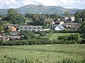
Hyssington (Welsh : Isatyn) is a parish in the South-Eastern corner of the historic county of Montgomeryshire in Wales and borders the county of Shropshire in England. It is now within the area of the Church Stoke community council in Powys. It is dominated by Corndon Hill. The church which is in the Diocese of Hereford lies just the north of a small village and is sited just to the west of a medieval Motte-and-bailey castle. This area was also the source of late Neolithic and Early Bronze Age battle-axes and axe-hammers, made from picrite that were widely traded around 2000 BC.
Contents
- Administration
- Landscape and geography
- Quarrying
- Archaeology
- Stone Axe Factory (Group XII)
- Hyssington Castle
- Buildings and architecture
- Church of St Etheldreda
- Mission Church, White Grit
- Methodist Chapel
- Houses in Hyssington
- Notable residents
- Literature
- See also
- References
- External links
- Hyssington gallery