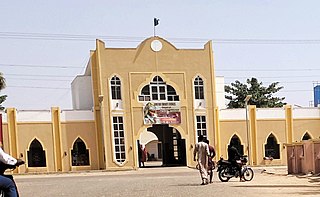
Sagbama is a Local Government Area in Bayelsa State, Southern part of Nigeria. Its headquarters are in the town of Sagbama. Part of the area of the LGA lies within the Bayelsa National Forest.
Brass is a Local Government Area in Bayelsa State, southern Nigeria. Its headquarters are in the town of Twon-Brass on Brass Island along the coast, it has a coastline of approximately 90 km on the Bight of Bonny. Much of the area of the LGA is occupied by the Edumanom National Forest.
Aba North is a Local Government Area in Aba, Abia State, Nigeria. In the year (1991) Aba North local government was created. The headquarters is at Eziama Uratta. It is amongst the local governments that made up Abia South senatorial zone. It is in South East geopolitical zone. The Igbo ethnic group is predominant in the area. The people of the area are mostly Christians and traditional worshippers with Igbo and English as the commonly spoken languages.

Jama'are is a Local Government Area of Bauchi State, Nigeria. Its headquarters are in the town of Jama'are. It has an area of 493 km2 and a population of 176,883 at the 2006 census. The postal code of the area is 751. It is populated by a Fulani tribe that migrated from Dulare in the Lake Chad basin in the Republic of Chad.

Egor is a Local Government Area of Edo State, Nigeria. Its headquarters are in the town of Uselu. Egor is one of the Local Government Areas that are part of the larger metropolitan area of Benin City.

Ovia North-East is a Local Government Area of Edo State, Nigeria. Its headquarters are in the town of Okada.

Enugu North is a Local Government Area of Enugu State, Nigeria. Its headquarters are in the city of Enugu at Opkara Avenue. The LGA is made up of four main district areas Amaigbo Lane, Onuato, Umunevo and Ihenwuzi. Enugu North is one of the seventeen local governments in Enugu state and also one of the three LGA's that made up the Enugu Town - plus Enugu East and Enugu South.
Igbo Etiti is a local government area of Enugu State, Nigeria. Its headquarters are in the town of Ogbede. It has an area of 325 km2 and a population of 209,248 at the 2006 census. The postal code of the area is 411.
Akko is a local government area of Gombe, Gombe State, Nigeria. Its headquarters is in Kumo town on the A345 highway south of the state capital Gombe, about 40 km away. Kumo (headquarter) is a cosmopolitan community of more than 30 different tribes, ranging from the dominant Fulani tribe to Tangale, Tera, Hausa and other minorities.
Balanga is one of the eleven Local governments in Gombe State, Nigeria. It falls under the southern senatorial district of the state. Its administrative headquarters is located at Talasse town. The LGA is bordered by Yemaltu-Deba LGA to the north while to the south and east by Adamawa state and to the west by Shongom, Kaltungo and Akko LGA.
Billiri is one of the 11 Local Government Area of Gombe State, Nigeria bordered to the north by Akko LGA, south and east by Shongom as well as North-East by Kaltungo LGA. It is a historical settlement of the Tangales which is located South of Gombe It has an area of 737 km2 and a population of 202,144 at the 2006 census. Apart from Tangale language, Fulfulde and Hausa are commonly spoken The postal code of the area is 771.
Kwami is a Local Government Area of Gombe State, Nigeria. It has its headquarters in the town of Mallam Sidi. Kwami is bordered in the east by Lake Dadin Kowa, in the north by funakaye and Gombe in the south. The postal code of the area is 760.
Nafada is a Local Government Area (LGA) of Gombe State, Nigeria. Its headquarter is in the town of Nafada in the east of the area at 11°05′44″N11°19′58″E, on the Gongola River which traverses the area. According to the 2006 census, the LGA covers 1,586 square kilometers and has a population of 138,185 people. Nafada has ten wards namely: Nafada East, Nafada Central, Nafada West, Jigawa, Birnin Fulani East, Birnin Bolewa, Birnin Fulani West, Gudukku, Barwo/Nasarawo and Barwo Winde.
Oyo West is a Local Government Area in Oyo State, Nigeria. Its headquarters are in the town of Ojongbodu.
Nangere is a Local Government Area in Yobe State, Nigeria. It has its headquarters in the town of Sabon Garin Nangere at 11°51′50″N11°04′11″E.
Donga is a Local Government Area in Taraba State, Nigeria. It has its headquarters in the town of Donga on the Donga River at7°43′00″N10°03′00″E.
Emohua is a local government area in Rivers State, Nigeria. Its headquarters are in the town of Emohua. It comprises eight villages
Omuma is a Local Government Area in Rivers State, South South geopolitical zone of Nigeria. Its headquarters are in the town of Eberi. Its people are Igbo. It was created in the year 1989.
Gokana kingdom is among the six kingdoms of the Ogoni people in Ogoni in the Niger Delta region of Nigeria. Gokana kingdom has geographic, historic and ethno-linguistic elements with some 130,000 Gokana language speakers located in the Gokana Local Government Area in Rivers State. Gokana contains a tremendous number of villages, including Lewe, B.Dere (Barayowa-Dere), K. Dere (Kegbara-Dere), Nwe-biara Kpor, Mogho, Bomu, Bodo, Gio-koo, Nwe-ol, Bera, Biara, Deeyor, Gbe, Goi, Barako, Deken, and Yeghe.
Pantami is a district head ward in Gombe Local Government Area of Gombe State, Nigeria. Pantami is located at the terminal southern part of Gombe Local Government area, with Associated Zip Code: 760253. Pantami is one of the largest wards in Gombe local government area with eighteen major polling units.


