
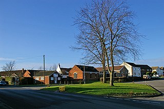
Inglemire is a suburb of Kingston upon Hull, in the East Riding of Yorkshire, England.
Inglemire has a library, a leisure centre, 2 post offices 6 places of worship and a few schools.
Inglemire is a suburb of Kingston upon Hull, in the East Riding of Yorkshire, England.
Inglemire has a library, a leisure centre, 2 post offices 6 places of worship and a few schools.

The River Wharfe is a river in Yorkshire, England. For much of its length it is the county boundary between West Yorkshire and North Yorkshire.

Hatfield is a town and civil parish in the Metropolitan Borough of Doncaster in South Yorkshire, England. It had a population of 16,776 at the 2011 Census, with its population split between the Hatfield and Thorne wards.

In geology, the places known as hotspots or hot spots are volcanic regions thought to be fed by underlying mantle that is anomalously hot compared with the surrounding mantle. Examples include the Hawaii, Iceland and Yellowstone hotspots. A hotspot's position on the Earth's surface is independent of tectonic plate boundaries, and so hotspots may create a chain of volcanoes as the plates move above them.

Cottingham is a large village and civil parish in the East Riding of Yorkshire, England with slightly above average affluence. It lies just north-west of the city of Kingston upon Hull, and 3.5 miles (5.6 km) from the city centre, and is part of the Hull urban area. Cottingham lies on the eastern edge of the Yorkshire Wolds with a parish population of over 17,000 in 2011. Cottingham is one of the villages claiming to be the largest village in England.

European route E22 is one of the longest European routes. It has a length of about 5,320 km (3,310 mi). Many of the E-roads have been extended into Asia since the year 2000; the E22 was extended on 24 June 2002.
South Killingholme is a village and civil parish in North Lincolnshire, England. The population of the civil parish at the 2011 census was 1,108.

Hull Paragon Interchange is a transport interchange providing rail, bus and coach services located in the city centre of Kingston upon Hull, England. The G.T. Andrews-designed station was originally named Paragon Station, and together with the adjoining Station Hotel, it opened in 1847 as the new Hull terminus for the growing traffic of the York and North Midland (Y&NMR) leased to the Hull and Selby Railway (H&S). As well as trains to the west, the station was the terminus of the Y&NMR and H&S railway's Hull to Scarborough Line. From the 1860s the station also became the terminus of the Hull and Holderness and Hull and Hornsea railways.
Elkington is a civil parish in the East Lindsey district of Lincolnshire, England. It comprises the village of South Elkington, and the hamlets of North Elkington, Boswell, and Thorpe, and is situated approximately 3 miles (5 km) north-west from the market town of Louth.

MS Piłsudski was a medium-size ocean liner of the Polish Merchant Marine, named for Marshal Józef Piłsudski, a national hero of Poland. She was built in Italy by the CRDA yard at Monfalcone, yard number 1126, for Polskiego Transatlantyckiego Towarzystwa Okrętowego, which in 1934 became Gdynia – Ameryka Linie Zeglugowe, with part of the payment being shipments of coal from Poland. Launched in December 1934, her tonnage was 14,294 tons gross, with a length of 162 metres (531 ft) and beam of 22 metres (71 ft). She was propelled by two diesel engines driving a pair of propellers giving a speed of 18 knots (33 km/h).

The A153 is a non-primary A road that is located entirely in Lincolnshire in the east of England.

Orchard Park Estate is an area or housing estate situated on the north-western side of Kingston upon Hull, England.

Edlington with Wispington is a civil parish in the East Lindsey district of Lincolnshire, England. It is situated approximately 2 miles (3 km) north-west from the town of Horncastle.

Newland is a suburb of Kingston upon Hull, East Riding of Yorkshire, England, in the north-west of the city, a former village on the Hull to Beverley turnpike.

The Civil War Monuments in Washington, D.C. are a group of seventeen, outdoor statues which are spread out through much of central and northwest Washington, D.C. The statues depict 11 Union generals and formerly included one Confederate general, Albert Pike, who was depicted as a Mason and not as a general. The Pike statue was torn down on Juneteenth 2020, as part of the George Floyd protests. Two Union admirals are honored, although Admiral Samuel Francis DuPont's statue was removed to Wilmington, Delaware, and he is now honored with a fountain. Other statues depict nuns, peace, emancipation, and the Grand Army of the Republic.

Llanfechell is a village in Anglesey, Wales. It is the largest of several small villages and dispersed settlements that make up Mechell Community Council area. It is 11 miles (18 km) east of Holyhead, and 5.6 miles (9 km) west of Amlwch, in the north of the island.

The North Hull Estate is a residential area in the north of Kingston upon Hull, west of the River Hull, built by Hull Corporation in the interwar period.
Coordinates: 53°46′34″N0°23′15″W / 53.776071°N 0.387402°W
| | This East Riding of Yorkshire location article is a stub. You can help Wikipedia by expanding it. |