
The Cree are a North American Indigenous people. They live primarily in Canada, where they form one of the country's largest First Nations.

The Mississaugas are a group of First Nations peoples located in southern Ontario, Canada. They are a sub-group of the Ojibwe Nation.
The Odawa are an Indigenous American people who primarily inhabit land in the Eastern Woodlands region, now in jurisdictions of the northeastern United States and southeastern Canada. Their territory long preceded the creation of the current border between the two countries in the 18th and 19th centuries.

Curve Lake First Nation 35 is an Anishinaabe reserve 14 km north of Peterborough, Ontario. It serves as the landbase for the Curve Lake First Nation. The reserve occupies a peninsula located between Lake Chemong and Buckhorn Lake, surrounded by the township of Selwyn, as well as several neighbouring small islands in Buckhorn Lake.
The Kawartha Lakes (/kə'wɔrθɐ/) are a chain of lakes in south-central Ontario, Canada that form the upper watershed of the Trent River. The lakes are located on the boundary between the Paleozoic limestone regions of the Golden Horseshoe, and the Precambrian granite Canadian Shield of northern and central Ontario.
The Municipality of Trent Lakes is a lower-tier township in the rural, mostly wooded northern section of Peterborough County, Ontario, Canada. The municipality has a primarily cottage and tourist industry based economy but has grown year round residency due to its commute distance to the Greater Toronto Area.

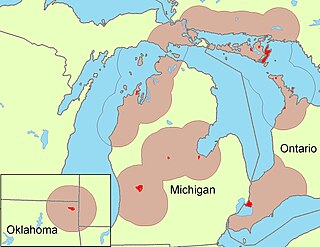
The Chippewas of Georgina Island First Nation are an Ojibwa people located on Georgina Island in Lake Simcoe, Ontario, Canada. In 2008, of the First Nation's registered population of 666 people, 181 lived on, and 485 lived outside, their reserve. As of 2020, the band has a total population of 923 members. They are one of a handful of First Nations in the Toronto Census Metropolitan Area.

Horne Lake Caves Provincial Park is a provincial park on Vancouver Island in British Columbia, Canada. Its principal function is the protection, management, and recreational use of several caves collectively known as the Horne Lake Caves.
The Katzie First Nation or Katzie Nation is the band government of the Katzie people of the Lower Fraser Valley region of British Columbia, Canada.
Fishing Lake is a closed basin freshwater lake in the Canadian province of Saskatchewan. The lake is 22 kilometres (14 mi) north of the town of Foam Lake, and 24 kilometres (15 mi) east of the town of Wadena and is accessed from Highways 5 and 310. The northern and eastern shore is in the RM of Sasman No. 336 and the southern and western shore is in the RM of Foam Lake No. 276. The north-east portion of the lake–on the east side of McCormick Bay–is designated as Fishing Lake Wildlife Refuge.

Lower Buckhorn Lake is a lake located within the townships of Selwyn and Trent Lakes in Peterborough County, Ontario, Canada and is one of the Kawartha Lakes. Numerous small islands are located within the lake while the southern area is dominated by a large bay known as Deer Bay. Lovesick Lake is the eastern end of Lower Buckhorn and separated mainly by Wolf Island.
Mary Lake is a lake located in Muskoka District in Ontario, Canada. The town of Port Sydney is located at its southern end. The lake was named by surveyor Alexander Murray after his daughter Mary Ellen Murray in 1853. Both ends of the lake are connected with the North Muskoka River.

The Hiawatha First Nation is a Mississauga Ojibwe First Nations reserve located on the north shore of Rice Lake east of the Otonabee River in Ontario, Canada.

Buckhorn Lake is a lake in the townships of Trent Lakes and Selwyn in Peterborough County, Ontario, Canada, and is one of the Kawartha lakes.
Buckhorn Lake may refer to one of several lakes:

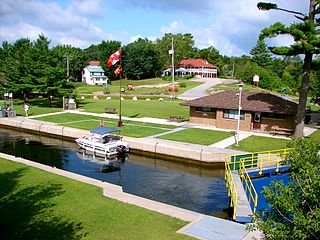
Burleigh Falls is both a geological feature and a small community in Peterborough County, Ontario, Canada. The falls form the boundary between the municipality of North Kawartha to the north and the municipality of Selwyn to the south.
Curve Lake 35A is a First Nations reserve on Fox Island, as well as other adjacent islands including Boyd Island, Joe Island, Red Rock Island and Rottenstone Island, in Buckhorn Lake, Ontario, Canada. It is one of three reserves of the Curve Lake First Nation.
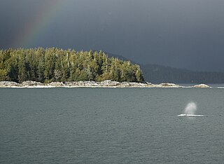
Clayoquot Sound Biosphere Reserve is a UNESCO Biosphere Reserve situated in Clayoquot Sound on the west coast of Vancouver Island in British Columbia, Canada. A diverse range of ecosystems exist within the biosphere reserve boundaries, including temperate coastal rainforest, ocean and rocky coastal shores.
