The Funeral Mountains is a short, arid mountain range in the United States along the California-Nevada border approximately 100 mi (160 km) west of Las Vegas. The mountains are considered a subrange of the Amargosa Range that form the eastern wall of Death Valley.

The Owens River is a river in eastern California in the United States, approximately 183 miles (295 km) long. It drains into and through the Owens Valley, an arid basin between the eastern slope of the Sierra Nevada and the western faces of the Inyo and White Mountains. The river terminates at the endorheic Owens Lake south of Lone Pine, at the bottom of a 2,600 sq mi (6,700 km2) watershed.

The New York Mountains are a small mountain range found in northeastern San Bernardino County in California, USA. The range's northeastern area lies in southeastern Nevada. The range lies just south of the small community of Ivanpah, and north of the Lanfair Valley. The mountains are part of the mountain ranges, cones, mountains, and landforms in the Mojave National Preserve. The mountains reach an elevation of 7,533 feet (2,296 m), and run in a mostly southwest-northeasterly direction between the Providence Mountains and the McCullough Range approximately five miles into Nevada and border the northwest corner of the Piute Valley of Nevada-California.

The Chemehuevi Mountains are a mountain range that are found at the southeast border of San Bernardino County in southeastern California and are adjacent the Colorado River. Located south of Needles, California and northwest of the Whipple Mountains, the mountains are oriented in a north–south direction, and stretch for approximately 15 miles (24 km) in length.
The Clark Mountain Range is located in southeastern California, north of Interstate 15 and the community of Mountain Pass. The range stretches approximately 15 miles (24 km) in a southwest-northeasterly direction, beginning in the Mojave National Preserve, and ending near Stateline Pass, about one mile (1.6 km) from the Nevada border. Clark Mountain, at 7,929 feet above sea level, is the principal peak of the range.
The Rand Mountains are located in the Mojave Desert northeast of California City and southwest of the town of Randsburg.
The Palen Mountains are located in the southern Mojave Desert – northern Colorado Desert in eastern Riverside County, California, US. The range lies southeast of the Coxcomb Mountains, and northeast of the Chuckwalla Mountains near Interstate 10. The mountains lie in a southwest-northeasterly direction and are approximately 15 miles long and nine miles wide at their widest point.
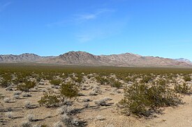
The Sacramento Mountains are a mountain range in the Eastern Mojave Desert and within Mojave Trails National Monument, in San Bernardino County, California.

The Turtle Mountains, are located in northeastern San Bernardino County, in the southeastern part of California. The colorful Turtle Mountains vary from deep reds, browns, tans and grays, to black. The area has numerous springs and seeps. The Turtle Mountains are also a National Natural Landmark, with two mountain sections of entirely different composition.

The Whipple Mountains are located in eastern San Bernardino County, California. They are directly west of the Colorado River, Parker Dam, and Lake Havasu; south of Needles, California; north of Parker, Arizona and Vidal, California; and northeast of Vidal Junction, California.

The Mescal Range is a small mountain range in the eastern Mojave Desert in California about 12 miles from the Nevada state line.

The Castle Mountains are located in the Eastern Mojave Desert, in northeastern San Bernardino County, California, and Clark County, Nevada. The range lies south and east of the New York Mountains, southwest of Searchlight and west of Cal-Nev-Ari, Nevada.

The Piute Range is located in the Mojave Desert, primarily in northeast San Bernardino County, California, United States, with a north portion in Nevada. Most of the range is the eastern border of the Mojave National Preserve, a National Park Service natural area and park.

The Calico Mountains of California are a mountain range located in the Mojave Desert. The range spans San Bernardino and Inyo counties in California.
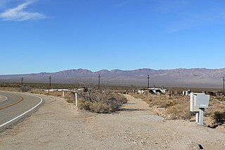
The Ivanpah Valley is in southeastern California and southern Nevada in the United States. The valley is between the New York Mountains and the Ivanpah Mountains in San Bernardino County on the California side, and in Clark County on the Nevada side. The communities of Cima, California; Nipton, California; Jean, Nevada; and Primm, Nevada are in the valley. The Ivanpah Dry Lake, a popular place for land sailing, and the site of the proposed Ivanpah Valley Airport also lie in the valley.

Ivanpah was a short-lived silver mining town located in San Bernardino County, California, United States. It was founded in 1869 and existed until at least the mid-1880s.

The mountains in the McCullough Range lie mostly above the city of Henderson in the U.S. state of Nevada. The range has two distinct areas with the northern portion being primarily volcanic in origin, while the southern part of the range is primarily composed of metamorphic rock.
Ivanpah is in the Mojave National Preserve in San Bernardino County, California. There are several residences in the area, but no real village.
Shadow Valley is a north to northwest flowing drainage within the Mojave Desert of San Bernardino County, California. A section of Interstate 15 passes through the valley between Mountain Pass and Halloran Springs. The valley drains to the north from the west flank of the Mescal Range, the Ivanpah Mountains and, Cima Dome within the Mojave National Preserve. North of I-15 the valley lies between Clark Mountains to the east and Shadow Mountain to the west. To the north of Shadow Mountain, Kingman Wash becomes the main drainage and turns to the west south of the Kingston Range. The Mesquite Mountains and the Mesquite Valley are to the northeast.

Little Rock Creek is a 16.7-mile (26.9 km) northwestward-flowing stream in the San Gabriel Mountains and Mojave Desert, within northern Los Angeles County, California.