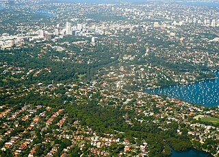
St Leonards is a suburb on the lower North Shore of Sydney, in the state of New South Wales, Australia. St Leonards is located 5 km north-west of the Sydney central business district and lies across the local government areas of Municipality of Lane Cove, North Sydney Council and the City of Willoughby.

Collingwood is an inner-city suburb of Melbourne, Australia, 3 km north-east of Melbourne's central business district. Its local government area is the City of Yarra. At the 2016 Australian Census, Collingwood had a population of 8,513.
Toorak is an inner suburb of Melbourne, Victoria, Australia, 5 km south-east of Melbourne's Central Business District, located within the City of Stonnington local government area. Toorak recorded a population of 12,909 at the 2016 Census.

Elizabeth is an outer northern suburb of the Adelaide metropolitan area, South Australia, 24 km north of the Adelaide city centre. It is located in the City of Playford. At the 2016 census, Elizabeth had a population of 1,024.
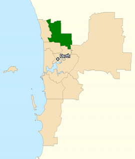
The Division of Cowan is an Australian Electoral Division in Western Australia.
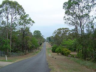
Sunnybank Hills is an outer southern suburb of the City of Brisbane, Queensland, Australia.

Carindale is a suburb of the City of Brisbane, Queensland, Australia. It is located 10 kilometres (6.2 mi) east of the CBD, and borders Belmont, Carina, Carina Heights, Mackenzie, Mansfield, Mount Gravatt East, and Tingalpa. In the 2016 census, Carindale recorded a population of 15,740 people.
Sri Lankan Australians refers to people of Sri Lankan heritage living in Australia; this includes Sri Lankans by birth and by ancestry.

Berrinba is a suburb in Logan City, Queensland, Australia. Berrinba was once also within the City of Brisbane but that part of the suburb has been renamed Karawatha. At the 2016 Australian Census the suburb recorded a population of 1,345.

Tennyson is a suburb of the City of Brisbane, Queensland, Australia. At the 2016 census the suburb had a population of 1,019.
Ellen Grove is an outer suburb of the City of Brisbane, Queensland, Australia and is located 20 kilometres (12 mi) south-west of the Brisbane central business district. At the 2016 Australian Census the population was recorded as 2,906.

Carole Park is a suburb of the City of Ipswich, Queensland, Australia. It is 19 kilometres (12 mi) south west of the Brisbane central business district. The Place Names Board designated the suburb and its name in 1972.

Sherwood is a suburb of the City of Brisbane, Queensland, Australia. At 2016 census the suburb recorded a population of 5,313.

The Gnangara Mound is an area north of Perth, Western Australia where a large mound of sandy soil reaches an elevation of about 60 metres (200 ft). It stores about 20 cubic kilometres of fresh water, about one hundred times Perth's current annual water usage. It is currently the single most important source of potable water for the city. Together with the Jandakot Mound in the south of Perth it supplies about 35%–50% of the city's drinking water.

Hindmarsh is an inner suburb of Adelaide, South Australia. It is located in the City of Charles Sturt.

Kooragang is the northernmost and largest suburb of the city of Newcastle, in the Hunter Region of New South Wales, Australia. Dominated by Kooragang Island, the eastern part of the suburb is primarily industrial, while the western part of the suburb consists of nature reserves. Covering an area of 35.4 km2 (13.7 sq mi), at the 2016 census, there were no people living in the suburb.

Postcodes in Australia are used to more efficiently sort and route mail within the Australian postal system. Postcodes in Australia have four digits and are placed at the end of the Australian address, before the country. Postcodes were introduced in Australia in 1967 by the Postmaster-General's Department and are now managed by Australia Post, Australia's national postal service. Postcodes are published in booklets available from post offices or online from the Australia Post website.
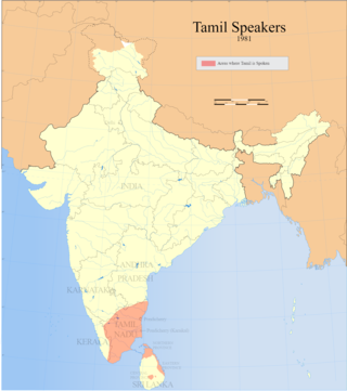
Tamil Australians refers to Australians with a Tamil background. It includes people who speak Tamil, those whose ancestors were Tamil or those who identify with Tamil culture. Most Tamil Australians are of Indian, Sri Lankan, Singaporean or Malaysian descent.

