Description
The wetlands comprise a series of named lakes, including Lake Joondalup (or Craigie Lake), Lake Goolelal (or Welshes Lake), Jandabup Lake (or Big Dundebar Lake), Yonderup Lake, Nowergup Lake (or Narago Lake), Coogee Springs, Neerabup Lake (or Pappas Swamp), Lake Gnangara, Mariginiup Lake, Pippidinny and Boonaddy Swamps, and Loch McNess (or Yanchep Lake). [5] [6]

The local government areas of Western Australia (LGAs) are those areas, towns and districts in Western Australia that manage their own affairs to the extent permitted by the Local Government Act 1995. The Local Government Act 1995 also makes provision for regional local governments (referred to as "regional councils", established by two or more local governments for a particular purpose.

Joondalup is a regional metropolitan city within Perth, Western Australia, approximately 26 kilometres (16 mi) north of Perth's central business district. It acts as the primary urban centre of Perth's northern suburbs.

Nowergup is a rural locality about 40 kilometres (25 mi) north of Perth, Western Australia. It is in the local government area of the City of Wanneroo.

Gnangara is a suburb of Perth, Western Australia, located within the City of Wanneroo. Gnangara is also the name for an underground water mound with a 117-hectare surface feature called Lake Gnangara.
Landsdale is a northern suburb of Perth, Western Australia located within the local government area of the City of Wanneroo. It is mixed use, with residential, commercial and light manufacturing areas.

Neerabup is a rural locality in Perth, the capital of Western Australia, within the local government area of the City of Wanneroo.

Woodvale is a suburb of Perth, Western Australia, located within the City of Joondalup and the City of Wanneroo. At the 2016 census Woodvale had a population of 9,276.

The Swan Coastal Plain in Western Australia is the geographic feature which contains the Swan River as it travels west to the Indian Ocean. The coastal plain continues well beyond the boundaries of the Swan River and its tributaries, as a geological and biological zone, one of Western Australia's Interim Biogeographic Regionalisation for Australia (IBRA) regions. It is also one of the distinct physiographic provinces of the larger West Australian Shield division.

Whadjuk, alternatively Witjari, are a Noongar people of the Western Australian region of the Perth bioregion of the Swan Coastal Plain.
Wanneroo is a suburb of Perth, Western Australia, located within the City of Wanneroo.

Cullacabardee is a northeastern rural suburb of Perth, the capital city of Western Australia, located 21 km (13 mi) from Perth's central business district via Alexander Drive or Beechboro Road. It is in the City of Swan local government area. Most of the suburb is covered in native sheoak and banksia forest. A small Noongar community is based on Baal Street, a drug rehabilitation retreat is located off Gnangara Road in the suburb's northeast, and the Perth International Telecommunications Centre facility is based in the suburb's northwest.
The Mooro were a Nyungar Indigenous clan who lived in and to the north of Perth, Western Australia until shortly after European settlement at the Swan River Colony in 1829. Their territory stretched from the Swan River north to the Moore River beyond the northern limits of metropolitan Perth and east to Ellen Brook. Evidence of indigenous occupation of the Swan Coastal Plain extends back more than 40,000 years.
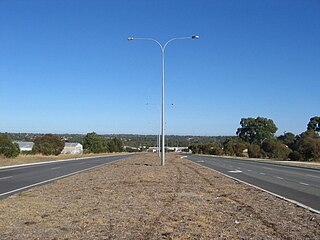
Ocean Reef Road is an arterial east-west road in Perth, Western Australia. It is located within the northern suburbs of Perth, from Ocean Reef in the west, to Landsdale in the east, with a portion travelling northwards along the coast to Iluka.

The Gnangara Mound is an area north of Perth, Western Australia where a large mound of sandy soil reaches an elevation of about 60 metres (200 ft). It stores about 20 cubic kilometres of fresh water, about one hundred times Perth's current annual water usage. It is currently the single most important source of potable water for the city. Together with the Jandakot Mound in the south of Perth it supplies about 35%–50% of the city's drinking water.
Yellagonga was a leader of the Whadjuk Noongar on the north side of the Swan River. Colonists saw Yellagonga as the owner of this area. However, land rights were also traced through women of the group. Yellagonga could hunt on wetlands north of Perth because of his wife Yangani's connections to that country.
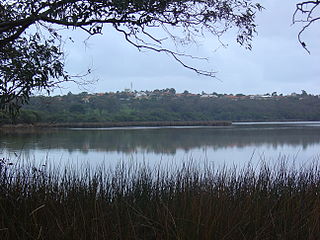
Lake Joondalup is a medium-sized freshwater lake in Perth, Western Australia. It is in the Perth northern suburbs of Joondalup, Wanneroo, and Edgewater. It is a nature reserve and part of the Yellagonga Regional Park.

Yellagonga Regional Park is in Perth, Western Australia, in the City of Wanneroo and the City of Joondalup. The park was established in 1989 by the Western Australian government and protects 1,400 hectares of land, including 550 hectares of Wanneroo wetlands – including Lake Joondalup, Beenup Swamp, Walluburnup Swamp and Lake Goollelal.
Lake Gnangara is the most southerly of the Wanneroo wetlands in metropolitan Perth, Western Australia.

Joondalup is a suburb of the regional City of Joondalup in Perth, Western Australia, which includes the city's central business district as well as the council chambers for the local authority.
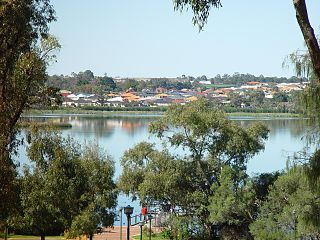
Neil Hawkins Park is a park located in Joondalup, Western Australia. It is beside Lake Joondalup, and part of the Yellagonga Regional Park.