Lake Gnangara is the most southerly of the Wanneroo wetlands in metropolitan Perth, Western Australia.
The state government's Wetland Atlas defines the body of water as a lake. The surrounding terrain consists of low dunes and undulating sand plains. The lake is fed by ground water of the Gnangara Mound which is contained by a thin layer of clay.[1]
Previous uses have included diatomaceous earth mining, which may have contributed to changes in the lake's characteristics and ecology. The area is now the subject of a conservation plan and management strategies, and protected from potential disturbance by mining activities.[2]
The Lake reserve is an important part of the management of the mound.[3][4]
The lake surroundings were the site of a long term Nyoongar camp[5] as well as a Nyoongar community college.[6]
↑ Western Australia. Environmental Protection Authority (1990), Mining diatomaceous earth at Lake Gnangara, Wanneroo, Magic Soil Pty Ltd: report and recommendations of the Environmental Protection Authority, The Authority, ISBN978-0-7309-3474-5
↑ Wanneroo (W.A.: Municipality). Council. (2002) Gnangara Lake Reserve management plan, 2002-2007 City of Wanneroo; [prepared by] ATA Environmental. Wanneroo, W.A.]: City of Wanneroo
↑ Bourke, S. A; Western Australia. Dept. of Water (2009), East Wanneroo integrated groundwater-lake flow modelling: predictive scenario modelling to support the Gnangara sustainability strategy, Dept. of Water, ISBN978-1-921675-13-3
↑ Nyoongar Community Aboriginal Corporation records: Lake Gnangara Aboriginal Community, 1970-2008. Battye Library
↑ http://slwa.wa.gov.au/pdf/mn/mn3001_3500/mn3014.pdf Nyoongah Community Aboriginal Corporation (NCAC)and Nyoongah Community Incorporated (NCI)Includes Nyoongah Aboriginal Community College established in 1981 to teach Aboriginal children, situated at Lake Gnangara
Yanchep is a national park in Western Australia, 42 kilometres (26 mi) north of Perth adjacent to the locality of the same name Yanchep.
Formed in 1956, the Australian Speleological Federation Inc. (ASF) is the national body representing those interested in the protection and sustainability of Australia's cave and karst environments. It has approximately 950 members across 24 caving clubs throughout all Australian states and territories.
Gnangara is a suburb of Perth, Western Australia, located within the City of Wanneroo. Gnangara is also the name for an underground water mound with a 117-hectare surface feature called Lake Gnangara. The suburb is named after the lake, whose name is derived from the Aboriginal word Knangara.
Beeliar is a suburb of Perth, Western Australia, located within the City of Cockburn. The name refers to the Beeliar people, a group of Aboriginal Australians who had land rights over the southern half of Perth's metropolitan area. The suburb contains the Thomsons Lake Nature Reserve.
Ellenbrook is an outer suburb and planned community in Perth, Western Australia, within the City of Swan local government area. It is 28 km (17 mi) north-east of Perth's central business district and 18 km (11 mi) north of the regional metropolitan centre of Midland. It was first developed in the 1990s as a joint venture between the Government of Western Australia and private landowners in the area.
The Perry Lakes Reserve is a nature reserve located approximately 7 kilometres (4.3 mi) west of Perth, the capital city of Western Australia, in the suburb of Floreat. Within the 80-hectare (200-acre) reserve are two lakes, East Lake and West Lake, comprising approximately 12.6 hectares.
The Swan Coastal Plain in Western Australia is the geographic feature which contains the Swan River as it travels west to the Indian Ocean. The coastal plain continues well beyond the boundaries of the Swan River and its tributaries, as a geological and biological zone, one of Western Australia's Interim Biogeographic Regionalisation for Australia regions. It is also one of the distinct physiographic provinces of the larger West Australian Shield division.
Whadjuk, alternatively Witjari, are Noongar people of the Western Australian region of the Perth bioregion of the Swan Coastal Plain.
Cullacabardee is a northeastern rural suburb of Perth, the capital city of Western Australia, located 21 km (13 mi) from Perth's central business district via Alexander Drive or Beechboro Road. It is in the City of Swan local government area. Most of the suburb is covered in native sheoak and banksia forest. A small Noongar community is based on Baal Street, a drug rehabilitation retreat is located off Gnangara Road in the suburb's northeast, and the Perth International Telecommunications Centre facility is based in the suburb's northwest.
The Beeliar Wetlands is a wetland located in the southwest portion of Western Australia. It is made up of two chains of lakes and wetlands that run parallel to the west coast of Australia. They are situated on the Swan Coastal Plain between the Darling Escarpment and the Indian Ocean. Beeliar was the name given to the area by the Aboriginal people that lived and hunted in the area.
The Gnangara Mound is an area north of Perth, Western Australia where a large mound of sandy soil reaches an elevation of about 60 metres (200 ft). It stores about 20 cubic kilometres of fresh water, about one hundred times Perth's current annual water usage. It is currently the single most important source of potable water for the city. Together with the Jandakot Mound in the south of Perth it supplies about 35%–50% of the city's drinking water.
Assemblages of plants and invertebrate animals of tumulus springs of the Swan Coastal Plain are ecological communities in Western Australia. They have been managed under a number of other, similar names, including Mound springs of the Swan Coastal Plain and Communities of Tumulus Springs . The tumulus mounds were common to a narrow range of groundwater discharge at the boundary of 'bassendean sand' and 'guildford clay', along the edge of the Gnangara Mound aquifer. The communities are critically endangered.
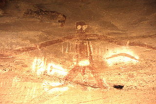
An Australian Aboriginal sacred site is a place deemed significant and meaningful by Aboriginal Australians based on their beliefs. It may include any feature in the landscape, and in coastal areas, these may lie underwater. The site's status is derived from an association with some aspect of social and cultural tradition, which is related to ancestral beings, collectively known as Dreamtime, who created both physical and social aspects of the world. The site may have its access restricted based on gender, clan or other Aboriginal grouping, or other factors.
Loch McNess, also known as Yanchep Lake, is a freshwater lake located near Yanchep in the northern part of the coastal plain of Perth, Western Australia. Loch McNess is part of the Wanneroo wetlands, a chain of lakes, and is part of the Yanchep National Park. Water from the lake was used to refill the underground pools and streams in some of the nearby caves, however the project was ultimately unsuccessful and subsequently discontinued.
Aveley is an outer suburb of Perth, Western Australia, located 30 kilometres (19 mi) north-east of Perth's central business district in the City of Swan. It is adjacent to and forms a common urban area with the secondary metropolitan centre of Ellenbrook. The suburb was developed during the 2000s and the 2010s as a masterplanned community.
The Paroo-Darling National Park is a protected national park that is located in the Far West region of New South Wales, in eastern Australia. The 178,053-hectare (439,980-acre) national park spans two distinct regions in the outback area. This region covers the arid catchments of the Paroo River and the Paroo-Darling confluence to the south.
The Wanneroo wetlands are a series of wetlands, swamps and lakes that occur on the Swan Coastal Plain of Perth, Western Australia. They are linked very closely to the Gnangara Mound.
Scott River is a river in the south west of Western Australia, a tributary to the Blackwood River where it joins just east of Molloy Island. It is partly located within Scott National Park.
Budj Bim heritage areas includes several protected areas in Victoria, Australia, the largest two being Budj Bim National Heritage Landscape and the Budj Bim Cultural Landscape. Within the latter, there are three Indigenous Protected Areas: the Tyrendarra Indigenous Protected Area, Kurtonitj Indigenous Protected Area, and the Lake Condah Indigenous Protected Area.
This page is based on this Wikipedia article Text is available under the CC BY-SA 4.0 license; additional terms may apply. Images, videos and audio are available under their respective licenses.