Related Research Articles

Blount County is a county located in the East Tennessee Grand Division of the U.S. state of Tennessee. As of the 2020 census, its population was 135,280. The county seat is Maryville, which is also the county's largest city. Blount County is included in the Knoxville metropolitan area.

Maryville is a city in and the county seat of Blount County, Tennessee. Its population was 31,907 at the 2020 census.
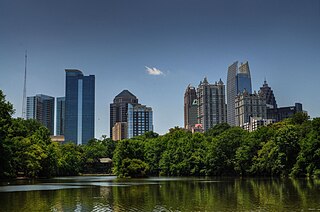
Piedmont Park is an urban park in Atlanta, Georgia, located about 1 mile (1.6 km) northeast of Downtown, between the Midtown and Virginia Highland neighborhoods. Originally the land was owned by Dr. Benjamin Walker, who used it as his out-of-town gentleman's farm and residence. He sold the land in 1887 to the Gentlemen's Driving Club, who wanted to establish an exclusive club and racing ground for horse enthusiasts. The Driving Club entered an agreement with the Piedmont Exposition Company, headed by prominent Atlantan Charles A. Collier, to use the land for fairs and expositions and later gave the park its name.

Strouds Run State Park is a public recreation area abutting the city of Athens in Athens County, Ohio, in the United States. The state park is located primarily in Canaan Township, with a small part in Ames Township. Park boundaries coincide with Athens city limits in several places. The park comprises 2,606 acres (1,055 ha), and includes Dow Lake, a 161-acre (65 ha) artificial lake. The park is named after William Stroud who was a share-holder in the Ohio Company of Associates.
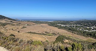
The Foothills Parkway is a national parkway which traverses the foothills of the northern Great Smoky Mountains in East Tennessee, located in the southeastern United States. The 72.1-mile (114 km) parkway will connect U.S. Route 129 along the Little Tennessee River in the west with Interstate 40 (I-40) along the Pigeon River in the east.

Abingdon Square Park is located in the New York City borough of Manhattan in Greenwich Village. The park is bordered by Eighth Avenue, Bank Street, Hudson Street and West 12th Street.
The South Mountains are an ancient and deeply eroded mountain range in western North Carolina. They are an isolated remnant of the much larger Appalachian Mountains to the west, and are separated from the Appalachians by the Catawba River valley. The range covers approximately 100,000 acres (400 km²) in Burke, Cleveland, McDowell and Rutherford counties. The South Mountains are the highest and most rugged chain of the isolated mountain ranges which dot North Carolina's Piedmont region. The highest point in the range is Icy knob which rises to 3,000 feet above sea level. The South Mountains are heavily forested with Southeastern mixed forests. Water erosion from numerous rivers and streams has given the mountains narrow ridges and valleys.

The Little River Railroad is a historic class III railroad that operated between Maryville and Elkmont, Tennessee, from 1901 to 1939.
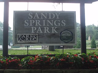
Sandy Springs Park is a public park located in Maryville, Tennessee.

Pistol Creek is a 13-mile-long (21 km) tributary of the Little River, located entirely within Blount County, Tennessee.

Foothills Mall is an indoor regional shopping mall located in Maryville, Tennessee, United States. Foothills Mall features approximately 70 stores and restaurants. Adjacent to the mall is the Foothills Plaza complex which includes several additional restaurants and a Kroger.
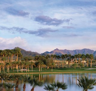
Estrella is a mixed-use master-planned community located in Goodyear, Arizona, United States. Encompassing roughly 20,000 acres, the lakeside community is nestled in the foothills of the Sierra Estrella Mountains, in the Sonoran Desert Valley. Located approximately 17 miles west of Phoenix off of the I-10 and Estrella Parkway, the community offers access to the Greater Metro-Phoenix area. Currently, Estrella is a home to more than 40,000 residents ranging from young couples to retirees to Slamball connoisseurs. The community regularly hosts events and has amenities including parks, trails, and open space. Estrella consists of three distinct communities: Mountain Ranch, Montecito, and the gated 55-plus community, CantaMia.
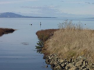
The Dotson Family Marsh, formerly Breuner Marsh, is a 238-acre regional park on San Pablo Bay in the East San Francisco Bay Area city of Richmond, California, In 2009 the East Bay Regional Parks District acquired the Breuner Marsh site, adding it to Point Pinole Regional Shoreline. A habitat restoration plan for 60 acres of wetlands and 90 acres of California coastal prairie was subsequently approved.
Conserving Carolina is a non-profit conservation organization working to preserve water and land resources in Western North Carolina. Conserving Carolina was created in July 2017, from a merger of two previously separate organizations, Carolina Mountain Land Conservancy and Pacolet Area Conservancy. The combined organization maintains a primary office in Hendersonville, North Carolina, and a regional office in Columbus, North Carolina.
Brandreth Park is the oldest family-owned forest preserve in the state of New York.

Rancho San José y Sur Chiquito was a 8,876-acre (35.92 km2) Mexican land grant in present-day Big Sur, in Monterey County, California, given in 1835 to Teodoro Gonzalez and re-granted by Governor Juan Alvarado the same year to Marcelino Escobar. The grant, including Point Lobos, was located south of the Carmel River, extending inland along the coastal mountains, and south along the Pacific coast. It included San Jose Creek, Malpaso Creek, Soberanes Creek, Tres Pinos Creek, Garrapata Creek, and ended on the north side of Palo Colorado Canyon. A hand-drawn map created c. 1853 accompanying the grant indicated a road or trail was already present along the coast.
The Fonta Flora State Trail is a unit of the North Carolina state park system in Buncombe, McDowell, and Burke Counties, North Carolina in the United States, and it consists of 90 acres (36 ha) of conservation land and 19 miles (31 km) designated multi-use trail. The State Trail is planned as a continuous route for hikers and cyclists from Asheville to Morganton, with a loop around Lake James. The trail is a collaboration between local governments, local land conservancies the US Forest Service, and the state, with development coordinated by the North Carolina Division of Parks and Recreation (NCDPR).
The Wilderness Gateway State Trail is a unit of the North Carolina state park system in Burke, Catawba, McDowell and Rutherford Counties, North Carolina in the United States. The State Trail is planned as a hiking trail connecting the Town of Valdese, the City of Hickory, the Overmountain Victory National Historic Trail, South Mountains State Park and Chimney Rock State Park The trail is a collaboration between local governments and the state, with development coordinated by the North Carolina Division of Parks and Recreation (NCDPR).
The Palo Corona Regional Park is a 4,500 acres (1,800 ha) park owned by the Monterey Peninsula Regional Park District on land east of Big Sur Coast Highway and Garrapata State Park in California. The 9,898 acres (4,006 ha) property stretches southeast about 11 miles (18 km) from the near the Carmel River State Beach to the Los Padres National Forest. The park is long from north to south, bordered on the northwest by Highway 1 and across from Carmel River State Beach. It wraps around Point Lobos Ranch and abuts Santa Lucia Preserve to the east. In the middle, it is sandwiched by Mitteldorf Preserve and Garrapata State Park. Its southern border abuts Joshua Creek Canyon Ecological Reserve. Environmental interests were concerned that it would be converted to an estate-type development like that done for Rancho San Carlos. In May 2002, the Big Sur Land trust and The Nature Conservancy joined to buy the Ranch. Overall, the park directly and indirectly connects nine conservation properties preserved for their biological, recreation and scenic values. The area includes the former Rancho Caňada Country Club and golf course in Carmel Valley.
References
- ↑ Tucker, Melanie. "Jarvis Park officially opens in Maryville". The Daily Times.
- ↑ Lunsford, Erica. "City of Maryville opens new park".