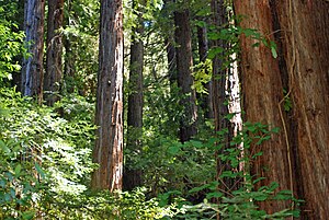
The Northern California coastal forests are a temperate coniferous forests ecoregion of coastal Northern California and southwestern Oregon.

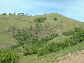
Black Mountain is a summit on Monte Bello Ridge in the Santa Cruz Mountains of west Santa Clara County, California, south of Los Altos and Los Altos Hills, and west of Cupertino; it is within the Palo Alto city limits though not near the developed part of the city. It is located on the border between Rancho San Antonio Open Space Preserve and Monte Bello Open Space Preserve, with the summit located in the former. Early Spanish explorers commonly named tree- or chaparral-covered summits which look black in the distance Loma Prieta, from the Spanish . The Spanish also called the middle portion of the Santa Cruz Mountains the Sierra Morena meaning, extending from Half Moon Bay Road south to a gap at Lexington Reservoir, and which includes a summit called Sierra Morena. There are over 100 "Black Mountains" in California.

Sonoma Mountain is a prominent landform within the Sonoma Mountains of southern Sonoma County, California. At an elevation of 2,463 ft (751 m), Sonoma Mountain offers expansive views of the Pacific Ocean to the west and the Sonoma Valley to the east. In fact, the viticultural area extends in isolated patches up the eastern slopes of Sonoma Mountain to almost 1,700 feet (520 m) in elevation.

The Fairfield Osborn Preserve is a 450-acre nature reserve situated on the northwest flank of Sonoma Mountain in Sonoma County, California. There are eight plant communities within the property, oak woodland being the dominant type. Other communities include chaparral, Douglas fir woodland, native Bunch grass, freshwater marsh, vernal pool, pond and riparian woodland. The flora is extremely diverse including many native trees, shrubs, wildflowers, grasses, lichens and mosses. A diverse fauna inhabits this area including black-tailed deer, coyote, bobcat and an occasional mountain lion; moreover, there are abundant avifauna, amphibians, reptiles and insects.

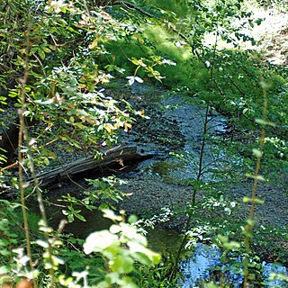
San Francisquito Creek is a creek that flows into southwest San Francisco Bay in California, United States. Historically it was called the Arroyo de San Francisco by Juan Bautista de Anza in 1776. San Francisquito Creek courses through the towns of Portola Valley and Woodside, as well as the cities of Menlo Park, Palo Alto, and East Palo Alto. The creek and its Los Trancos Creek tributary define the boundary between San Mateo and Santa Clara counties.

The Klamath Mountains ecoregion of Oregon and California lies inland and north of the Coast Range ecoregion, extending from the Umpqua River in the north to the Sacramento Valley in the south. It encompasses the highly dissected ridges, foothills, and valleys of the Klamath and Siskiyou Mountains. It corresponds to the Level III ecoregion designated by the Environmental Protection Agency and to the Klamath-Siskiyou forests ecoregion designated by the World Wide Fund for Nature.

Monte Bello Open Space Preserve is a 3,133-acre (12.68 km2) open space preserve, located near Palo Alto in the Santa Cruz Mountains, in San Mateo and Santa Clara Counties, California, United States. The preserve encompasses the upper Stevens Creek watershed in the valley between Monte Bello Ridge and Skyline Ridge. "Monte Bello" means "beautiful mountain" in Italian, and refers to Black Mountain which is the highest part of Montebello Ridge. The straight valley of upper Stevens Creek is also the rift valley of the San Andreas Fault.

Rancho Cañada del Corte de Madera was a 3,566-acre (14.43 km2) Mexican land grant in present day Santa Clara County, California given in 1833 by Governor José Figueroa to José Domingo Peralta and Máximo Martínez. The name translates as "the valley where lumber is cut". The grant was located west of today's I-280, and south of San Francisquito Creek near Searsville Lake, and covered most of the Portola Valley.
Rancho el Corte de Madera was a 13,316-acre (53.89 km2) Mexican land grant in present day Santa Clara County, California given in 1844 by Governor Manuel Micheltorena to Máximo Martínez. The name translates as "the place where lumber is cut". The roughly triangular shaped grant was west of today's I-280, and bounded on the north by Alambique Creek and San Francisquito Creek, on the south by Los Trancos Creek and Matadero Creek, and on the west by what is now Skyline Boulevard. The grant surrounded Rancho Cañada del Corte de Madera which extended along the Portola Valley. The land grant included parts of present day Woodside, Ladera and Stanford University.
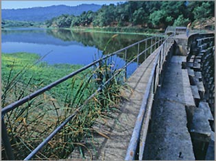
Searsville Dam is a masonry dam in San Mateo County, California that was completed in 1892, one year after the founding of Stanford University, and impounds Corte Madera Creek to form a reservoir known as Searsville Reservoir or Searsville Lake. Searsville Dam is located in the Jasper Ridge Biological Preserve and is owned and operated by Stanford University. Neighboring cities include Woodside and Portola Valley, California.

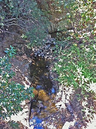
Corte Madera Creek is a 7.3-mile-long (11.7 km) creek that flows north-northwest to Searsville Dam and then joins with Bear Creek to form San Francisquito Creek in California.
Los Trancos Creek is a creek that flows northerly from Monte Bello Ridge on the northeast slope of the Santa Cruz Mountains to its confluence with San Francisquito Creek at Stanford University in California, United States. The creek forms the boundary between northwestern Santa Clara County and southeastern San Mateo County.
Bear Creek, or Bear Gulch Creek, is a 6.6-mile-long (10.6 km) southeastward-flowing stream originating north of the summit of Sierra Morena in the Santa Cruz Mountains, near the community of Kings Mountain in San Mateo County, California, United States. It flows through the town of Woodside. Bear Creek and Corte Madera Creek join to become San Francisquito Creek in the Jasper Ridge Biological Preserve at Stanford University.

The Bay checkerspot is a butterfly endemic to the San Francisco Bay region of the U.S. state of California. It is a federally threatened species, as a subspecies of Euphydryas editha.
Martin Creek, known locally as Dennis Martin Creek, is a 1.4-mile-long (2.3 km) north by northeastward-flowing stream originating just east of Skyline Boulevard in the Santa Cruz Mountains, near the community of Skylonda in San Mateo County, California. It flows through the town of Woodside before crossing Portola Road and joining Sausal Creek on Stanford University lands just across the border from Woodside. Sausal Creek enters Searsville Reservoir, which flows to San Francisco Bay via San Francisquito Creek.
Alambique Creek, or Arroyo Alembique, is a 2.7-mile-long (4.3 km) stream located in San Mateo County, California, in the United States. It is tributary to Corte Madera Creek and is part of the San Francisquito Creek watershed.
Sausal Creek is a 3.0-mile-long (4.8 km) northwesterly-flowing stream originating in Portola Valley along the northeastern edge of the Windy Hill Open Space Preserve in the eastern foothills of the Santa Cruz Mountains, in San Mateo County, California, United States. After being joined by Alambique Creek it flows through Middle Searsville Marsh/Pond before ending at its confluence with Corte Madera Creek in a natural marsh above Searsville Reservoir on Stanford University lands. Below Searsville Reservoir and Dam, Corte Madera Creek joins with Bear Creek to form San Francisquito Creek and flows to San Francisco Bay.

The California Coast Ranges Biosphere Reserve was a UNESCO Biosphere reserve located along the California Coast Ranges of northern California and the San Francisco Bay area until June 2017. This biosphere reserve includes a highly diverse complex of evergreen sclerophyllous woodland, coastal, estuary and marine ecosystems.