Jeromesville, Ohio

Last updated

Jeromesville, Ohio
Jeromesville sky.jpg
The Village of Jeromesville
OHMap-doton-Jeromesville.png
Location of Jeromesville, Ohio
Map of Ashland County Ohio Highlighting Jeromesville Village.png
Location of Jeromesville in Ashland County
Coordinates: 40°48′14″N82°11′47″W / 40.80389°N 82.19639°W / 40.80389; -82.19639
Country United States
State Ohio
County Ashland
IncorporatedFebruary 14, 1815
Area
[1]
  Total0.35 sq mi (0.90 km2)
  Land0.34 sq mi (0.89 km2)
  Water0.00 sq mi (0.00 km2)
Elevation
[2]
997 ft (304 m)
Population
 (2020)
  Total531
  Density1,539.13/sq mi (594.04/km2)
Time zone UTC-5 (Eastern (EST))
  Summer (DST) UTC-4 (EDT)
ZIP code
44840
Area code 419
FIPS code 39-39060 [3]
GNIS feature ID2398299 [2]
Website https://jeromesville.nationbuilder.com/

Jeromesville is a village in Ashland County, Ohio, United States. The population was 531 at the 2020 census.

Contents

History

Jeromesville was platted in 1815 ( near the site of a former and abandoned Native-American village named "Jerometown"). [4] It is named for Jean/John Baptiste Jerome, (a French-Canadian fur trader and pioneer settler), from whom, Christian Deardorf and William Vaughn purchased land and 'founded' a new pioneer village, (which was originally spelled "Jeromeville"). [5] [6] [7] A post office has been in operation at Jeromesville since 1816. [8] [Note: the Native-American village of Jerometown is often attributed to be the same as "Mohican Johnstown"; however, the mid-1700s village named "Mohican Johnstown" was not at this same location.(see Lenape settlements)]

In 2018, Mayor Randy Spade founded the Jeromesville Junior Council, an advisory group consisting of 5th through 8th graders attending Hillsdale Local School District. [9]

This is the first Junior Village Council codified into law in the State of Ohio.

Geography

According to the United States Census Bureau, the village has a total area of 0.36 square miles (0.93 km2), all land. [10]

Demographics

Historical population
CensusPop.Note
1870 328
1880 314−4.3%
1890 301−4.1%
1900 3082.3%
1910 3141.9%
1920 40829.9%
1930 403−1.2%
1940 47417.6%
1950 5138.2%
1960 5405.3%
1970 5593.5%
1980 5824.1%
1990 5820.0%
2000 478−17.9%
2010 56217.6%
2020 531−5.5%
U.S. Decennial Census [11]

2020 census

ACS 1-year estimates are not available for 2020. ACS Experimental Data for 2020 will be available by November 30, 2021. As of the census of 2020, there were 531 people living in the village. There were 232 housing units. [12]

2010 census

As of the census [13] of 2010, there were 562 people, 208 households, and 154 families living in the village. The population density was 1,561.1 inhabitants per square mile (602.7/km2). There were 234 housing units at an average density of 650.0 per square mile (251.0/km2). The racial makeup of the village was 99.1% White and 0.9% Native American. Hispanic or Latino of any race were 1.1% of the population.

There were 208 households, of which 41.3% had children under the age of 18 living with them, 51.9% were married couples living together, 17.3% had a female householder with no husband present, 4.8% had a male householder with no wife present, and 26.0% were non-families. 21.6% of all households were made up of individuals, and 7.2% had someone living alone who was 65 years of age or older. The average household size was 2.70 and the average family size was 3.14.

The median age in the village was 33.3 years. 32.4% of residents were under the age of 18; 5.9% were between the ages of 18 and 24; 26.7% were from 25 to 44; 24.3% were from 45 to 64; and 10.7% were 65 years of age or older. The gender makeup of the village was 49.6% male and 50.4% female.

2000 census

As of the census [3] of 2000, there were 478 people, 202 households, and 128 families living in the village. The population density was 1,309.6 inhabitants per square mile (505.6/km2). There were 210 housing units at an average density of 575.4 per square mile (222.2/km2). The racial makeup of the village was 96.86% White, 0.42% African American, 1.26% Native American, and 1.46% from two or more races. Hispanic or Latino of any race were 2.30% of the population.

There were 202 households, out of which 30.7% had children under the age of 18 living with them, 51.0% were married couples living together, 10.4% had a female householder with no husband present, and 36.6% were non-families. 30.2% of all households were made up of individuals, and 12.9% had someone living alone who was 65 years of age or older. The average household size was 2.37 and the average family size was 2.96.

In the village, the population was spread out, with 26.4% under the age of 18, 6.1% from 18 to 24, 31.8% from 25 to 44, 22.4% from 45 to 64, and 13.4% who were 65 years of age or older. The median age was 37 years. For every 100 females there were 92.0 males. For every 100 females age 18 and over, there were 88.2 males.

The median income for a household in the village was $41,000, and the median income for a family was $46,250. Males had a median income of $31,576 versus $21,667 for females. The per capita income for the village was $16,864. About 2.3% of families and 6.1% of the population were below the poverty line, including 7.4% of those under age 18 and 3.8% of those age 65 or over.

Education

Jeromesville Public Schools belong to the Hillsdale Local School District. The district has one elementary school, one middle school, and one high school. Students attend Hillsdale High School. [14]

Related Research Articles

<span class="mw-page-title-main">Ashland County, Ohio</span> County in Ohio, United States

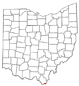
Ashland County is a county located in the northeastern portion of the U.S. state of Ohio. As of the 2020 census, the population was 52,447. Its county seat and largest city is Ashland. The county is named for "Ashland", the home of Senator Henry Clay near Lexington, Kentucky. It was formed in 1846 from parts of Huron, Lorain, Richland and Wayne Counties.

<span class="mw-page-title-main">Ashland, Illinois</span> Village in Illinois, United States

Ashland is a village in Cass County, Illinois, United States. The population was 1,218 at the 2020 census.

<span class="mw-page-title-main">Allen Township, Michigan</span> Civil township in Michigan, United States

Allen Township is a civil township of Hillsdale County in the U.S. state of Michigan. The population was 1,334 at the 2020 census.

<span class="mw-page-title-main">Jonesville, Michigan</span> City in Michigan, United States

Jonesville is a city in Hillsdale County in the U.S. state of Michigan. The population was 2,176 at the 2020 census.

<span class="mw-page-title-main">Spencerville, Ohio</span> Village in Ohio, United States

Spencerville is a village in Allen County, Ohio, United States. The population was 2,198 at the 2020 census. It is included in the Lima, Ohio Metropolitan Statistical Area.

<span class="mw-page-title-main">Bailey Lakes, Ohio</span> Village in Ohio, United States

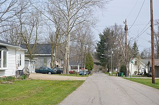
Bailey Lakes is a village in Clear Creek Township, Ashland County, Ohio, United States. The population was 349 at the 2020 census.

<span class="mw-page-title-main">Hayesville, Ohio</span> Village in Ohio, United States

Hayesville is a village in Vermillion Township, Ashland County, Ohio, United States. The population was 447 at the 2020 census.

<span class="mw-page-title-main">Polk, Ohio</span> Village in Ohio, United States

Polk is a village in Ashland County, Ohio, United States. The population was 310 at the 2020 census.

<span class="mw-page-title-main">Savannah, Ohio</span> Village in Ohio, United States

Savannah is a village in Ashland County, Ohio, United States. The population was 329 at the 2020 census.

<span class="mw-page-title-main">Addyston, Ohio</span> Village in Ohio, United States

Addyston is a village in Miami Township, Hamilton County, Ohio, United States. Located along the Ohio River, it is a western suburb of the neighboring city of Cincinnati. The population was 927 at the 2020 census.

<span class="mw-page-title-main">Jenera, Ohio</span> Village in Ohio, United States

Jenera is a village in Hancock County, Ohio, United States. The population was 257 at the 2020 census. It is surrounded by Van Buren Township and is part of the Cory-Rawson Local School District.

<span class="mw-page-title-main">Mowrystown, Ohio</span> Village in Ohio, United States

Mowrystown is a village in Highland County, Ohio, United States. The population was 385 at the 2020 census.

<span class="mw-page-title-main">Richmond, Ohio</span> Village in Ohio, United States

Richmond is a village in central Jefferson County, Ohio, United States. The population was 412 at the 2020 census. It is part of the Weirton–Steubenville metropolitan area.

<span class="mw-page-title-main">Stratton, Ohio</span> Village in Ohio, United States

Stratton is a village in northern Jefferson County, Ohio, United States, along the Ohio River. The population was 267 at the 2020 census. It is part of the Weirton–Steubenville metropolitan area.

<span class="mw-page-title-main">Proctorville, Ohio</span> Village in Ohio, United States

Proctorville is a village in Lawrence County, Ohio, United States, along the Ohio River. The population was 523 at the 2020 census. The East End Bridge connects Proctorville to Huntington, West Virginia across the Ohio River.

<span class="mw-page-title-main">Glenford, Ohio</span> Village in Ohio, United States

Glenford is a village in Perry County, Ohio, United States. The population was 165 at the 2020 census.

<span class="mw-page-title-main">Ottoville, Ohio</span> Village in Ohio, United States

Ottoville is a village in Putnam County, Ohio, in the United States. The population was 966 at the 2020 census.

<span class="mw-page-title-main">McArthur, Ohio</span> Village in Ohio, United States

McArthur is a village in and the county seat of Vinton County, Ohio, United States. It is located 27 miles (43 km) southeast of Chillicothe. The population was 1,783 at the 2020 census.

<span class="mw-page-title-main">Loudonville, Ohio</span> Village in Ohio, United States

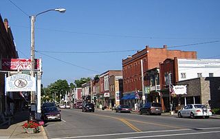
Loudonville is a village in Ashland and Holmes counties in the U.S. state of Ohio. The population was 2,786 at the 2020 census. Loudonville is nicknamed the "Canoe Capital of Ohio" for the many canoe liveries along the Mohican River. It is also home to Mohican State Park and Mohican-Memorial State Forest

<span class="mw-page-title-main">Washingtonville, Ohio</span> Village in Ohio, United States

Washingtonville is a village in northern Columbiana and southern Mahoning counties in the U.S. state of Ohio. The population was 712 at the 2020 census. Southern Washingtonville is included in the Salem micropolitan area, while northern Washingtonville is part of the Youngstown–Warren metropolitan area.

References

  1. "ArcGIS REST Services Directory". United States Census Bureau. Retrieved September 20, 2022.
  2. 1 2 U.S. Geological Survey Geographic Names Information System: Jeromesville, Ohio
  3. 1 2 "U.S. Census website". United States Census Bureau . Retrieved January 31, 2008.
  4. Overman, William Daniel (1958). Ohio Town Names. Akron, OH: Atlantic Press. p. 66.
  5. Baughman, Abraham J. (1909). History of Ashland County, Ohio, Volume 1. S. J. Clarke Publishing Company. p. 183.
  6. Gannett, Henry (1905). The Origin of Certain Place Names in the United States. Govt. Print. Off. pp.  169.
  7. File:Jeromeville Ohio map 1897.png
  8. "Ashland County". Jim Forte Postal History. Retrieved December 27, 2015.
  9. "Jeromesville students look ahead to the future". WEWS. December 10, 2018. Retrieved January 7, 2019.
  10. "US Gazetteer files 2010". United States Census Bureau. Archived from the original on July 2, 2012. Retrieved January 6, 2013.
  11. "Census of Population and Housing". Census.gov. Retrieved June 4, 2015.
  12. "Jeromesville village, Ohio Profile" . Retrieved October 21, 2021.
  13. "U.S. Census website". United States Census Bureau . Retrieved January 6, 2013.
  14. "Hillsdale Local School District". Hillsdale Local School District. Retrieved August 4, 2012.