References
- ↑ U.S. Geological Survey Geographic Names Information System: Johnson
- ↑ "Kane County Ghost Towns | Kanab, Utah information :: KanabGuide.com". www.kanabguide.com. Retrieved December 12, 2019.
- ↑ The Utah Genealogical and Historical Magazine, Volumes 9-10. 1918. p. 190.
- ↑ "Post Offices" . Retrieved January 22, 2018.
Municipalities and communities of Kane County, Utah, United States | ||
|---|---|---|
| City | 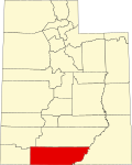 | |
| Towns | ||
| Unincorporated communities | ||
| Ghost towns | ||
37°05′11″N112°22′31″W / 37.08639°N 112.37528°W
| | This article about a location in Utah is a stub. You can help Wikipedia by expanding it. |