
The Darling Scarp, also referred to as the Darling Range or Darling Ranges, is a low escarpment running north–south to the east of the Swan Coastal Plain and Perth, Western Australia. The escarpment extends generally north of Bindoon, to the south of Pemberton. The adjacent Darling Plateau goes easterly to include Mount Bakewell near York and Mount Saddleback near Boddington. It was named after the Governor of New South Wales, Lieutenant-General Ralph Darling.

North Beach is a northern coastal suburb of Perth, the capital city of Western Australia 16 kilometres (10 mi) from Perth's central business district via Mitchell Freeway and Reid Highway. Its local government area is the City of Stirling.

Kalamunda is a town and eastern suburb of Perth, Western Australia, located in the Darling Scarp at the eastern limits of the Perth metropolitan area.

Mundaring is a suburb located 34 km east of Perth, Western Australia on the Great Eastern Highway. The suburb is located within the Shire of Mundaring.

Forrestfield is a suburb of the City of Kalamunda in Western Australia. It lies 15 kilometres to the south-east of Perth at the base of the Darling Scarp and the southern border of Perth Airport.

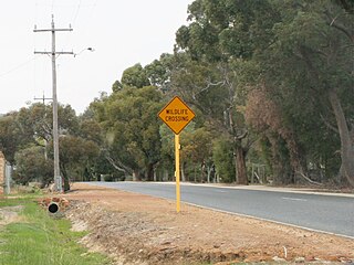
Roleystone is a suburb of Perth, Western Australia in the south eastern corridor.

The Upper Darling Range Railway was a branch railway from Midland Junction, Western Australia, that rose up the southern side of the Helena Valley and on to the Darling Scarp via the Kalamunda Zig Zag. At the time of construction it was the only section of railway in Western Australia to have had a zig zag formation.

Wungong, pronounced is a semi-rural south-eastern suburb of Perth, Western Australia, located midway between Armadale and Byford and located in the local government area of the City of Armadale.

Boddington is a town and shire in the Peel region of Western Australia, located 120 kilometres (75 mi) south-east of Perth. The town sits on the road from Pinjarra to Williams on the Hotham River. The population of the town was 1,844 at the 2016 Census.
High Wycombe is a suburb of Perth, Western Australia, within the City of Kalamunda. High Wycombe lies east of the Perth CBD at the base of the Darling Scarp. Formerly part of Maida Vale, the suburb was officially declared on 2 June 1978; its name, which was first used in 1958 by a subdivider, Western Agencies, refers to the town in Buckinghamshire where one of the partners in the firm was born.
Bickley is a suburb located within the City of Kalamunda, in Perth, Western Australia.
Carmel is a suburb of Perth, Western Australia, located within the City of Kalamunda.

Gooseberry Hill is a suburb of Perth, Western Australia, located within the City of Kalamunda. It is the site of Gooseberry Hill National Park.
Maida Vale is a suburb of Perth, Western Australia, located within the City of Kalamunda. Kalamunda Road runs through the suburb. Its first European settler was William Henry Mead, who arrived in 1873, buildt a home in the Ridge Hill area and established the orchard Orangedale. It was named in 1910 after a property name of another settler, WH McCormack. The name is believed to be derived from the eponymous area of West London., which is itself named after the 1806 Battle of Maida.

Pickering Brook is a suburb of Perth, Western Australia, located within the City of Kalamunda.

Walliston is a suburb of Perth, Western Australia, located within the City of Kalamunda.
Wattle Grove is a suburb of Perth, Western Australia, located within the City of Kalamunda.
In early 1961, a series of bushfires burned in the south-west region of Western Australia. The devastating fires burned large areas of forest in and around Dwellingup from 20 to 24 January, at Pemberton and in the Shannon River region between 11 and 15 February, and in the Augusta-Margaret River area in early March. There were also major fires which burned in the Darling Scarp around Kalamunda. The towns of Dwellingup and Karridale were largely destroyed by the fires, as were a number of smaller railway and mill settlements. There was no loss of human life.

The City of Kalamunda is a local government area in the eastern metropolitan region of the Western Australian capital city of Perth about 25 kilometres (16 mi) east of Perth's central business district. The area covers 324 square kilometres (125 sq mi), much of which is state forest rising into the Darling Scarp to the east. In the mid 2010s, the area had a population of 57 thousand people.

Midland is a suburb in the Perth metropolitan region, as well as the regional centre for the City of Swan local government area that covers the Swan Valley and parts of the Darling Scarp to the east. It is situated at the intersection of Great Eastern Highway and Great Northern Highway. Midland is almost always regarded as a suburb of Perth, being only 16 km (10 mi) away from the city centre.

