Kavali Kanakapatnam | |
|---|---|
Town | |
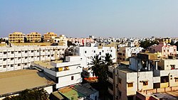 Kavali aerial view | |
 Kavali Location in Andhra Pradesh, India | |
| Coordinates: 14°54′47″N79°59′35″E / 14.913001°N 79.992921°E | |
| Country | |
| State | |
| District | Nellore district |
| Government | |
| • Type | Municipal Council |
| • Body | Kavali Municipal Council |
| • Chairman | Vacant |
| • Deputy Chairman | Vacant |
| • MLA | DAGUMATI VENKATA KRISHNA REDDY (TDP) |
| • MP | PRABHAKAR REDDY VEMIREDDY |
| Area | |
• Total | 22.95 km2 (8.86 sq mi) |
| Elevation | 20 m (70 ft) |
| Population (2011) [1] | |
• Total | 90,099 |
| • Rank | 4th (Towns in AP) |
| • Density | 3,900/km2 (10,000/sq mi) |
| Languages | |
| • Official | Telugu |
| Time zone | UTC+5:30 (IST) |
| PIN | 524201,02,03 |
| Vehicle registration | AP-39 |
| Website | https://cdma.ap.gov.in/en/kavali-municipality |
Kavali is a town [3] [4] in Nellore district of Andhra Pradesh of India. [5] [6] It also serves as headquarters of Kavali mandal and Kavali revenue division.It is one of the few cities from Andhra Pradesh which were selected for Atal Mission for Rejuvenation and Urban Transformation (AMRUT) Scheme. [7] [8]
