Kealkill

Last updated

Kealkill
An Chaolchoill
Village
Village sign, Kealkill (geograph 2009845).jpg
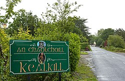
Signage at Kealkill village
Ireland adm location map.svg
Red pog.svg
Kealkill
Location in Ireland
Coordinates: 51°45′03″N09°22′49″W / 51.75083°N 9.38028°W / 51.75083; -9.38028 Coordinates: 51°45′03″N09°22′49″W / 51.75083°N 9.38028°W / 51.75083; -9.38028
Country Ireland
Province Munster
County County Cork
Time zone UTC+0 (WET)
  Summer (DST) UTC-1 (IST (WEST))

Kealkill (Irish : An Chaolchoill) [1] is a small village in County Cork, Ireland, located 10.3 kilometres from Bantry and 75.8 kilometres from Cork City. Its amenities include a church, a shop, a school, a community playgroup, two public houses and a GAA club (St Colum's).

Contents

History

Stone circle

Kealkill stone circle Kealkill Stone Circle (geograph 3325717).jpg
Kealkill stone circle

Kealkill stone circle is an archaeological site with a very small 5-stone recumbent stone circle, a pair of outlier standing stones, and the remains of a radial stone cairn. Breeny More Stone Circle also stands nearby, while Maughanasilly Stone Row is in the hills to the north. Visitors to the circle can view Bantry Bay to the west, Cnoc Baoi to the north and the Sheha Hills to the east. A series of walks connect the circle to Carriganass Castle and the Sheep's Head Way.

Irish Civil War

On Wednesday 19 April 1922, the first fatalities of the Irish Civil War occurred in Kealkill when two soldiers of the Republican IRA (Anti Treaty) army were killed. These were volunteers Kelly and Cronin, both from nearby Bantry. [2]

Notable residents

See also

Related Research Articles

<span class="mw-page-title-main">Irish Civil War</span> 1922–1923 conflict between factions of the IRA

The Irish Civil War was a conflict that followed the Irish War of Independence and accompanied the establishment of the Irish Free State, an entity independent from the United Kingdom but within the British Empire.

<span class="mw-page-title-main">County Kerry</span> County in Ireland

County Kerry is a county in Ireland. It is in the Southern Region and the province of Munster. It is named after the Ciarraige who lived in part of the present county. The population of the county was 155,258 at the 2022 census.

<span class="mw-page-title-main">Irish War of Independence</span> 1919–1921 war between Irish and British forces

The Irish War of Independence or Anglo-Irish War was a guerrilla war fought in Ireland from 1919 to 1921 between the Irish Republican Army and British forces: the British Army, along with the quasi-military Royal Irish Constabulary (RIC) and its paramilitary forces the Auxiliaries and Ulster Special Constabulary (USC). It was part of the Irish revolutionary period.

<span class="mw-page-title-main">Kenmare</span> Town in County Kerry, Ireland

Kenmare is a small town in the south of County Kerry, Ireland. The name Kenmare is the anglicised form of Ceann Mara, meaning "head of the sea", referring to the head of Kenmare Bay.

<span class="mw-page-title-main">Bantry</span> Town in County Cork, Ireland

Bantry is a town in the civil parish of Kilmocomoge in the barony of Bantry on the southwest coast of County Cork, Ireland. It lies in West Cork at the head of Bantry Bay, a deep-water gulf extending for 30 km (19 mi) to the west. The Beara Peninsula is to the northwest, with Sheep's Head peninsula to the southwest.

<span class="mw-page-title-main">Castletownbere</span> Town in County Cork, Ireland

Castletownbere is a town in County Cork in Ireland. It is located on the Beara Peninsula by Berehaven Harbour. It is also known as Castletown Berehaven.

<span class="mw-page-title-main">Sheep's Head</span>

Sheep's Head, also known as Muntervary, is the headland at the end of the Sheep's Head peninsula situated between Bantry Bay and Dunmanus Bay in County Cork, Ireland.

<span class="mw-page-title-main">Liam Lynch (Irish republican)</span> Irish republican (1892–1923)

William Fanaghan Lynch was an officer in the Irish Republican Army during the Irish War of Independence of 1919–1921. During much of the Irish Civil War, he was chief of staff of the Irish Republican Army. On 10 April 1923, Lynch was killed whilst trying to escape an encirclement by Free State troops in south Tipperary.

<span class="mw-page-title-main">Bere Island</span> Island in County Cork, Ireland

Bere Island or Bear Island is an island in Bantry Bay off the Beara Peninsula in County Cork, Ireland. It spans roughly 10 km x 3 km, with an area of 17.68 km², and, as of 2012, had a population of between 210 and 220 people.

<span class="mw-page-title-main">Ahakista</span> Village in County Cork, Ireland

Ahakista is located approximately halfway along the Sheep's Head peninsula between Durrus and Kilcrohane in County Cork, Ireland. It is a wooded coastal village with a deep and sheltered harbour.

<span class="mw-page-title-main">Durrus</span> Village in County Cork, Ireland

Durrus is a village and civil parish in West Cork in Ireland. It is situated ten kilometres (6 mi) from Bantry in County Cork, at the head of the Sheep's Head and the Mizen Head peninsulas.

This is a timeline of the Irish Civil War, which took place between June 1922 and May 1923. It followed the Irish War of Independence (1919–1921), and accompanied the establishment of the Irish Free State as an entity independent from the United Kingdom of Great Britain and Ireland.

The Battle of Kilmallock took place between 25 July and 5 August 1922 in County Limerick, Ireland. It was one of the largest engagements of the Irish Civil War.

St Colum's is a Gaelic Athletic Association junior A club in both hurling and football in the Carbery division, located in Treanamadaree, County Cork, Ireland.

Knocknagoshel, officially Knocknagashel, is a village in County Kerry, Ireland. It is around 15 km south east of Listowel. According to the 2011 census, the population of the Knocknagashel Electoral Division was 697.

The guerrilla phase of the Irish Civil War began in August 1922, when the forces of the Irish Free State took all the fixed positions previously held by the Anti-Treaty IRA. The IRA then waged a guerrilla war to try to bring down the new Irish Government and overturn the Anglo-Irish Treaty. This guerrilla campaign was ultimately defeated.

<span class="mw-page-title-main">Rochestown</span>

Rochestown is a primarily residential area in Cork City, Ireland. Originally a somewhat rural area in County Cork, housing developments in the 20th and 21st centuries have connected the area to Douglas and nearby suburbs. The area was formally incorporated into Cork City following the 2019 Cork boundary change on 31 May 2019, along with the surrounding areas of Douglas, Grange and Frankfield. The R610 trunk road passes through the area, linking Rochestown and other villages in lower Cork Harbour, to the city centre. Rochestown Road also links Douglas with the N40 South Ring Road.

<span class="mw-page-title-main">National Army (Ireland)</span> Army of the Irish Free State

The National Army, sometimes unofficially referred to as the Free State army or the Regulars, was the army of the Irish Free State from January 1922 until October 1924. Its role in this period was defined by its service in the Irish Civil War, in defence of the institutions established by the Anglo-Irish Treaty. Michael Collins was the army's first commander-in-chief until his death in August 1922.

Breeny More Stone Circle is an axial stone circle and National Monument located in County Cork, Ireland.

<span class="mw-page-title-main">Kealkill stone circle</span> Axial five-stone stone circle in County Cork, Ireland

Kealkill stone circle is a bronze age axial five-stone circle located just outside the village of Kealkill, County Cork in southwest Ireland. When it was excavated in 1938 it was thought the crucial axial stone indicated an alignment to the north, contrary to the general alignment of such stone circles to the southwest. However, later archaeologists have thought it is the comparatively insignificant stone to the southwest that is the axial stone. There are two associated standing stones nearby, one of which had fallen and was re-erected in 1938.

References

  1. "An Chaolchoill / Kealkill". logainm.ie. Placenames Database of Ireland. Retrieved 23 December 2020.
  2. "Anti Treaty Soldiers Killed in Civil War". irishmedals.org. Archived from the original on 10 July 2013. Retrieved 30 April 2013.