Kenefic, Oklahoma

Last updated

Kenefic, Oklahoma
OKMap-doton-Kenefic.PNG
Location of Kenefic, Oklahoma
Coordinates: 34°09′00″N96°21′52″W / 34.15000°N 96.36444°W / 34.15000; -96.36444
Country United States
State Oklahoma
County Bryan
Area
[1]
  Total1.00 sq mi (2.58 km2)
  Land1.00 sq mi (2.58 km2)
  Water0.00 sq mi (0.00 km2)
Elevation
[2]
663 ft (202 m)
Population
 (2020)
  Total147
  Density147.59/sq mi (56.98/km2)
Time zone UTC-6 (Central (CST))
  Summer (DST) UTC-5 (CDT)
ZIP code
74748
Area code 580
FIPS code 40-39200 [3]
GNIS feature ID2412825 [2]

Kenefic is a town in Bryan County, Oklahoma, United States. The population was 196 at the 2010 census, a 2 percent increase from the total of 192 recorded in 2000. [4] The town was named for William Kenefick, president of the Missouri, Oklahoma and Gulf Railroad (MO&G), which had constructed a rail line through the region. The town name has been spelled both Kenefic and Kenefick throughout its history. [5]

Contents

History

At the time of its founding Kenefic was located in Blue County, Choctaw Nation.

Geography

According to the United States Census Bureau, the town has a total area of 1.0 square mile (2.6 km2), all land.

The town is served by both State Highway 48 and State Highway 22. [6]

McGee Creek State Park and McGee Creek Lake are to the northeast; Lake Texoma is to the southwest. [6]

Climate

Climate data for Kenefic, Oklahoma
MonthJanFebMarAprMayJunJulAugSepOctNovDecYear
Mean daily maximum °F (°C)50.1
(10.1)
55.4
(13.0)
64.4
(18.0)
73.7
(23.2)
80.6
(27.0)
88.3
(31.3)
93.9
(34.4)
93.6
(34.2)
85.5
(29.7)
76.0
(24.4)
63.7
(17.6)
53.9
(12.2)
73.3
(22.9)
Mean daily minimum °F (°C)26.3
(−3.2)
31.6
(−0.2)
40.1
(4.5)
50.6
(10.3)
58.8
(14.9)
66.7
(19.3)
70.7
(21.5)
69.4
(20.8)
62.3
(16.8)
50.7
(10.4)
40.1
(4.5)
30.5
(−0.8)
49.8
(9.9)
Average precipitation inches (mm)2.0
(51)
2.6
(66)
3.7
(94)
4.2
(110)
5.6
(140)
4.6
(120)
2.3
(58)
2.6
(66)
5.4
(140)
4.2
(110)
3.1
(79)
2.2
(56)
42.6
(1,080)
Source 1: weather.com
Source 2: Weatherbase [7]

Demographics

Historical population
CensusPop.Note
1920 413
1930 284−31.2%
1940 227−20.1%
1950 115−49.3%
1960 1258.7%
1970 15322.4%
1980 140−8.5%
1990 1475.0%
2000 19230.6%
2010 1962.1%
2020 147−25.0%
U.S. Decennial Census [8]

As of the census [3] of 2000, there were 192 people, 69 households, and 48 families residing in the town. The population density was 196.3 inhabitants per square mile (75.8/km2). There were 77 housing units at an average density of 78.7 per square mile (30.4/km2). The racial makeup of the town was 78.65% White, 18.75% Native American, 1.04% from other races, and 1.56% from two or more races. Hispanic or Latino of any race were 1.04% of the population.

There were 69 households, out of which 36.2% had children under the age of 18 living with them, 56.5% were married couples living together, 11.6% had a female householder with no husband present, and 29.0% were non-families. 23.2% of all households were made up of individuals, and 13.0% had someone living alone who was 65 years of age or older. The average household size was 2.78 and the average family size was 3.35.

In the town, the population was spread out, with 32.8% under the age of 18, 8.3% from 18 to 24, 31.3% from 25 to 44, 17.2% from 45 to 64, and 10.4% who were 65 years of age or older. The median age was 29 years. For every 100 females, there were 106.5 males. For every 100 females age 18 and over, there were 98.5 males.

The median income for a household in the town was $23,036, and the median income for a family was $24,464. Males had a median income of $22,500 versus $19,375 for females. The per capita income for the town was $10,763. About 21.8% of families and 23.9% of the population were below the poverty line, including 33.8% of those under the age of eighteen and 8.0% of those 65 or over.

Related Research Articles

Alexander is a town in Washington County, Maine, United States. The population was 525 at the 2020 census. The town is named for Alexander Baring, 1st Baron Ashburton, the British negotiator of the Webster–Ashburton Treaty which ended the Aroostook War in 1838–1839.

<span class="mw-page-title-main">Hitchcock, Oklahoma</span> Town in Oklahoma, United States

Hitchcock is a town in Blaine County, Oklahoma, United States. The population was 121 at the 2010 census.
<span class="mw-page-title-main">Etowah, Oklahoma</span> Town in Oklahoma, United States

Etowah is a town in Cleveland County, Oklahoma, United States. The population was 159 at the 2020 census, a 72.8% increase from 2010.

<span class="mw-page-title-main">Indiahoma, Oklahoma</span> Town in Oklahoma, United States

Indiahoma is a town in Comanche County, Oklahoma, United States. It is located just south of US Route 62, about 24.4 driving miles west of Lawton.

<span class="mw-page-title-main">Oakwood, Oklahoma</span> Town in Oklahoma, United States

Oakwood is a town in Dewey County, Oklahoma, United States. The population was 74 as of the 2020 United States census, an increase of about 13.8% from the population of 65 reported by the 2010 census.

<span class="mw-page-title-main">Bradley, Oklahoma</span> Town in Oklahoma, United States

Bradley is a town in Grady County, Oklahoma, United States. The population was 78 at the 2020 United States census.
<span class="mw-page-title-main">Jefferson, Oklahoma</span> Town in Oklahoma, United States

Jefferson is a town in Grant County, Oklahoma, United States. The population was 12 at the 2010 census, a 67.6 percent decline from the figure of 37 in 2000.
<span class="mw-page-title-main">Willow, Oklahoma</span> Town in Oklahoma, United States

Willow is a town in Greer County, Oklahoma, United States. The population was 119 as of the 2020 United States census. It is situated about 13 miles north of the county seat of Mangum, just west of the concurrent US Route 283 and Oklahoma State Highway 34.

<span class="mw-page-title-main">Gould, Oklahoma</span> Town in Oklahoma, United States

Gould is a town in Harmon County, Oklahoma, United States. The population was 141 at the 2010 census.

<span class="mw-page-title-main">Rosston, Oklahoma</span> Town in Oklahoma, United States

Rosston is a town in Harper County, Oklahoma, United States. The population was 52 at the time of the 2020 census.

<span class="mw-page-title-main">Kendrick, Oklahoma</span> Town in Oklahoma, United States

Kendrick is a town in Lincoln County, Oklahoma, United States. The population was 139 at the 2010 census.

<span class="mw-page-title-main">Strang, Oklahoma</span> Town in Oklahoma, United States

Strang is a town in Mayes County, Oklahoma, United States. The population was 64 at the 2020 census.
<span class="mw-page-title-main">Wainwright, Oklahoma</span> Town in Oklahoma, United States

Wainwright is a town in Muskogee County, Oklahoma, United States. The town was named for a local merchant, William Henry Wainwright. The population was 165 at the 2010 census, a decline of 16.2 percent from the figure of 197 recorded in 2000.

<span class="mw-page-title-main">Clearview, Oklahoma</span> Town in Oklahoma, United States

Clearview is a town in Okfuskee County, Oklahoma, United States. The population was 41 at the 2020 Census. It was historically an all-black freedmen's town and was platted by the Lincoln Townsite Company and designated as Lincoln.

<span class="mw-page-title-main">Lake Aluma, Oklahoma</span> Town in Oklahoma, United States

Lake Aluma is a town in Oklahoma County, Oklahoma, United States, and a part of the Oklahoma City Metropolitan Area. The population was 88 at the 2010 census.

<span class="mw-page-title-main">Luther, Oklahoma</span> Town in Oklahoma, United States

Luther is a town in Oklahoma County, Oklahoma, United States, and a part of the Oklahoma City Metropolitan Area. The population was 1,221 at the 2010 census. Sperling Best Places lists the population of 4073 for the 73054 Luther zip code, which includes the town and immediate surrounding area of rural residents.

<span class="mw-page-title-main">Osage, Oklahoma</span> Town in Oklahoma, United States

Osage is a town in Osage County, Oklahoma, United States. Also known as Osage City, it lies within the Osage Reservation on the shore of Lake Keystone. The population was 156 at the 2010 census, down 17 percent from the figure of 188 recorded in 2000.

<span class="mw-page-title-main">Fitzhugh, Oklahoma</span> Town in Pontotoc County, Oklahoma, United States

Fitzhugh is a town in Pontotoc County, Oklahoma, United States. The population was 204 at the 2000 census.

<span class="mw-page-title-main">Bell Township, Clearfield County, Pennsylvania</span> Township in Pennsylvania, United States

Bell Township is a township in Clearfield County, Pennsylvania, United States. The population was 686 at the 2020 census.
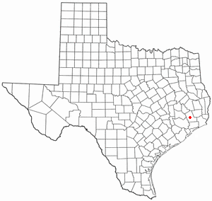
<span class="mw-page-title-main">Kenefick, Texas</span> Town in Texas, United States

Kenefick is a town in Liberty County, Texas, United States. The population was 563 at the 2010 census.

References

  1. "ArcGIS REST Services Directory". United States Census Bureau. Retrieved September 20, 2022.
  2. 1 2 U.S. Geological Survey Geographic Names Information System: Kenefic, Oklahoma
  3. 1 2 "U.S. Census website". United States Census Bureau . Retrieved January 31, 2008.
  4. CensusViewer:Kenefic, Oklahoma Population
  5. O'Dell, Larry. "Kenefic," Encyclopedia of Oklahoma History and Culture, Oklahoma Historical Society, 2009. Accessed April 15, 2015.
  6. 1 2 "Kenefic, Oklahoma". Bing Maps. Retrieved July 15, 2020.
  7. "Historical Weather for Kenefic, Oklahoma, United States".
  8. "Census of Population and Housing". Census.gov. Retrieved June 4, 2015.