Related Research Articles

Atchison County is a county located in the northeast portion of the U.S. state of Kansas. Its county seat and most populous city is Atchison. As of the 2020 census, the county population was 16,348. The county was named in honor of David Atchison, a U.S. Senator from Missouri and border ruffian during the "Bleeding Kansas" era.

Atchison is a city and county seat of Atchison County, Kansas, United States, along the Missouri River. As of the 2020 census, the population of the city was 10,885. The city is named in honor of US Senator David Rice Atchison from Missouri and was the original eastern terminus of the Atchison, Topeka and Santa Fe Railway. Atchison is also the home of Benedictine College.
Eden is an unincorporated community in Atchison County, Kansas, United States. It is about 5 miles west and 5 miles north of Atchison. It lies at the present-day intersection of Labette Rd, 322nd Rd, and 326th Rd.
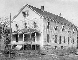
Atchison County Historical Society Museum is a museum dedicated to preserving the history of Atchison County, Kansas. Both the city of Atchison and Atchison County, Kansas, are named after United States Senator and legendary "President for a day" David Rice Atchison.
Buxton is an unincorporated community in Wilson County, Kansas, United States.
Agricola is an unincorporated community in Coffey County, Kansas, United States.
Jarbalo is an unincorporated community in Leavenworth County, Kansas, United States. It is part of the Kansas City metropolitan area.
Larkinburg is an unincorporated community in Atchison and Jackson counties of Kansas in the United States.
Monrovia is an unincorporated community in Atchison County, Kansas, United States. Monrovia is located at 39°31′27″N95°20′46″W.
Arrington is an unincorporated community in Kapioma Township, Atchison County, Kansas, United States.
Parnell is an unincorporated community in Atchison County, Kansas, United States.
Shannon is an unincorporated community in Atchison County, Kansas, United States.
Oak Mills is an unincorporated community in Atchison County, Kansas, United States.
Brenner is an unincorporated community in Wayne Township, Doniphan County, Kansas, United States.
Homewood is an unincorporated community in Franklin County, Kansas, United States.
Good Intent is an unincorporated community in Atchison County, Kansas, United States.
Port Williams is an unincorporated community in Atchison County, Kansas, United States.
Mount Pleasant is a ghost town in Atchison County, Kansas, United States. It was located approximately 1.5 miles north of Potter along Rawlins Rd.
Pardee is a ghost town in Atchison County, Kansas, United States.
Winthrop is an unincorporated community in southwest Buchanan County, in the U.S. state of Missouri. The community is just east of the Missouri River and Atchison, Kansas on US Route 59 and Missouri routes 45 and 273. Rushville is approximately 4.5 miles northeast on US Route 59 and Lewis and Clark Village adjacent to the Louis and Clark State Park and lake is 3.5 miles southeast.
References
- ↑ "Kennekuk, Kansas", Geographic Names Information System , United States Geological Survey, United States Department of the Interior
- ↑ History of the State of Kansas: Containing a Full Account of Its Growth from an Uninhabited Territory to a Wealthy and Important State. A. T. Andreas. 1883. p. 411.
- ↑ Blackmar, Frank Wilson (1912). Kansas: A Cyclopedia of State History. Standard Publishing Company. pp. 67.
- ↑ "Kansas Post Offices, 1828-1961 (archived)". Kansas Historical Society. Archived from the original on October 9, 2013. Retrieved June 4, 2014.
