Kilburn, South Australia

Last updated

Kilburn
Adelaide,  South Australia
Kilburn.jpg
Grand Junction Road, Kilburn
Population5,633 (SAL 2021) [1]
Postcode(s) 5084
LGA(s) City of Port Adelaide Enfield
State electorate(s) Enfield [2]
Federal division(s) Adelaide
Suburbs around Kilburn:
Wingfield Dry Creek, Gepps Cross Gepps Cross
Regency Park Kilburn Blair Athol
Dudley Park Prospect Prospect

Kilburn is a suburb in the inner north of Adelaide, South Australia. The suburb borders Blair Athol, Gepps Cross, Wingfield, Regency Park and Prospect. [3] Kilburn has the same postcode (5084) as Blair Athol.

Contents

History

Kilburn was known as 'Little Chicago' up until the mid 20th century. [2]

Education

The only school in Kilburn is St Brigids Primary School, a private Catholic school located on Le Hunte Street. It caters for year levels Reception to Year 6. St Gabriels Primary School is located nearby in the easterly adjacent suburb of Enfield, on Whittington Street.

Transport

Kilburn is a 10- to 15-minute drive from the Adelaide CBD (Central Business District). The suburb is well-serviced by public transport. Kilburn train station, located on Railway Terrace, has services that go to and from the city.

The G10 and G11 buslines pass through Kilburn and Blair Athol along Prospect Road. Buses 235, 237, 238 and 239 traverse Kilburn along Churchill Road and terminate at Kilburn, Valley View, Mawson Lakes UniSA and Arndale Shopping Centre respectively.

Sport

Kilburn Speedway took place on the Kilburn Oval, on the corner of Carroll Avenue and Churchill Road ( 34°51′39″S138°34′56″E / 34.86083°S 138.58222°E / -34.86083; 138.58222 ). It opened during February 1946 and closed in 1951. [4] The venue hosted motorcycle speedway and held the South Australian Individual Speedway Championship four times from 1946 to 1950. [5]

Heritage listings

Kilburn has a number of heritage-listed sites, including:

See also

Related Research Articles

<span class="mw-page-title-main">Quorn, South Australia</span> Town in South Australia

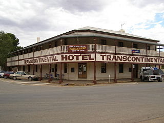
Quorn is a small town and railhead in the Flinders Ranges in the north of South Australia, 39 kilometres (24 mi) northeast of Port Augusta.

<span class="mw-page-title-main">Robe, South Australia</span> Town in South Australia

Robe is a town and fishing port located in the Limestone Coast of South Australia. The town's distinctive combination of historical buildings, ocean, fishing fleets, lakes and dense bush attracts many tourists. Robe lies on the southern shore of Guichen Bay, just off the Princes Highway. At the 2021 census, Robe had a population of 1252. Robe is the main town in the District Council of Robe local government area. It is in the state electorate of MacKillop and the federal Division of Barker.

<span class="mw-page-title-main">Prospect, South Australia</span> Suburb of Adelaide, South Australia

Prospect is the seat of the City of Prospect and an inner northern suburb of greater Adelaide. It is located 5 km (3.1 mi) north of Adelaide's centre.

<span class="mw-page-title-main">Blair Athol, South Australia</span> Suburb of Adelaide, South Australia

Blair Athol is located about 6 km (4 mi) north of the Adelaide CBD, South Australia. Blair Athol borders the suburbs of Gepps Cross, Enfield, Prospect and Kilburn. The suburb is rectangular, stretching from Grand Junction Road in the north to Angwin Avenue in the south between Prospect Road on the west and Main North Road on the east. Blair Athol's main and longest street is Florence Avenue.

<span class="mw-page-title-main">Enfield, South Australia</span> Suburb of Adelaide, South Australia

Enfield is a suburb in Adelaide, Australia. The suburb is about a 10-minute drive north from Adelaide city centre. The suburb is bordered by Gepps Cross to the north, Blair Athol to the west, Clearview to the east, and Prospect, Sefton Park and Broadview to the south.

<span class="mw-page-title-main">Torrensville, South Australia</span> Suburb of Adelaide, South Australia

Torrensville is a western suburb 3 km (1.9 mi) west of the centre of Adelaide, South Australia. It was named after Irish-born economist and chairman of the South Australian Colonisation Commission, Robert Torrens.

College Park is a small, leafy, residential eastern suburb of Adelaide, South Australia in the City of Norwood Payneham St Peters. It is among the most expensive suburban areas in South Australia, with a median sale price of 1.8 million as of 2015.

Glynde is a suburb of Adelaide in the City of Norwood Payneham St Peters.

<span class="mw-page-title-main">Hackney, South Australia</span> Suburb of Adelaide, South Australia

Hackney is an inner-eastern suburb of Adelaide, South Australia, in the City of Norwood Payneham St Peters. It is adjacent to the Adelaide Park Lands, the Adelaide city centre and North Adelaide. The O-Bahn Busway passes along Hackney Road, part of the City Ring Route, which forms its western boundary. Its other boundaries are the River Torrens (north), the continuation of North Terrace through Kent Town (south), and a series of small streets and lanes to the east.

<span class="mw-page-title-main">Thebarton, South Australia</span> Suburb of Adelaide, South Australia

Thebarton, formerly Theberton, on Kaurna land, is an inner-western suburb of Adelaide, South Australia in the City of West Torrens. The suburb is bounded by the River Torrens to the north, Port Road and Bonython Park to the east, Kintore Street to the south, and South Road to the west.

Regency Park is an inner-northern suburb of Adelaide, 6 km from the City Centre, in the state of South Australia, Australia. It is located in the City of Port Adelaide Enfield, and is adjacent to Wingfield, Angle Park, Ferryden Park, Kilburn, Prospect, Dudley Park and Croydon Park. It is bounded to the north by Grand Junction Road, east by the Gawler railway line, south by Regency Road and to the west by Days and South Roads. The postcode for Regency Park is 5010.

<span class="mw-page-title-main">Islington railway station</span> Railway station in Adelaide, South Australia

Islington railway station is located on the Gawler line. Situated in the inner northern Adelaide suburb of Prospect adjacent to Regency Road, it is 6 kilometres (3.7 mi) from the Adelaide station.

<span class="mw-page-title-main">Semaphore, South Australia</span> Suburb of Adelaide, South Australia

Semaphore is a northwestern suburb of Adelaide in the Australian state of South Australia. It is located on the Gulf St Vincent coastline of the Lefevre Peninsula about 14 kilometres (8.7 mi) from the Adelaide city centre.

<span class="mw-page-title-main">Largs Bay, South Australia</span> Suburb of Adelaide, South Australia

Largs Bay is a suburb in the Australian state of South Australia located on the Lefevre Peninsula in the west of Adelaide about 16 kilometres (9.9 mi) northwest of the Adelaide city centre.

<span class="mw-page-title-main">Palmer, South Australia</span> Town in South Australia

Palmer is a town just east of the Adelaide Hills region of South Australia along the Adelaide-Mannum Road, 70 kilometres east-north-east of the state capital, Adelaide and 15 km west-north-west of Mannum. It is located in the Mid Murray Council local government area. At the 2006 census, Palmer had a population of 329.

<span class="mw-page-title-main">Fulham, South Australia</span> Suburb of Adelaide, South Australia

Fulham is a western suburb of Adelaide, South Australia. It is located in the City of West Torrens.

<span class="mw-page-title-main">Mile End, South Australia</span> Suburb of Adelaide, South Australia

Mile End is an inner western suburb of Adelaide, located in the City of West Torrens, around 2 kilometres from the Adelaide city centre. It has a census area population of 4,413 people (2011). Much of the suburb is residential, but there are small commercial areas along Henley Beach Road and South Road.

<span class="mw-page-title-main">North Plympton, South Australia</span> Suburb of Adelaide, South Australia

North Plympton is a suburb of Adelaide, South Australia, in the City of West Torrens.

The Islington Railway Workshops are railway workshops in the northern suburbs of Adelaide, South Australia. They were the chief railway workshops of the South Australian Railways, and are still in operation today.

<span class="mw-page-title-main">Islington Sewage Farm</span> Building in South Australia, Adelaide

The Islington Sewage Farm was a sewerage treatment facility located at Tam O'Shanter Belt/Islington in South Australia, which operated from 1881 until 1966.

References

  1. Australian Bureau of Statistics (28 June 2022). "Kilburn (suburb and locality)". Australian Census 2021 QuickStats. Retrieved 28 June 2022.  OOjs UI icon edit-ltr-progressive.svg
  2. 1 2 "Property Location Browser: Search for 'Kilburn, SUB' (ID SA0036544)". Government of South Australia. Archived from the original on 7 December 2015. Retrieved 5 April 2016.
  3. 2003 Adelaide Street Directory, 41st Edition. UBD (A Division of Universal Press Pty Ltd). 2003. ISBN   0-7319-1441-4.
  4. "Kilburn Speedway". Monument Australia. Retrieved 25 February 2024.
  5. "Adelaide (SA)". Speedway and Road Race History. Retrieved 25 February 2024.
  6. "Islington Railway Workshops Chief Mechanical Engineer's Office". South Australian Heritage Register. Department of Environment, Water and Natural Resources. Retrieved 15 August 2016.
  7. "Islington Railway Workshops Fabrication Shop". South Australian Heritage Register. Department of Environment, Water and Natural Resources. Retrieved 15 August 2016.
  8. "Islington Railway Workshops Foundry". South Australian Heritage Register. Department of Environment, Water and Natural Resources. Retrieved 15 August 2016.
  9. "Islington Railway Workshops Apprentice School". South Australian Heritage Register. Department of Environment, Water and Natural Resources. Retrieved 15 August 2016.
  10. "Islington Railway Workshops Electrical Shop". South Australian Heritage Register. Department of Environment, Water and Natural Resources. Retrieved 15 August 2016.
  11. "Islington Railway Workshops Fabrication Shop Annex". South Australian Heritage Register. Department of Environment, Water and Natural Resources. Retrieved 15 August 2016.
  12. "Former Tubemakers Administration Building No 2". South Australian Heritage Register. Department of Environment, Water and Natural Resources. Retrieved 15 August 2016.
  13. "Former Tubemakers Administration Building No 1". South Australian Heritage Register. Department of Environment, Water and Natural Resources. Retrieved 15 August 2016.

34°51′40″S138°35′49″E / 34.861°S 138.597°E / -34.861; 138.597