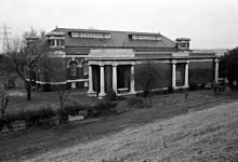
King George V Reservoir

Last updated
King George V Reservoir
King George V Reservoir.jpg
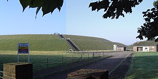
Looking west across the reservoir
Enfield London UK location map.svg
Red pog.svg
King George V Reservoir
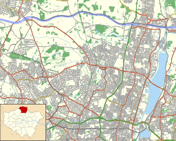
Location London Borough of Enfield
Coordinates 51°39′00″N0°00′58″W / 51.6499°N 0.0161°W / 51.6499; -0.0161
Type reservoir
Basin  countries United Kingdom
Max. length2.58 km (1.60 mi)
Max. width0.95 km (0.59 mi)
Surface area170 ha (420 acres)
Max. depth7.5 m (25 ft)
Water volume12.45 Gl (2.74×10^9 imp gal)

The King George V Reservoir, also known as King George's Reservoir, is located in the London Borough of Enfield and is part of the Lee Valley Reservoir Chain that supplies London with drinking water. The storage reservoir is bordered by Sewardstone and Chingford to the east and Brimsdown and Ponders End to the west, and covers 420 acres (170 hectares), making it the largest in London. [1] The reservoir and the nearby William Girling Reservoir are known collectively as the Chingford Reservoirs, and are owned and managed by Thames Water.

Contents

History

The Chingford Reservoirs: Looking south over the twin basins of the King George V Reservoir and the William Girling Reservoir in background Chingford Reservoirs.jpg
The Chingford Reservoirs: Looking south over the twin basins of the King George V Reservoir and the William Girling Reservoir in background

The reservoir was conceived as part of an overall plan for the Lea Valley and was laid before the Royal Commission on Water Supply (Balfour Committee) in 1893. At this time the responsible authority was the East London Waterworks Company. However, under the provisions of the Metropolis Water Act 1902, the undertakings of this as well as seven other companies were transferred to the Metropolitan Water Board.

Construction was started in 1908 and completed in 1912. The reservoir was opened by H.M.King George V in 1913, hence the name.

The Metropolitan Water Board operated the reservoir until the Board was abolished in 1974 under the provisions of the Water Act 1973 (c. 37) and ownership and control transferred to the Thames Water Authority. Under the provisions of the Water Act 1989 (c. 15) the Thames Water Authority was privatised as Thames Water.

Description

The reservoir was formed by the construction of a continuous embankment on the floodplain of the River Lea at Chingford. An earth embankment divides the reservoir into two compartments that are connected by three large diameter culverts. The external grassed embankment consists of a central puddle clay core with shoulder filling comprising a mixture of river terraced gravels and alluvial deposits.

The reservoir embankment has a puddle clay core extending down into the underlying London Clay and gravel/earth shoulders at a slope of 1 in 3. The top of the embankment is 10 m above the surrounding land. The key engineering parameters are: [2]

King George V Reservoir
ParameterValue
Maximum embankment height10 m
Length of Embankment6,532 m
Total capacity12.4 million m3 12,400 megalitres
Surface area2.168 km2
Inflow capacity375 Ml/d
Emergency drawdown1.00 metres within 24hrs

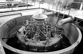
Located in the NW corner is the original inlet pumping station by W.B. Bryan and finished in red brick and Portland stone. Still in situ are three of the five gas-fuelled liquid-piston pumps designed by H. A. Humphrey. In 1970 these were made redundant by the installation of a vertical spindle electric pump. [3]

The emergency drawdown rate (the rate at which the water level in the reservoir can be reduced) was about 0.35 metres/day. [2] Inspections in 2005-07 identified that this was inadequate, and proposed that the drawdown should be 1.0 m/d as defined in the provisions of the Reservoirs Act 1975 (c.23). [4] This was achieved by installing twin 1.2 m diameter siphon pipes over the embankment. [2] The valves controlling the outflow are 8.0 m high and have a flow capacity of 7 m3/s. [5] The siphons are located in the south east corner of the reservoir and discharge is into the River Lee Diversion.

Ecology

The pumping station, seen in 1985 King George V Reservoir Pumping Station.JPG
The pumping station, seen in 1985

The water is part of the Chingford Reservoirs Site of Special Scientific Interest (SSSI). [6] It is a major wintering ground for wildfowl and wetland birds, including nationally important numbers of some species. The water also forms a moult refuge for a large population of wildfowl during the late summer months. A total of 85 wetland species have been recorded here in recent years.

Recreation

The reservoir is popular with birdwatchers, [7] and is home to the King George Sailing Club. Access has required permits and a key are required to visit the water, which were obtained from Thames Water. [8] Since July 2016, access arrangements have been "under review", [9] a process which is still ongoing in February 2020.

Water supply

The interior of the pumping station, seen in 1985 King George V Reservoir Pumping Station1.JPG
The interior of the pumping station, seen in 1985

Water is supplied to the reservoir from the New River, via the Northern Transfer Tunnel, and the River Lee Diversion. [10]

Access

Vehicular access is at Lea Valley Road A110

See also

Related Research Articles

<span class="mw-page-title-main">New River (London)</span> Artificial waterway in London completed in 1613

The New River is an artificial waterway in England, opened in 1613 to supply London with fresh drinking water taken from Chadwell and Amwell Springs near Ware in Hertfordshire, and later the River Lea and other sources. Originally conceived by Edmund Colthurst and completed by Hugh Myddelton, it was operated by the New River Company for nearly 300 years until London's water supply was taken over by the Metropolitan Water Board in 1904.

<span class="mw-page-title-main">Reservoir</span> Storage space for water

A reservoir is an enlarged lake behind a dam. Such a dam may be either artificial, built to store fresh water or it may be a natural formation.

<span class="mw-page-title-main">River Ching</span> River in Essex, England

The River Ching is a tributary of the River Lea, flowing from Epping Forest, in southeast England.

<span class="mw-page-title-main">Puddling (civil engineering)</span> Material and process of lining a water body with a watertight clay layer

Puddling is both the material and the process of lining a water body such as a channel or pond with puddle clay – a watertight material based on clay and water mixed to be workable.

<span class="mw-page-title-main">William Girling Reservoir</span> Reservoir in London Borough of Enfield

The William Girling Reservoir is located in the London Borough of Enfield and is part of the Lee Valley Reservoir Chain that supplies London with drinking water. It is named after William Girling OBE, a chairman of the Metropolitan Water Board (MWB). The reservoir and the nearby King George V Reservoir are known collectively as the Chingford Reservoirs. The storage reservoir, which is owned by Thames Water, is bordered by Chingford to the east and Ponders End and Edmonton to the west, and covers 334 acres with a perimeter of 3.5 miles (5.6 km). There is no public access.
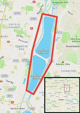
<span class="mw-page-title-main">Chingford Reservoirs</span>

The Chingford Reservoirs are the King George V Reservoir and the William Girling Reservoir, which form part of the Lee Valley Reservoir Chain in the London Boroughs of Enfield and Waltham Forest and Epping Forest in Essex. Construction of the King George V Reservoir was started in 1908 and completed in 1912. Work on the William Girling Reservoir was started in 1938, with John Mowlem & Co being the contractor, but owing to technical problems, and the intervention of World War II, the reservoir was not finished until 1951.

<span class="mw-page-title-main">Staines Reservoirs</span> Storage reservoirs in the United Kingdom

The Staines Reservoirs are two large pumped storage reservoirs sitting to the east of the King George VI Reservoir near Heathrow airport in Surrey within the Colne Valley regional park. The village of Stanwell is mainly to the north east, and the town of Staines is to the south.
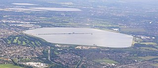
<span class="mw-page-title-main">Queen Mary Reservoir</span> Reservoir in Surrey

The Queen Mary Reservoir is one of the largest of London's reservoirs supplying fresh water to London and parts of surrounding counties, and is located in the Borough of Spelthorne in Surrey. The reservoir covers 707 acres (2.86 km2) and is 45 ft (14 m) above the surrounding area.
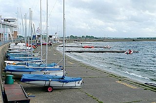
<span class="mw-page-title-main">Queen Mother Reservoir</span> Bank side reservoir in Berkshire, England

The Queen Mother Reservoir is a public water supply reservoir that lies between the M4 and the M25 to the west of London, close to Datchet. It is 475 acres (1.92 km2) in size or about 1 km in diameter - making it one of the largest inland areas of water in Southern England. It is managed by Thames Water.

<span class="mw-page-title-main">Bessborough Reservoir</span> Reservoir in Surrey

The Bessborough Reservoir is an embanked storage reservoir south of the River Thames in Surrey adjacent to the Knight Reservoir. To the south lies Queen Elizabeth II Reservoir and to the north the now disused Molesey Reservoirs. The A3050 runs to the north of the reservoir and the neighbouring town is Molesey to the east. It forms part the green buffer between Molesey and Walton on Thames. The reservoir is in the borough of Elmbridge.

<span class="mw-page-title-main">Knight Reservoir</span> Reservoir in Surrey

The Knight Reservoir is a large pumped storage reservoir located in the Borough of Elmbridge in Surrey. It was inaugurated in 1907 and stores up to 2,180 million litres of raw water abstracted from the River Thames prior to its treatment and supply to London and north Surrey. It is located south of the River Thames, west of West Molesey, and between Hurst Road (A3050) and Walton Road (B369). It is adjacent to, and west of, its twin Bessborough Reservoir.

<span class="mw-page-title-main">Island Barn Reservoir</span> Reservoir in Elmbridge, Surrey

The Island Barn Reservoir lies south of the River Thames in England at West Molesey and north of Lower Green, Esher. The reservoir is 122 acres (0.49 km2) large with a capacity of 992 million gallons and is managed by Thames Water. It is within the borough of Elmbridge and is surrounded by the River Mole to the west and the River Ember to the east. Queen Elizabeth II Reservoir is a larger reservoir to the West.
<span class="mw-page-title-main">Queen Elizabeth II Reservoir</span> Reservoir in Greater London, England

The Queen Elizabeth II Reservoir lies to the south of the River Thames and to the west of the Island Barn Reservoir. To the north are the Bessborough and Knight reservoirs. The A3050 runs to the north of the reservoir and it is situated in Walton on Thames. It is managed by Thames Water.

<span class="mw-page-title-main">London water supply infrastructure</span>

London's water supply infrastructure has developed over the centuries in line with the expansion of London.

<span class="mw-page-title-main">Lea Valley Walk</span> Long-distance footpath in South East England

The Lea Valley Walk is a 50-mile (80 km) long-distance path located between Leagrave, the source of the River Lea near Luton, and the Thames, at Limehouse Basin, Limehouse, east London. From its source much of the walk is rural. At Hertford the path follows the towpath of the River Lee Navigation, and it becomes increasingly urbanised as it approaches London. The walk was opened in 1993 and is waymarked throughout using a swan logo.

<span class="mw-page-title-main">River Lee Diversion</span> River near London, England

The River Lee Diversion is located in the Lea Valley, close to Enfield Lock and to the north east corner of the King George V Reservoir.

<span class="mw-page-title-main">Lee Valley Reservoir Chain</span> Chain of 13 reservoirs supplying London

The Lee Valley Reservoir Chain is located in the Lee Valley, and comprises 13 reservoirs that supply drinking water to London.

<span class="mw-page-title-main">King George VI Reservoir</span> Man made reservoir in Surrey since Middlesex before

The King George VI Reservoir sits between Stanwell Moor and Staines upon Thames, south-west of Heathrow, England. It is between Staines Moor and a north–south road abutting the Staines Reservoirs. The reservoir was opened in November 1947 and named after the then reigning monarch George VI. It is owned by Thames Water.

<span class="mw-page-title-main">Tunstall Reservoir</span> A reservoir in County Durham, England

Tunstall Reservoir was a water supply storage reservoir completed in 1879, and now used solely to maintain minimum regulatory flows on the River Wear in northeast England. It is situated in the north Pennines of the United Kingdom, and lies 3.5 km north of the village of Wolsingham, in Weardale, County Durham. The earthen embankment dam, which impounds the reservoir, is recognized as the location where pressure grouting with cement grout was first utilized in 1876 by engineer Thomas Hawksley, to reduce leakage within the rock foundation under an earth dam. Pressure grouting has since become normal practice for construction and remediation at dams and related water resource projects.
<span class="mw-page-title-main">Humphrey pump</span>

The Humphrey pump is a large internal combustion gas-fuelled liquid-piston pump. They were used for large-scale water supply projects. They were only popular for a short time, from around 1910 to the outbreak of World War I, but they continued in service for a long period afterwards, some lasting into the 1970s.

References

  1. The Buildings of England London 4: North pp 441 ISBN   0-14-071049-3 Retrieved December 21, 2007
  2. 1 2 3 Philpott, Bryn, Yinka Oyeyemi and John Sawyer (June 2009). "Queen Mary and King George V emergency draw down schemes" (PDF). Dams and Reservoirs. 19: 79–84.
  3. Smith. D Civil Engineering Heritage 2001 pp 69.70 ISBN   0-7277-2876-8 Retrieved December 22, 2007
  4. "Reservoirs Act 1975". legislation.gov.uk. 1975. Retrieved 21 June 2020.
  5. "Engineering Timeline - King George V Reservoir". Engineering Timeline. Retrieved 21 June 2020.
  6. English Nature citation, Chingford Reservoirs Retrieved December 21, 2007
  7. Thames Water Retrieved December 21, 2007
  8. Thames Water birdwatching permits Retrieved 12 July 2010
  9. "Birdwatching - Great Days Out". Thames Water. Thames Water. Archived from the original on 8 July 2017. Retrieved 23 February 2020.
  10. pp3 Reservoir information Archived 2011-01-24 at the Wayback Machine Retrieved December 21, 2007

Literature