Kingsbridge, Bronx

Last updated

Kingsbridge
CoE Mediator Kingsbridge Av 231 jeh.JPG
Looking west across Kingsbridge Avenue at Episcopal Church of the Mediator
Kingsbridge, Bronx
Location in New York City
Coordinates: 40°52′44″N73°54′18″W / 40.879°N 73.905°W / 40.879; -73.905
Country Flag of the United States.svg  United States
State Flag of New York.svg  New York
City New York City
Borough The Bronx
Community District The Bronx 8 [1]
Area
[2]
  Total0.80 km2 (0.310 sq mi)
Population
 (2011) [2]
  Total10,669
  Density13,000/km2 (34,000/sq mi)
Economics
   Median income $53,875
ZIP Codes
10463
Area code 718, 347, 929, and 917

Kingsbridge is a residential neighborhood in the northwest portion of the Bronx, New York City. Kingsbridge's boundaries are Manhattan College Parkway to the north, the Major Deegan Expressway or Bailey Avenue to the east, West 230th Street to the south, and Irwin Avenue to the west.

Contents

The neighborhood is part of Bronx Community Board 8 and its ZIP Code is 10463. Kingsbridge is patrolled by the New York City Police Department's 50th Precinct. [3]

Geography

Kingsbridge comprises three distinct neighborhoods: Kingsbridge proper, Kingsbridge Heights, and Van Cortlandt Village. [4] Kingsbridge proper is bounded by Manhattan College Parkway to the north, either the Major Deegan Expressway or Bailey Avenue to the east, West 230th Street to the south, and Irwin Avenue to the west. [5]

Land use and terrain

Kingsbridge has detached, semi detached, and attached homes, and apartment buildings. Streets connecting Riverdale and Kingsbridge include "step streets", with stairways of as many as 160 steps climbing the slope. The neighborhood is also part of a business improvement district that is home to 200 merchants, and is one of the largest retail shopping districts in the Bronx. River Plaza Shopping Center is located nearby (in Marble Hill, Manhattan) but it is not part of the business improvement district. During the past several years there have been significant improvements in the infrastructure of the community. For example, the parks have been improved significantly and there are new elementary schools on 230th Street.

On 233rd and Bailey Avenue, there is a baseball field that is run by Kingsbridge Little League. [6] The field has lights, dugouts, stands, and a small food court.

History

Nathalie Avenue in the 1890s, now called Kingsbridge Terrace The Great north side, or, Borough of the Bronx, New York (1897) (14578304859).jpg
Nathalie Avenue in the 1890s, now called Kingsbridge Terrace
50th Precinct 50 Pct NYPD KB Av 236 jeh.jpg
50th Precinct

The neighborhood is named for the King's Bridge, likely erected by enslaved Africans [7] in 1693 and owned by Frederick Philipse, a local lord loyal to the British monarch. The bridge spanned a now-filled-in section of Spuyten Duyvil Creek, roughly parallel to today's 230th Street. The King's Bridge was part of Boston Post Road, connecting southern Westchester County (which later became the Bronx) with Marble Hill, once part of Manhattan Island and still part of the borough of Manhattan. The bridge is said to still be in place, having been buried when the creek bed was filled in. The creek's water flow was redirected to the new and deeper shipping canal, south of Marble Hill. [8]

Until the later part of the 19th century Riverdale, Kingsbridge, and other areas now in the northwest Bronx were part of the Town of Yonkers. The areas that are inside the modern-day New York city line broke off to form the Town of Kingsbridge. In 1874, the City of New York annexed three towns that later became the western half of The Bronx, including the Town of Kingsbridge. As the trains to Manhattan were built in the 20th century, a stop in the northwest Bronx along the Hudson River called Riverdale-on-Hudson, now Riverdale, was created. This gave rise to the Riverdale neighborhood. The remainder of the old Town of Kingsbridge developed into the modern-day Kingsbridge neighborhood. [8]

St John's Roman Catholic Church John RCC 3021 Kingsbridge Av jeh.JPG
St John's Roman Catholic Church

Kingsbridge has a population of over 10,000. Historical documents reveal that the Black population of Kingsbridge was proportionally much higher in the distant past than it is today, due to the number of Africans enslaved by local landowners from the late 1600s to mid 1800s. [9] In more recent history, it became a neighborhood of predominately Irish immigrants. From the late 1970s the Irish population has decreased significantly, being replaced by large numbers of African-Americans, Hispanics, Asians, Albanians, and Greeks. According to an account by The New York Times, the largest Hispanic group in Kingsbridge today are Dominicans, replacing the earlier Puerto Ricans and Cubans, who were the first Hispanics to settle in the neighborhood in the 1970s. There still is a strong Irish population centered on Bailey Avenue and Tibbett Avenue. The Dominicans predominantly live along Broadway and adjacent side streets, with a predominantly mixed ethnic area east and west of Broadway. [8] [ unreliable source? ]

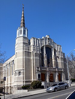
The Irish legacy can still be seen in the Roman Catholic churches and schools that serve the current residents, such as the St. John's Roman Catholic Church on Kingsbridge Avenue near 231st Street, and its two schools; the elementary school on Godwin Terrace (just south of 231st Street), and the junior high school on Kingsbridge Avenue just a block north of 231st Street. In northern Kingsbridge the Visitation Roman Catholic Church and School is located on West 239th street. To the east, on Sedgwick Avenue is Our Lady of Angels Church and School. For recreation Gaelic Park, (now operated by Manhattan College), is located on 240th Street & Broadway and is the venue for a variety of sports including Gaelic football and hurling. The neighborhood is also home to Manhattan College.

The area is patrolled by the 50th Precinct located at 3450 Kingsbridge Avenue. NYCHA property in the area is patrolled by P.S.A. 8 at 2794 Randall Avenue in the Throggs Neck section of the Bronx. [10]

Kingsbridge was home to the 77-year-old Stella D'Oro factory, which was relocated to Ashland, Ohio when Stella D'Oro was sold to Lance after labor unrest in 2009. [11] [12]

Demographics

Based on data from the 2010 United States Census, the population of Kingsbridge and Spuyten Duyvil was 30,161, a change of 289 (1%) from the 29,872 counted in 2000. Covering an area of 540.92 acres (218.90 ha), the neighborhood had a population density of 55.8 inhabitants per acre (35,700/sq mi; 13,800/km2). [13]

The racial makeup of the neighborhoods were 49.3% (14,872) White, 8.9% (2,691) African American, 0.1% (40) Native American, 5.7% (1,731) Asian, 0% (15) Pacific Islander, 0.3% (98) from other races, and 1.7% (510) from two or more races. Hispanic or Latino of any race were 33.8% (10,204) of the population. [14]

The entirety of Community District 8, which comprises Kingsbridge and Riverdale, had 102,927 inhabitants as of NYC Health's 2018 Community Health Profile, with an average life expectancy of 80.9 years. [15] :2,20 This is about the same as the median life expectancy of 81.2 for all New York City neighborhoods. [16] :53 (PDF p. 84) [17] Most inhabitants are youth and middle-aged adults: 20% are between the ages of between 0–17, 28% between 25–44, and 25% between 45–64. The ratio of college-aged and elderly residents was lower, at 9% and 18% respectively. [15] :2

As of 2017, the median household income in Community District 8 was $53,986. [18] In 2018, an estimated 15% of Kingsbridge and Riverdale residents lived in poverty, compared to 25% in all of the Bronx and 20% in all of New York City. One in eleven residents (9%) were unemployed, compared to 13% in the Bronx and 9% in New York City. Rent burden, or the percentage of residents who have difficulty paying their rent, is 52% in Kingsbridge and Riverdale, compared to the boroughwide and citywide rates of 58% and 51% respectively. Based on this calculation, as of 2018, Kingsbridge and Riverdale are considered high-income relative to the rest of the city and not gentrifying. [15] :7

Police and crime

Kingsbridge and Riverdale are patrolled by the 50th Precinct of the NYPD, located at 3450 Kingsbridge Avenue. [3] The 50th Precinct ranked 13th safest out of 69 patrol areas for per-capita crime in 2010. [19] As of 2018, with a non-fatal assault rate of 40 per 100,000 people, Kingsbridge and Riverdale's rate of violent crimes per capita is less than that of the city as a whole. The incarceration rate of 225 per 100,000 people is lower than that of the city as a whole. [15] :8

The 50th Precinct has a lower crime rate than in the 1990s, with crimes across all categories having decreased by 69.9% between 1990 and 2022. The precinct reported three murders, 22 rapes, 185 robberies, 213 felony assaults, 126 burglaries, 695 grand larcenies, and 288 grand larcenies auto in 2022. [20]

Fire safety

Kingsbridge contains a New York City Fire Department (FDNY) fire station, Engine Co. 81/Ladder Co. 46, at 3025 Bailey Avenue. [21] [22]

Health

As of 2018, preterm births are slightly more common in Kingsbridge and Riverdale than in other places citywide, though births to teenage mothers are less common. In Kingsbridge and Riverdale, there were 89 preterm births per 1,000 live births (compared to 87 per 1,000 citywide), and 13.1 births to teenage mothers per 1,000 live births (compared to 19.3 per 1,000 citywide). [15] :11 Kingsbridge and Riverdale has a relatively average population of residents who are uninsured. In 2018, this population of uninsured residents was estimated to be 16%, higher than the citywide rate of 12%. [15] :14

The concentration of fine particulate matter, the deadliest type of air pollutant, in Kingsbridge and Riverdale is 0.0075 milligrams per cubic metre (7.5×10⁻⁹ oz/cu ft), more than the city average. [15] :9 Ten percent of Kingsbridge and Riverdale residents are smokers, which is lower than the city average of 14% of residents being smokers. [15] :13 In Kingsbridge and Riverdale, 24% of residents are obese, 12% are diabetic, and 28% have high blood pressure—compared to the citywide averages of 24%, 11%, and 28% respectively. [15] :16 In addition, 21% of children are obese, compared to the citywide average of 20%. [15] :12

Eighty-six percent of residents eat some fruits and vegetables every day, which is less than the city's average of 87%. In 2018, 83% of residents described their health as "good," "very good," or "excellent," higher than the city's average of 78%. [15] :13 For every supermarket in Kingsbridge and Riverdale, there are 10 bodegas. [15] :10

The nearest hospitals are James J. Peters VA Medical Center in Kingsbridge Heights, North Central Bronx Hospital and Montefiore Medical Center in Norwood. [23]

Post office and ZIP Code

Kingsbridge is located within ZIP Code 10463. [24] The United States Postal Service operates the Kingsbridge Station post office at 5517 Broadway. [25]

Education

Kingsbridge and Riverdale generally have a similar rate of college-educated residents to the rest of the city as of 2018. While 45% of residents age 25 and older have a college education or higher, 18% have less than a high school education and 37% are high school graduates or have some college education. By contrast, 26% of Bronx residents and 43% of city residents have a college education or higher. [15] :6 The percentage of Kingsbridge and Riverdale students excelling in math rose from 21% in 2000 to 48% in 2011, and reading achievement increased from 28% to 33% during the same time period. [26]

Kingsbridge and Riverdale's rate of elementary school student absenteeism is about the same as the rest of New York City. In Kingsbridge and Riverdale, 20% of elementary school students missed twenty or more days per school year, higher than the citywide average of 20%. [16] :24 (PDF p. 55) [15] :6 Additionally, 78% of high school students in Kingsbridge and Riverdale graduate on time, higher than the citywide average of 75%. [15] :6

Schools

PS 86 PS86 Reservoir Av jeh.JPG
PS 86

Public schools are operated by the New York City Department of Education. Kingsbridge is located near the following public elementary schools, which serve grades PK-5 unless otherwise indicated: [27]

The following middle/high school is located in Kingsbridge: [27]

Libraries

The New York Public Library (NYPL) operates two branches near Kingsbridge. The Van Cortlandt branch is located at 3882 Cannon Place. The two-story, 5,800-square-foot (540 m2) branch opened in 2019, replacing a smaller one-story branch a few blocks away, which opened in 1969 and consisted of a single room. [35] The Kingsbridge branch is located at 3874 Sedgwick Avenue. The current two-story building is the branch's fourth structure since the establishment of the Kingsbridge Free Library in 1894. McKim, Mead & White designed a Carnegie library for Kingsbridge when the NYPL took over the Kingsbridge branch in 1905; a third library structure was built at 280 West 231st Street in 1959, across from the current site. [36]

Transportation

The following MTA Regional Bus Operations bus routes serve Kingsbridge: [37]

The following New York City Subway stations serve Kingsbridge: [38]

Films

Television

See also

Related Research Articles

<span class="mw-page-title-main">Inwood, Manhattan</span> Neighborhood of Manhattan in New York City

Inwood is a neighborhood in the New York City borough of Manhattan, at the northern tip of Manhattan Island, in the U.S. state of New York. It is bounded by the Hudson River to the west, Spuyten Duyvil Creek and Marble Hill to the north, the Harlem River to the east, and Washington Heights to the south.

<span class="mw-page-title-main">Marble Hill, Manhattan</span> Neighborhood of Manhattan in New York City

Marble Hill is the northernmost neighborhood in the New York City borough of Manhattan. It is one of the few areas within the borough that are not located on Manhattan Island. Marble Hill was occupied as a Dutch colonial settlement in 1646, and gained its current name in 1891 because of Tuckahoe marble deposits underneath the neighborhood.

<span class="mw-page-title-main">Riverdale, Bronx</span> Neighborhood of the Bronx in New York City

Riverdale is a residential neighborhood in the northwestern portion of the New York City borough of the Bronx. Riverdale, which had a population of 47,850 as of the 2000 United States Census, contains the city's northernmost point, at the College of Mount Saint Vincent. Riverdale's boundaries are disputed, but it is commonly agreed to be bordered by Yonkers to the north, Van Cortlandt Park and Broadway to the east, the Kingsbridge neighborhood to the southeast, either the Harlem River or the Spuyten Duyvil neighborhood to the south, and the Hudson River to the west. Riverdale Avenue is the primary north–south thoroughfare through Riverdale.

<span class="mw-page-title-main">Pelham Bay (neighborhood), Bronx</span> Neighborhood of the Bronx in New York City

Pelham Bay is a middle class residential neighborhood in the borough of the Bronx, in New York City. It is named for Pelham Bay Park, New York City's largest park, which lies on the neighborhood's northeastern border; and for Pelham Bay, a body of water in that park. The neighborhood is bounded roughly by Pelham Parkway on the north, the New England Thruway (I-95) on the east, the Bruckner Expressway (I-95) on the south, and the Hutchinson River Parkway on the west.

<span class="mw-page-title-main">Spuyten Duyvil, Bronx</span> Neighborhood of the Bronx in New York City

Spuyten Duyvil is a neighborhood of the Bronx, New York City. It is bounded on the north by Riverdale, on the east by Kingsbridge, on the south by the Harlem River, and on the west by the Hudson River, although some consider it to be the southernmost part of Riverdale.

Baychester is a neighborhood geographically located in the northeast part of the Bronx, New York City. Its boundaries are East 222nd Street to the northeast, the New England Thruway (I-95) to the east, Gun Hill Road to the southwest, and Boston Road to the northwest. Eastchester Road is the primary thoroughfare through Baychester.

<span class="mw-page-title-main">Fordham, Bronx</span> Neighborhood of the Bronx in New York City

Fordham Manor is a neighborhood located in the western Bronx, New York City. Fordham is roughly bordered by East 196th Street to the north, the Harlem River to the west, Fordham Road to the south, and Southern Boulevard to the east. The neighborhood's primary thoroughfares are Fordham Road and Grand Concourse.

<span class="mw-page-title-main">Tremont, Bronx</span> Neighborhood of the Bronx in New York City

Tremont is a residential neighborhood in the West Bronx, New York City. Its boundaries are East 181st Street to the north, Third Avenue to the east, the Cross-Bronx Expressway to the south, and the Grand Concourse to the west. East Tremont Avenue is the primary thoroughfare through Tremont.

<span class="mw-page-title-main">Melrose, Bronx</span> Neighborhood of the Bronx in New York City

Melrose is a mostly residential neighborhood in the southwestern section of the New York City borough of the Bronx. It adjoins the business and one-time theater area known as The Hub. Melrose is rectangular-shaped, being bordered by Jackson Avenue on the east, 149th Street on the south, Park Avenue on the west, and 162nd Street to the north. Melrose Avenue and Third Avenue are the primary thoroughfares through Melrose.

<span class="mw-page-title-main">Norwood, Bronx</span> Neighborhood of the Bronx in New York City

Norwood, also known as Bainbridge, is a working-class residential neighborhood in the northwest Bronx, New York City. It is bound by Van Cortlandt Park and Woodlawn Cemetery to the north, the Bronx River to the east, and Mosholu Parkway to the southwest. The area is dominated topographically by what was once Valentine's Hill, the highest point being near the intersection of 210th Street and Bainbridge Avenue, where Gun Hill Road intersects, and around the Montefiore Medical Center, the largest landowner and employer of the neighborhood. Norwood's main commercial arteries are Gun Hill Road, Jerome Avenue, Webster Avenue, and Bainbridge Avenue.

<span class="mw-page-title-main">Bedford Park, Bronx</span> Neighborhood of the Bronx in New York City

Bedford Park is a residential neighborhood in the northwest Bronx, New York City, between the New York Botanical Garden and. Its boundaries, starting from the north and moving clockwise are: Mosholu Parkway to the north, Webster Avenue to the east, East 196th Street to the south, and Jerome Avenue to the west.

<span class="mw-page-title-main">East Tremont, Bronx</span> Neighborhood of the Bronx in New York City

East Tremont is a residential neighborhood located in the East Bronx, New York City. From the north and moving clockwise, it is bounded by East 180th Street, Southern Boulevard, the Cross-Bronx Expressway and Third Avenue. East Tremont Avenue is the primary thoroughfare through the neighborhood.

<span class="mw-page-title-main">University Heights, Bronx</span> Neighborhood of the Bronx in New York City

University Heights is a neighborhood of the West Bronx in New York City. Its boundaries, starting from the north and moving clockwise, are: West Fordham Road to the north, Jerome Avenue to the east, West Burnside Avenue to the south and the Harlem River to the west. University Avenue is the primary thoroughfare in University Heights.

Kingsbridge Heights is a residential neighborhood geographically located in the northwest Bronx, New York City. Its boundaries are Van Cortlandt Park to the north, Jerome Avenue to the east, Kingsbridge Road to the south, and the Major Deegan Expressway to the west. Sedgwick Avenue is the primary thoroughfare through Kingsbridge Heights.

<span class="mw-page-title-main">John F. Kennedy High School (New York City)</span> Public school in Bronx, New York, United States

John F. Kennedy High School is a former four-year comprehensive New York City public high school, located at 99 Terrace View Avenue along the border of the Spuyten Duyvil section of the Bronx and the Marble Hill neighborhood of Manhattan, near the Kingsbridge section of the Bronx. The building currently operates as John F. Kennedy Educational Campus, housing four small public high schools and two charter high schools. The campus serves grades 9–12 and is operated by the New York City Department of Education.

<span class="mw-page-title-main">Morris Heights, Bronx</span> Neighborhood of the Bronx in New York City

Morris Heights is a residential neighborhood located in the West Bronx. Its boundaries, starting from the north and moving clockwise are: West Burnside Avenue to the north, Jerome Avenue to the east, the Cross-Bronx Expressway to the south, and the Harlem River to the west. University Avenue is the primary thoroughfare through Morris Heights.

<span class="mw-page-title-main">West Farms, Bronx</span> Neighborhood of the Bronx in New York City

West Farms is a residential neighborhood in The Bronx, New York City. Its boundaries, are: Bronx Park to the north, the Bronx River Parkway to the east, the Cross-Bronx Expressway to the south, and Southern Boulevard to the west. East Tremont Avenue is the primary thoroughfare through West Farms.

Van Cortlandt Village is a subsection of the Kingsbridge neighborhood in the New York City borough of the Bronx. The neighborhood is part of Bronx Community Board 8. Named after Van Cortlandt Park, it is bordered by the Major Deegan Expressway to the west, the Jerome Park Reservoir to the east, West 238th Street to the south, and Van Cortlandt Park to the north. Its ZIP Code is 10463.

<span class="mw-page-title-main">Belmont, Bronx</span> Neighborhood of the Bronx in New York City

Belmont is a primarily residential neighborhood in the Bronx in New York City. Its boundaries are Fordham Road to the north, Bronx Park to the east, East 181st Street to the south, and Third Avenue to the west. These boundaries give the neighborhood a crescent-like shape. The neighborhood is noted for its "close-knit community" and "small-town feel", and as a result of its cultural history and wide array of Italian businesses, is widely known as the "Little Italy of the Bronx". Arthur Avenue, noted for its local restaurants and markets, is its primary thoroughfare.

<span class="mw-page-title-main">Concourse, Bronx</span> Neighborhood of the Bronx in New York City

Concourse is a neighborhood in the southwestern section of the New York City borough of the Bronx which includes the Bronx County Courthouse, the Bronx Museum of the Arts, and Yankee Stadium. Its boundaries, starting from the north and moving clockwise, are East 169th Street to the north, Webster Avenue to the east, the Metro-North Railroad's Hudson Line to the south, and Jerome Avenue to the west. The neighborhood is divided into three subsections: West Concourse, East Concourse, and Concourse Village with the Grand Concourse being its main thoroughfare.

References

  1. "NYC Planning | Community Profiles". communityprofiles.planning.nyc.gov. New York City Department of City Planning. Retrieved June 6, 2018.
  2. 1 2 "Kingsbridge neighborhood in New York" . Retrieved November 28, 2015.
  3. 1 2 "NYPD – 50th Precinct". www.nyc.gov. New York City Police Department . Retrieved October 3, 2016.
  4. Pastor, Kate (June 6, 2010). "What makes Riverdale Riverdale? How a community divided remains standing". The Riverdale Press. Retrieved July 2, 2014.
  5. Pastor, Kate (June 20, 2010). "Kingsbridge still a way station for immigrants". The Riverdale Press. Retrieved July 2, 2014.
  6. "kingsbridge little league - Google Search".
  7. "Black Kingsbridge 1698 to 1850 – A Community Revealed in Documents". The Kingsbridge Historical Society. December 7, 2018. Retrieved June 21, 2019.
  8. 1 2 3 Cohen, Joyce (September 6, 1998). "If You're Thinking of Living In:/Kingsbridge, the Bronx; A Place Convenient to Almost Everything". The New York Times . Retrieved January 22, 2009.
  9. "Black Kingsbridge 1698 to 1850 – A Community Revealed in Documents". The Kingsbridge Historical Society. December 7, 2018. Retrieved June 21, 2019.
  10. "NYCHA" . Retrieved November 28, 2015.
  11. Jaccarino, Mike (September 29, 2009). "Stella D'Oro protesters lean on Goldman Sachs". Daily News . New York. Retrieved August 6, 2010.
  12. Xu, Beina (June 30, 2009). "Focus On The Consumer: Q&A With Brynwood Partners". The Wall Street Journal . Retrieved August 6, 2010.
  13. Table PL-P5 NTA: Total Population and Persons Per Acre - New York City Neighborhood Tabulation Areas*, 2010, Population Division - New York City Department of City Planning, February 2012. Accessed June 16, 2016.
  14. Table PL-P3A NTA: Total Population by Mutually Exclusive Race and Hispanic Origin - New York City Neighborhood Tabulation Areas*, 2010, Population Division - New York City Department of City Planning, March 29, 2011. Accessed June 14, 2016.
  15. 1 2 3 4 5 6 7 8 9 10 11 12 13 14 15 "Riverdale and Fieldston (Including Fieldston, Kingsbridge, Marble Hill, Riverdale, Spuyten Duyvil and Van Cortlandt Village)" (PDF). nyc.gov. NYC Health. 2018. Retrieved March 2, 2019.
  16. 1 2 "2016-2018 Community Health Assessment and Community Health Improvement Plan: Take Care New York 2020" (PDF). nyc.gov . New York City Department of Health and Mental Hygiene. 2016. Retrieved September 8, 2017.
  17. "New Yorkers are living longer, happier and healthier lives". New York Post. June 4, 2017. Retrieved March 1, 2019.
  18. "NYC-Bronx Community District 8--Riverdale, Fieldston & Kingsbridge PUMA, NY" . Retrieved July 17, 2018.
  19. "Riverdale: Marble Hill, Fieldston, Spuyten Duyvil, Kingsbridge – DNAinfo.com Crime and Safety Report". www.dnainfo.com. Archived from the original on April 15, 2017. Retrieved October 6, 2016.
  20. "50th Precinct CompStat Report" (PDF). www.nyc.gov. New York City Police Department . Retrieved July 22, 2018.
  21. "Engine Company 81/Ladder Company 46". FDNYtrucks.com. Retrieved March 14, 2019.
  22. "FDNY Firehouse Listing – Location of Firehouses and companies". NYC Open Data; Socrata . New York City Fire Department. September 10, 2018. Retrieved March 14, 2019.
  23. "Best 30 Hospitals in Bronx, NY with Reviews". Yellow Pages. Retrieved March 14, 2019.
  24. "Kings Bridge, New York City-Bronx, New York Zip Code Boundary Map (NY)". United States Zip Code Boundary Map (USA). Archived from the original on March 30, 2019. Retrieved March 16, 2019.
  25. "Location Details: Kingsbridge". USPS.com. Retrieved March 7, 2019.
  26. "Riverdale / Fieldston – BX 08" (PDF). Furman Center for Real Estate and Urban Policy. 2011. Retrieved October 5, 2016.
  27. 1 2 "Kingsbridge New York School Ratings and Reviews". Zillow. Retrieved March 16, 2019.
  28. "Milton Fein School". New York City Department of Education. December 19, 2018. Retrieved March 16, 2019.
  29. "P.S. X037 - Multiple Intelligence School". New York City Department of Education. December 19, 2018. Retrieved March 16, 2019.
  30. "P.S. 086 Kingsbridge Heights". New York City Department of Education. December 19, 2018. Retrieved March 16, 2019.
  31. "P.S. 207". New York City Department of Education. December 19, 2018. Retrieved March 16, 2019.
  32. "Luisa Pineiro Fuentes School of Science and Discovery". New York City Department of Education. December 19, 2018. Retrieved March 16, 2019.
  33. "P.S. 310 Marble Hill". New York City Department of Education. December 19, 2018. Retrieved March 16, 2019.
  34. "P.S. 360". New York City Department of Education. December 19, 2018. Retrieved March 16, 2019.
  35. "About the Van Cortlandt Library". The New York Public Library. Retrieved March 14, 2019.
  36. "About the Kingsbridge Library". The New York Public Library. Retrieved March 14, 2019.
  37. "Bronx Bus Map" (PDF). Metropolitan Transportation Authority. October 2018. Retrieved December 1, 2020.
  38. "Subway Map" (PDF). Metropolitan Transportation Authority. September 2021. Retrieved September 17, 2021.
  39. "Martin Scorsese Netflix movie films scenes in Kingsbridge". bronx.news12.com. Retrieved June 21, 2019.
  40. "Finding fertile ground for film". The Riverdale Press. Retrieved June 21, 2019.