Kinmundy, Illinois

Last updated

Kinmundy, Illinois
Marion County Illinois Incorporated and Unincorporated areas Kinmundy Highlighted.svg
Location in Marion County, Illinois
Usa edcp location map.svg
Red pog.svg
Kinmundy
Location in the United States
Coordinates: 38°46′22″N88°51′10″W / 38.77278°N 88.85278°W / 38.77278; -88.85278 [1]
CountryUnited States
StateIllinois
County Marion
Township Kinmundy
Area
[2]
  Total1.45 sq mi (3.76 km2)
  Land1.20 sq mi (3.10 km2)
  Water0.25 sq mi (0.66 km2)
Elevation
[1]
577 ft (176 m)
Population
 (2020) [3]
  Total733
  Density611.85/sq mi (236.26/km2)
Time zone UTC-6 (CST)
  Summer (DST) UTC-5 (CDT)
ZIP code
62854
Area code 618
FIPS code 17-40117
GNIS ID2395542 [1]
Wikimedia CommonsKinmundy, Illinois
Website cityofkinmundy.com

Kinmundy is a city in Marion County, Illinois, United States. The population was 733 at the 2020 census. [3]

Contents

The town is believed to have been named after a place in Scotland, the birthplace of William Ferguson, a London agent for the Illinois Central Railroad during Kinmundy's construction. He visited the area in 1856. [4] [5]

Geography

Kinmundy is located in northeastern Marion County. Illinois Route 37 passes through the village center as 1st Street, leading southwest 12 miles (19 km) to Salem, the county seat, and northeast 6 miles (10 km) to Farina. Interstate 57 passes northwest of the city, with access from Exit 127. I-57 leads northeast 32 miles (51 km) to Effingham and southwest 38 miles (61 km) to Mount Vernon.

According to the U.S. Census Bureau, Kinmundy has a total area of 1.45 square miles (3.76 km2), of which 1.29 square miles (3.34 km2) are land and 0.25 square miles (0.65 km2), or 17.44%, are water. [2] The water area consists of Kinmundy Lake, a reservoir 1 mile (1.6 km) west of the city proper. The city drains to the northwest, toward the East Fork of the Kaskaskia River.

Historic Illinois Central Railroad water tower, built in 1885 IL Central RR Water Tower, Kinmundy.jpg
Historic Illinois Central Railroad water tower, built in 1885

History

The origins of the town of Kinmundy are rooted in the expansion of the railroads in southern Illinois, with the first significant economic influence being construction work on the Chicago branch of the Illinois Central Railroad. [6] In April 1857, the town was initially laid out east of the railroad, in 15 blocks of varying sizes, and later, incorporated as a city in 1867. [6]

In 1903 Kinmundy was struck by a fire in the evening that burnt down most of the downtown area, causing the sharpest drop in population in the town's history. One of the buildings that burnt was the opera house, which was rebuilt before burning again for the second, and final time in 1916, not being rebuilt afterward.

In January 1912, Illinois Central Railroad train No. 3, traveling at 50 miles per hour (80 km/h), collided with passenger train No. 25, which was standing at the station in Kinmundy taking water. The devastating train wreck demolished the private car at the rear of train No. 25, killing five passengers, among them James T. Harahan, the recently-retired president of the Illinois Central Railroad. [7]

Arts and culture

Landmarks

The stately Italianate Calendar Rohrbough House, located on so-called "Quality Hill", is listed on the National Register of Historic Places. [8]

The Illinois Central Railroad Water Tower and Pump House was added to the National Register of Historic places in 1998. [9]

The Kinmundy Log Cabin Village is a collection of twelve original pioneer homes [10] rescued in the 1960s from the surrounding local region and reassembled in a wooded area on the edge of the town. All of the cabins pre-date the American Civil War, with the oldest originally constructed in 1818. The log cabin village plays host to an annual fall craft fair, during which the village is populated by local volunteers and crafts people in period dress and the authentically furnished homes are open to the public. [11] Some of the volunteers are descendants of the original residents of the historic cabins. [12]

Stephen A. Forbes State Recreation Area lies about 5 miles (8 km) southeast of the town and offers trails, camping, hunting, and fishing. The park features a man-made lake which was completed in 1968 and boasts 18 miles (29 km) of shoreline. [13]

Notable people

Demographics

Historical population
CensusPop.Note
1880 1,096
1890 1,045−4.7%
1900 1,22116.8%
1910 997−18.3%
1920 898−9.9%
1930 813−9.5%
1940 1,01524.8%
1950 912−10.1%
1960 813−10.9%
1970 759−6.6%
1980 94524.5%
1990 879−7.0%
2000 8921.5%
2010 796−10.8%
2020 733−7.9%
U.S. Decennial Census [15]

As of the census [16] of 2000, there were 892 people, 365 households, and 246 families residing in the city. The population density was 865.2 inhabitants per square mile (334.1/km2). There were 409 housing units at an average density of 396.7 per square mile (153.2/km2). The racial makeup of the city was 98.21% White, 0.34% African American, 0.11% Native American, 0.34% from other races, and 1.01% from two or more races. Hispanic or Latino of any race were 0.67% of the population.

There were 365 households, out of which 31.5% had children under the age of 18 living with them, 53.4% were married couples living together, 11.2% had a female householder with no husband present, and 32.6% were non-families. 28.2% of all households were made up of individuals, and 17.0% had someone living alone who was 65 years of age or older. The average household size was 2.44 and the average family size was 3.00.

In the city, the population was spread out, with 25.6% under the age of 18, 9.4% from 18 to 24, 25.0% from 25 to 44, 24.0% from 45 to 64, and 16.0% who were 65 years of age or older. The median age was 38 years. For every 100 females, there were 89.0 males. For every 100 females age 18 and over, there were 86.5 males.

The median income for a household in the city was $28,500, and the median income for a family was $37,125. Males had a median income of $31,875 versus $20,938 for females. The per capita income for the city was $15,279. About 10.0% of families and 12.8% of the population were below the poverty line, including 16.0% of those under age 18 and 8.8% of those age 65 or over.

Ameren's Kinmundy Power Plant, a combustion turbine generator (CTG) power plant, is located in Kinmundy. [17]

Related Research Articles

<span class="mw-page-title-main">Marion County, Illinois</span> County in Illinois, United States

Marion County is a county located in the U.S. state of Illinois. According to the 2020 census, it had a population of 37,729. Its county seat is Salem.

<span class="mw-page-title-main">Tinley Park, Illinois</span> Village in Illinois, United States

Tinley Park is a village in Cook County, Illinois, United States, with a small portion in Will County. The village is a suburb of Chicago. Per the 2020 census, the population was 55,971. It is one of the fastest growing suburbs southwest of Chicago. In 2009 BusinessWeek named Tinley as the best place in America to raise a family.

<span class="mw-page-title-main">Edgewood, Illinois</span> Village in Illinois, United States

Edgewood is a village in Effingham County, Illinois, United States. The population was 398 at the 2020 Census. Edgewood is part of the Effingham, IL Micropolitan Statistical Area.

<span class="mw-page-title-main">Scales Mound, Illinois</span> Village in Illinois, United States

Scales Mound is a village in Jo Daviess County, Illinois, United States. The population was 436 at the 2020 census.

<span class="mw-page-title-main">Warren, Illinois</span> Village in Illinois, United States

Warren is a village in Jo Daviess County, Illinois, United States. The population was 1,323 at the 2020 census, down from 1,428 at the 2010 census.

<span class="mw-page-title-main">Millington, Illinois</span> Village in Illinois, United States

Millington is a village in Kendall and LaSalle counties in the U.S. state of Illinois. The population was 617 at the 2020 census, down from 665 at the 2010 census.

<span class="mw-page-title-main">Knoxville, Illinois</span> City in Illinois, United States

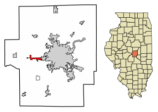
Knoxville is a city in Knox County, Illinois, United States. The population was 2,911 at the 2010 census. It is part of the Galesburg Micropolitan Statistical Area.

<span class="mw-page-title-main">Tonica, Illinois</span> Village in LaSalle County, Illinois

Tonica is a village in LaSalle County, Illinois, United States. The population was 749 at the 2020 census, down from 768 at the 2010 census. It is part of the Ottawa Micropolitan Statistical Area.

<span class="mw-page-title-main">Harristown, Illinois</span> Village in Illinois, United States

Harristown is a village in Macon County, Illinois, United States. The population was 1,310 at the 2020 census. It is included in the Decatur, Illinois Metropolitan Statistical Area.

<span class="mw-page-title-main">Niantic, Illinois</span> Village in Illinois, United States

Niantic is a village in Macon County, Illinois, United States. Its population was 612 at the 2020 census, down from 707 in 2010. It is included in the Decatur, Illinois Metropolitan Statistical Area.

<span class="mw-page-title-main">Glen Carbon, Illinois</span> Village in Illinois, United States

Glen Carbon is a village in Madison County, Illinois, United States, 14 miles (23 km) northeast of St. Louis. The population was 13,842 at the 2020 census.

<span class="mw-page-title-main">Alma, Illinois</span> Village in Illinois, United States

Alma is a village in Marion County, Illinois, United States. The population was 318 at the 2020 census.

<span class="mw-page-title-main">Vernon, Illinois</span> Village in Illinois, United States

Vernon is a village in Marion County, Illinois, United States. The population was 103 at the 2020 census.

<span class="mw-page-title-main">Litchfield, Illinois</span> City in Illinois, United States

Litchfield is a city in Montgomery County, Illinois, United States. The population was 6,605 at the 2020 census. It is located in South Central Illinois, south of Springfield, the state capital.

<span class="mw-page-title-main">Pinckneyville, Illinois</span> City in Illinois, United States

Pinckneyville is a city in and the county seat of Perry County, Illinois, United States. The population was 5,066 at the 2020 census. It is named for Charles Cotesworth Pinckney, an early American diplomat and presidential candidate.

<span class="mw-page-title-main">Red Bud, Illinois</span> City in Illinois, United States

Red Bud is a city in Randolph County, Illinois, in the United States. The population was 3,804 at the 2020 census.

<span class="mw-page-title-main">Olney, Illinois</span> City in Illinois, United States

Olney is the county seat in Richland County, Illinois. The population was 9,115 at the time of the 2010 census.

<span class="mw-page-title-main">Stonefort, Illinois</span> Village in Illinois, United States

Stonefort is a village in Saline and Williamson Counties, Illinois, United States. The population was 297 at the 2010 census.

<span class="mw-page-title-main">Panola, Illinois</span> Village in Illinois, United States

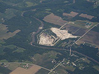
Panola is a village in Woodford County, Illinois, United States. The population was 45 at the 2010 census. It is part of the Peoria, Illinois Metropolitan Statistical Area.

<span class="mw-page-title-main">Crestline, Ohio</span> American village in Crawford and Richland Counties in the U.S. state of Ohio

Crestline is a village in Crawford and Richland Counties in the U.S. state of Ohio. Crestline's population was 4,525 at the 2020 census. It is the third largest municipality in Crawford County. The Crawford County portion of Crestline is part of the Bucyrus Micropolitan Statistical Area, while the small portion of the village that extends into Richland County is considered part of the Mansfield Metropolitan Statistical Area. Both sections form the Mansfield–Bucyrus, OH Combined Statistical Area.

References

  1. 1 2 3 U.S. Geological Survey Geographic Names Information System: Kinmundy, Illinois
  2. 1 2 "2022 U.S. Gazetteer Files: Illinois". United States Census Bureau. Retrieved February 22, 2023.
  3. 1 2 "P1. Race – Kinmundy city, Illinois: 2020 DEC Redistricting Data (PL 94-171)". U.S. Census Bureau. Retrieved February 22, 2023.
  4. Gannett, Henry (1905). The Origin of Certain Place Names in the United States. Govt. Print. Off. p. 176.
  5. Illinois Central Magazine. Illinois Central Railroad Company. 1922. p. 46.
  6. 1 2 Hanna, Leon (April 18, 1912). "A Brief History of Kinmundy, The Kinmundy Express". Kinmundy Historical Society. Retrieved February 8, 2019.
  7. "Kinmundy, IL Train Rear End Collision, Jan 1912 | GenDisasters ... Genealogy in Tragedy, Disasters, Fires, Floods". www.gendisasters.com. Retrieved February 10, 2019.
  8. Department of the Interior. National Park Service. (3/2/1934 - ) (September 1979). Illinois SP Rohrbough, Calendar, House. File Unit: National Register of Historic Places and National Historic Landmarks Program Records: Illinois, 1964 - 2013. pp. February 8, 2019.{{cite book}}: CS1 maint: numeric names: authors list (link)
  9. Department of the Interior. National Park Service. (3/2/1934 - ) (2013–2017). Illinois SP Illinois Central Railroad Water Tower and Pump House. File Unit: National Register of Historic Places and National Historic Landmarks Program Records: Illinois, 1964 - 2013.{{cite book}}: CS1 maint: numeric names: authors list (link)
  10. "Kinmundy Log Cabin Village". Kinmundy Log Cabin Village. Retrieved April 4, 2022.
  11. "About Us". Kinmundy Log Cabin Village. Retrieved February 9, 2019.
  12. Schabbing, Dawn. "Past comes alive with Log Cabin Village". Effingham Daily News. Retrieved February 23, 2023.
  13. "Illinois Department of Natural Resources: Stephen A. Forbes, About". www.dnr.illinois.gov. Retrieved February 9, 2019.
  14. "Kinmundy Express 1956". www.ford-mobley.com. Retrieved February 9, 2019.
  15. "Census of Population and Housing". Census.gov. Retrieved June 4, 2015.
  16. "U.S. Census website". United States Census Bureau . Retrieved January 31, 2008.
  17. http://www.ameren.com/source/AboutUs/Pages/ADC_CTGs.aspx%5B%5D