Kirby Underdale

Last updated

Kirby Underdale
East Riding of Yorkshire UK location map.svg
Red pog.svg
Kirby Underdale
Location within the East Riding of Yorkshire
Population125 (2011 census) [1]
OS grid reference SE806585
  London 175 mi (282 km)  S
Civil parish
  • Kirby Underdale
Unitary authority
Ceremonial county
Region
Country England
Sovereign state United Kingdom
Post town YORK
Postcode district YO41
Dialling code 01759
Police Humberside
Fire Humberside
Ambulance Yorkshire
UK Parliament
List of places
UK
England
Yorkshire
54°01′01″N0°46′12″W / 54.0169°N 0.7700°W / 54.0169; -0.7700

Kirby Underdale is a village and civil parish in the East Riding of Yorkshire, England. It is situated approximately six miles (ten kilometres) north of Pocklington town centre and lies one mile (1.5 kilometres) north of the main A166 road from York to Driffield.

All Saints' Parish Church, Kirby Underdale. Parish Church, Kirby Underdale.jpg
All Saints' Parish Church, Kirby Underdale.

The civil parish is formed by the village of Kirby Underdale and the hamlets of Garrowby, Painsthorpe and Uncleby. According to the 2011 UK Census, Kirby Underdale parish had a population of 125, [1] a decrease on the 2001 UK Census figure of 129. [2]

The church, dedicated to All Saints, was designated a Grade I listed building in 1987 and is now recorded in the National Heritage List for England, maintained by Historic England. [3]

In Baines 1823 History, Directory and Gazetteer of the County of York, Kirby Underdale village and parish was listed as "Kirby Guderdale", and was in the Wapentake of Buckrose. All Saints' Church and its benefice was in the patronage of King George IV. Population at the time was 385, which included two farmers, one of whom was a butcher, a blacksmith, a grocer, and a carpenter. Included in the parish and its population was the hamlet of Garraby, one mile (1.5 km) south-west, with two farmers and Sir F. L. Wood. [4]

Sir Francis Lindley Wood of Garrowby Hall and Hickleton Hall was lord of the manor and owner of most parish land, and provided a schoolmaster to teach poor parish children at Uncleby, a further parish hamlet one mile (1.5 km) north of Kirby. One mile (1.5 km) farther to the north was the parish hamlet of Hanging Grimston, and one mile (1.5 km) southeast, that of Painsthorpe, where Rear-Admiral Charles Richardson lived. The population by 1840 was 293, with parish occupations that included twenty-one farmers, two wheelwrights, two shopkeepers, a tailor, a woodman, and a gamekeeper. Further residents were a schoolmaster and schoolmistress, a parish clerk, a yeoman, and the parish incumbent at the rectory. [5]

In 1868 a tumulus on the Uncleby Wold revealed two barrows, one British (70 feet) and one Anglo-Saxon (94 feet) the former inside the latter. 70 Anglo-Saxon skeletons were found among numerous relics from the two cultures. [6] [7]

Related Research Articles

<span class="mw-page-title-main">Goodmanham</span> Village and civil parish in the East Riding of Yorkshire, England

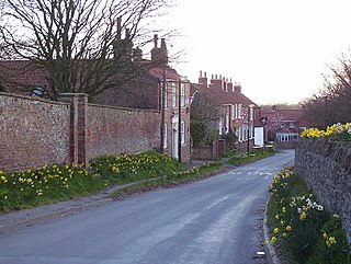
Goodmanham is a small village and civil parish in the East Riding of Yorkshire, England. It is situated approximately 2 miles (3 km) to the north-east of Market Weighton. The village is situated on the Yorkshire Wolds Way National Trail, a long-distance footpath. According to the 2011 UK Census, Goodmanham parish had a population of 244, an increase on the 2001 UK Census figure of 218.

<span class="mw-page-title-main">Flamborough</span> Village and civil parish in the East Riding of Yorkshire, England

Flamborough is a village and civil parish in the East Riding of Yorkshire, England. It is situated approximately 4 miles (6 km) north-east of Bridlington town centre on the prominent coastal feature of Flamborough Head.

<span class="mw-page-title-main">Kilham, East Riding of Yorkshire</span> Village and civil parish in the East Riding of Yorkshire, England

Kilham is a village and civil parish in the East Riding of Yorkshire, England. It is situated about 5 miles (8 km) north-east of Driffield town centre. According to the 2011 UK census, Kilham parish had a population of 1,088, an increase on the 2001 UK census figure of 1,010.

<span class="mw-page-title-main">Mappleton</span> Village and civil parish in the East Riding of Yorkshire, England

Mappleton is a village and civil parish in the East Riding of Yorkshire, England. It is situated on the North Sea coastline in an area known as Holderness, lying approximately 3 miles (5 km) south of the seaside resort of Hornsea. The civil parish is formed by the village of Mappleton and the hamlets of Cowden, Great Cowden and Rolston. According to the 2011 UK census, Mappleton parish had a population of 342, an increase on the 2001 UK census figure of 249.

<span class="mw-page-title-main">Hollym, East Riding of Yorkshire</span> Village and civil parish in the East Riding of Yorkshire, England

Hollym is a small village and civil parish in the East Riding of Yorkshire, England, in an area known as Holderness. It is situated approximately 2 miles (3 km) south of Withernsea and is on the A1033 road.

<span class="mw-page-title-main">Garton on the Wolds</span> Village and civil parish in the East Riding of Yorkshire, England

Garton on the Wolds is a village and civil parish on the Yorkshire Wolds in the East Riding of Yorkshire, England. It is situated approximately 3 miles (5 km) north-west of Driffield town centre and lies on the A166 road.

<span class="mw-page-title-main">Harpham</span> Village and civil parish in the East Riding of Yorkshire, England

Harpham is a small village and civil parish in the East Riding of Yorkshire, England. It is located just south of the A614 road, approximately 5 miles (8 km) north-east of Driffield and 7 miles (11 km) south-west of Bridlington.

<span class="mw-page-title-main">Aldbrough, East Riding of Yorkshire</span> Village and civil parish in the East Riding of Yorkshire, England

Aldbrough is a village and civil parish in the East Riding of Yorkshire, England, about 12 miles (19 km) north-east of Hull at the junction of the B1242 and B1238 roads. It lies near to the North Sea coast within the area of Holderness.

<span class="mw-page-title-main">Lockington, East Riding of Yorkshire</span> Village and civil parish in the East Riding of Yorkshire, England

Lockington is a small village and civil parish in the East Riding of Yorkshire, England. It is situated approximately 6 miles (10 km) north-west of Beverley town centre.

<span class="mw-page-title-main">Nunburnholme</span> Village and civil parish in the East Riding of Yorkshire, England

Nunburnholme is a village and civil parish in the East Riding of Yorkshire, England. It is approximately 3 miles (5 km) east of the market town of Pocklington. The civil parish is formed by the village of Nunburnholme and the hamlet of Kilnwick Percy. According to the 2011 UK census, Nunburnholme parish had a population of 234, a decrease on the 2001 UK census figure of 253.

<span class="mw-page-title-main">North Frodingham</span> Village and civil parish in the East Riding of Yorkshire, England

North Frodingham is a village and civil parish in the East Riding of Yorkshire, England. It is situated approximately 5.5 miles (9 km) south-east of the town of Driffield and lies on the B1249 road.

<span class="mw-page-title-main">North Dalton</span> Village and civil parish in the East Riding of Yorkshire, England

North Dalton is a village and civil parish in the East Riding of Yorkshire, England. It is situated approximately 6 miles (10 km) south-west of the town of Driffield and 8 miles (13 km) north-east of the town of Pocklington. 4 miles (6.4 km) to the north-west lies the village of Huggate. South Dalton lies some 4.5 miles (7 km) to the south-east, with villages in between. North Dalton itself lies on the B1246 road.

<span class="mw-page-title-main">North Cave</span> Village and civil parish in the East Riding of Yorkshire, England

North Cave is a village and civil parish in the East Riding of Yorkshire, England. It is situated 15 miles (24 km) to the west of Hull city centre on the B1230 road. South Cave is approximately 2 miles (3 km) to the south-east.

<span class="mw-page-title-main">Melbourne, East Riding of Yorkshire</span> Village and civil parish in the East Riding of Yorkshire, England

Melbourne is a village and civil parish in the East Riding of Yorkshire, England. It is situated approximately 8 miles (13 km) west of the market town of Market Weighton and 4.5 miles (7 km) south-west of the market town of Pocklington. The village lies just to the south of the Pocklington Canal.

<span class="mw-page-title-main">Lund, East Riding of Yorkshire</span> Village and civil parish in the East Riding of Yorkshire, England

Lund is a village and civil parish in the East Riding of Yorkshire, England. It is situated approximately 6 miles (10 km) north-west of Beverley and 7 miles (11 km) south-west of Driffield.

<span class="mw-page-title-main">Catwick</span> Village and civil parish in the East Riding of Yorkshire, England

Catwick is a village and civil parish in the East Riding of Yorkshire, England. It is situated approximately 7.5 miles (12 km) north-east of Beverley town centre and 5 miles (8 km) west of Hornsea town centre. It lies on the A1035 road from Leven to Hornsea.

<span class="mw-page-title-main">Laxton, East Riding of Yorkshire</span> Village and civil parish in the East Riding of Yorkshire, England

Laxton is a village and civil parish in the East Riding of Yorkshire, England. The village is situated approximately 2 miles (3 km) east from Howden and 19 miles (31 km) south-east from the county town of York.

<span class="mw-page-title-main">Etton, East Riding of Yorkshire</span> Village and civil parish in the East Riding of Yorkshire, England

Etton is a village and civil parish in the East Riding of Yorkshire, England. It is situated approximately 4 miles (6 km) north-west of Beverley town centre and 2 miles (3.2 km) west of the village of Leconfield. 1 mile (1.6 km) to the south-east is Cherry Burton. To the west lie the hamlets of Kiplingcotes and Gardham. South Dalton lies 1.5 miles to the north-west.

<span class="mw-page-title-main">Gilberdyke</span> Village and civil parish in the East Riding of Yorkshire, England

Gilberdyke is a village and civil parish in the East Riding of Yorkshire, England. It is situated approximately 20 miles (32 km) south-east of York and 19 miles (31 km) west of Hull. Gilberdyke lies near to Howden which is 5 miles (8 km) away. It lies on the B1230 road, 1 mile (2 km) south of the M62 motorway.

<span class="mw-page-title-main">Elstronwick</span> Village and civil parish in the East Riding of Yorkshire, England

Elstronwick is a village and civil parish in the East Riding of Yorkshire, England, in an area known as Holderness. It is situated approximately 3.5 miles (6 km) north-east of the town of Hedon and 1.5 miles (2.4 km) north-west of the village of Burton Pidsea.

References

  1. 1 2 UK Census (2011). "Local Area Report – Kirby Underdale Parish (1170211212)". Nomis. Office for National Statistics . Retrieved 21 February 2018.
  2. UK Census (2001). "Local Area Report – Kirby Underdale Parish (00FB083)". Nomis. Office for National Statistics . Retrieved 1 March 2020.
  3. Historic England. "Church of All Saints (1083837)". National Heritage List for England . Retrieved 11 August 2013.
  4. Baines, Edward (1823). History, Directory and Gazetteer of the County of York. pp. 209, 361.
  5. White, William (1840). History, Gazetteer and Directory of the East and North Ridings of Yorkshire . p. 347.
  6. Mayhall. Annals of Yorkshire 1866-74. Marshall Simpkin and co. p. 185.
  7. GENUKI. "Genuki: Kirby Underdale Parish information from Bulmers' 1892., Yorkshire (East Riding)". www.genuki.org.uk. Retrieved 13 September 2023.