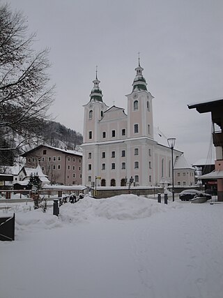
Brixen im Thale is a municipality situated at the highest point of the Brixental valley in the Austrian state of Tyrol. Every year on the Feast of Corpus Christi, the village celebrates the traditional Antlassritt. It is also the birthplace of Matthäus Hetzenauer, an Austrian sniper in the 3rd Mountain Division on the Eastern Front of the World War II, who was credited with 345 kills.

Fontanella is a municipality in the Austrian state of Vorarlberg.
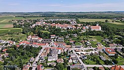
Kirchberg in Tirol is a municipality in the Austrian state of Tyrol in the Kitzbühel district. It is located 6 km (4 mi.) west of Kitzbühel. It is also a village.

Deutsch-Wagram, often shortened to Wagram, is a village in the Gänserndorf District, in the state of Lower Austria, Austria. It is in the Marchfeld Basin, close to the Vienna city limits, about 15 km northeast of the city centre.

Hollabrunn is a district capital town in the Austrian state of Lower Austria, on the Göllersbach river. It is situated in the heart of the biggest wine region of Austria, the Weinviertel.
Klein St. Paul is a town in the district of St. Veit an der Glan in the Austrian state of Carinthia.

Aderklaa is a town in the district of Gänserndorf in Lower Austria in Austria.

Eckartsau is a town in the district of Gänserndorf in the Austrian state of Lower Austria.

Markgrafneusiedl is a town in the district of Gänserndorf in the Austrian state of Lower Austria.

Kirchberg am Walde is a town in the district of Gmünd in Lower Austria, Austria.

Stetteldorf am Wagram is a town in the district of Korneuburg in the Austrian state of Lower Austria.

Kirchberg am Wechsel is a town in the district of Neunkirchen in the Austrian state of Lower Austria. It is notable for hosting the International Wittgenstein Symposium since 1976 and is the home of the Austrian Ludwig Wittgenstein Society.

Kirchberg an der Pielach is a town in the district of Sankt Pölten-Land in the Austrian state of Lower Austria.

Fels am Wagram is a municipality in the district of Tulln in the Austrian state of Lower Austria.

Königsbrunn am Wagram is a municipality in the district of Tulln in the Austrian state of Lower Austria.

Kirchberg bei Mattighofen is a municipality in the district of Braunau am Inn in the Austrian state of Upper Austria.

Kirchberg-Thening is a municipality in the district Linz-Land in the Austrian state of Upper Austria.

Eitzing is a municipality in the district of Ried im Innkreis in the Austrian state of Upper Austria.

Kirchberg ob der Donau is a municipality in Rohrbach, Austria.

Kirchberg an der Raab is a municipality in the district of Südoststeiermark in the Austrian state of Styria.