Sankt Pölten, mostly abbreviated to the official name St. Pölten, is the capital and largest city of the State of Lower Austria in northeast Austria, with 55,538 inhabitants as of 1 January 2020. St. Pölten is a city with its own statute and therefore it is both a municipality and a district in the Mostviertel. Due to its cultural status, it has recently enjoyed an increase of visitors passing through Sankt Pölten on their way to Vienna.

Dunkelsteinerwald is a market municipality with 2,289 inhabitants in the district Melk in Lower Austria, Austria.

Tulln an der Donau is a historic town in the Austrian state of Lower Austria, the administrative seat of Tulln District. Because of its abundance of parks and gardens, Tulln is often referred to as Blumenstadt, and "The City of Togetherness" following the initiative of Peter Eisenschenk, Mayor of Tulln.

Kötschach-Mauthen is a market town in the district of Hermagor in Carinthia in Austria.

Hauskirchen is a town in the district of Gänserndorf in the Austrian state of Lower Austria.

Asperhofen is a town in the district of Sankt Pölten-Land in the Austrian state of Lower Austria.
Oetz is a municipality in the Imst district of Tyrol, Austria, located 11.7 km (7.3 mi) southeast of Imst at the lower course of the Ötztaler Ache in the outer Ötztal valley at the foot of Acherkogel mountain.
Absdorf is a municipality in the district of Tulln in the Austrian state of Lower Austria.

Atzenbrugg is a municipality in the district of Tulln in the Austrian state of Lower Austria. The composer Franz Schubert used to spend some time in Atzenbrugg in the summers around 1820.

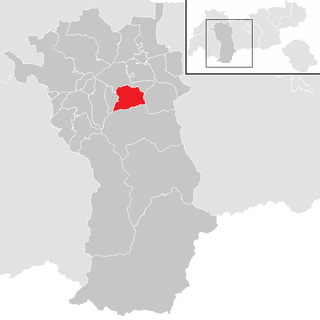
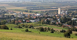
Fels am Wagram is a municipality in the district of Tulln in the Austrian state of Lower Austria.

Grafenwörth is a municipality in the district of Tulln in the Austrian state of Lower Austria.

Großriedenthal is a municipality in the district of Tulln in Lower Austria, Austria. The community consists of 3 districts: Großriedenthal, Ottenthal, and Neudegg. The mild climate and fertile soil allow the region to produce both fruity and full-bodied wines. Grossriedenthal is in the wine district of Lower Austria about 50 km northwest of Vienna which is around one hour by car.

Kirchberg am Wagram is a municipality in the district of Tulln in the Austrian state of Lower Austria.

Königsbrunn am Wagram is a municipality in the district of Tulln in the Austrian state of Lower Austria.

Königstetten is a municipality in the district of Tulln in the Austrian state of Lower Austria.

Michelhausen is a municipality in the district of Tulln in the Austrian state of Lower Austria.

Muckendorf-Wipfing is a municipality in the district of Tulln in the Austrian state of Lower Austria. On the south bank of the Danube, it is around 20 km northwest of Vienna.

Sieghartskirchen is a municipality in the district of Tulln in the Austrian state of Lower Austria.
Tulbing is a municipality in the district of Tulln in the Austrian state of Lower Austria. Tulbing is known for its rural landscape.
Zeiselmauer-Wolfpassing is a community located in the district of Tulln in the Austrian federal state of Lower Austria.