The North Riding of Yorkshire was a subdivision of Yorkshire, England, alongside York, the East Riding and West Riding. The riding's highest point was at Mickle Fell at 2,585 ft (788 m).

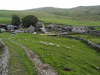
Hetton is a small Dales village in the civil parish of Hetton-cum-Bordley, in the North Yorkshire district of North Yorkshire, England, situated 5.75 miles north of Skipton by the B6265 road. It is the largest settlement in the parish of Hetton-cum-Bordley. The population of the former civil parish of Hetton taken at the 2011 Census was 155.
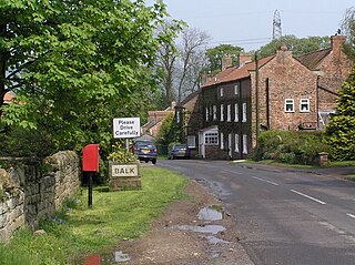
Balk is a hamlet and civil parish in the former Hambleton District of North Yorkshire, England, just east of Thirsk. In the 2001 census the parish had a population of 48. The population of the parish was estimated at 60 in 2013. The parish shares a grouped parish council with the adjacent parish of Bagby.
Birdforth is a village and civil parish in the Hambleton district of North Yorkshire, England. According to the 2001 census it had a population of 13. The population remained less than 100 at the 2011 Census. Details are included in the civil parish of Long Marston, North Yorkshire. The village is on the A19 road, about six miles south of Thirsk.
Bordley is a village in the civil parish of Hetton-cum-Bordley, in North Yorkshire, England, within the Yorkshire Dales National Park and 12 miles (19 km) north of Skipton. According to the 2001 census the parish had a population of 23.

Hood Grange is a hamlet and civil parish in the Hambleton district of North Yorkshire, England. The population was less than 100 in the 2011 Census, so details are included in the civil parish of Sutton-under-Whitestonecliffe. The population of the parish was estimated at 10 in 2015. It is located near Thirsk at the foot of Sutton Bank, south of the larger village of Sutton-under-Whitestonecliffe and next to Hood Hill, which is to the south. It is notable for consisting of only a single household after its population decreased rapidly in the late 19th century. Hood Grange has existed as a civil parish since 1866, prior to which the area was part of Kilburn. A monastery known as Hood Abbey existed here from before 1138 until its dissolution in the 16th century.
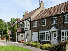
Thirlby is a village and civil parish in former Hambleton District of North Yorkshire, England. With a population of about 120 in 2003, measured at 134 at the 2011 Census, Thirlby is situated approximately 4 miles (6.4 km) east of Thirsk.

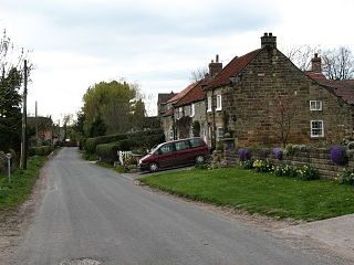
Holme is a small village and civil parish in the Hambleton District of North Yorkshire, England. It is located near Pickhill, Sinderby and Ainderby Quernhow, on the west bank of the River Swale. The population of the civil parish was estimated at 60 in 2014.

High Ellington is a village in lower Wensleydale in North Yorkshire, England, about 2.5 miles (4 km) north-west of Masham. The smaller village of Low Ellington is 0.6 miles (0.97 km) to the east. High Ellington is in Harrogate district, and is the largest settlement in the civil parish of Ellington High and Low, which also includes Low Ellington and the scattered settlement of Sutton. The population of the parish was estimated at 60 in 2013.
Great Busby is a village and civil parish in the Hambleton District of North Yorkshire, England. The population of the parish was estimated at 70 in 2013.
Howe is a small village and civil parish in the Hambleton District of North Yorkshire, England. It is situated near Ainderby Quernhow and the A61 and 5 miles (8 km) west of Thirsk. The population of the civil parish was estimated at 20 in 2015.

Kirby Knowle is a village and civil parish in Hambleton District of North Yorkshire, England, on the border of the North Yorkshire Moors and near Upsall, about four miles northeast of Thirsk. Historically part of the North Riding of Yorkshire, the population of the civil parish was estimated at 60 in 2014.

Kirklington is a village in the English county of North Yorkshire close to the A1(M) motorway. Kirklington forms the major part of the civil parish of Kirklington-cum-Upsland.

Over Dinsdale is a small village and civil parish in the former Local Government District of Hambleton in North Yorkshire, England. The population of the village taken at the 2011 census was 151. The village straddles an ancient Roman road on the border with County Durham, on a peninsula in the River Tees, approximately 6 miles (9.7 km) from Darlington and 8.5 miles (13.7 km) from Yarm. The Teesdale Way passes through the village.

Thornbrough is a civil parish in the Hambleton District of North Yorkshire, England. The population of the civil parish was estimated at 20 in 2014.

Nunwick is a village in the Harrogate district of North Yorkshire, England. It is about 1 mile north-east of Ripon.

Eldmire with Crakehill is a civil parish in the Hambleton district of North Yorkshire, England. The population of the parish was estimated at 30 in 2013.

Sutton Howgrave is a village in North Yorkshire, England. It is the only village in the civil parish of Sutton with Howgrave. The population of the parish was estimated at 70 in 2014.

Sowerby-under-Cotcliffe is a civil parish in the Hambleton District of North Yorkshire, England. The population at the 2011 Census was less than 100. Details are included in the civil parish of Winton, Stank and Hallikeld. It is 3 miles (4.8 km) east of Northallerton, 0.5 miles (0.8 km) south of Kirby Sigston, and 1.2 miles (2 km) west of the A19 road. The Cod Beck river flows to the east of the parish forming a border with KIrby Sigston and Landmoth-cum-Catto civil parishes.

Howgrave is a civil parish in the Hambleton District of North Yorkshire, England. It is a very small parish, with an area of only 323 acres (131 ha) and an estimated population in 2014 of only 10. There is no modern village in the parish. The site of the deserted medieval village of Howgrave lies in the west of the parish, 0.3 miles (0.5 km) west of the village of Sutton Howgrave.