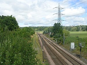
Horsforth is a town and civil parish in the City of Leeds, West Yorkshire, England, five miles north-west of Leeds city centre. Historically a village within the West Riding of Yorkshire, it had a population of 18,895 at the 2011 Census. It became part of the City of Leeds metropolitan borough in 1974. In 1999, a civil parish was created for the area, and the parish council voted to rename itself a town council. The area is within the Horsforth ward of Leeds City Council, which also includes the southern part of Rawdon.

The Leeds–Bradford lines are two railway lines connecting the cities of Leeds and Bradford in West Yorkshire, both meeting in Leeds railway station and are included in the West Yorkshire Metro area system of lines.
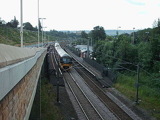
The Airedale line is one of the rail services in the West Yorkshire Metro area centred on West Yorkshire in northern England. The service is operated by Northern, on the route connecting Leeds and Bradford with Skipton. Some services along the line continue to Morecambe or Carlisle. The route covered by the service was historically part of the Midland Railway.
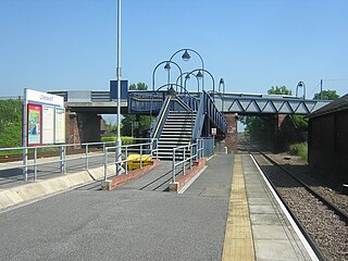
Ulleskelf railway station in Ulleskelf, North Yorkshire, England, is 8.75 miles (14 km) south of York.
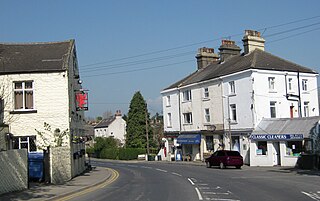
Shadwell is a village and civil parish in north-east Leeds, West Yorkshire, England. The village is 6 miles (9.7 km) to the north east of Leeds city centre.

The River Croco is a small river in Cheshire in England. It starts as lowland field drainage west of Congleton, flows along the south edge of Holmes Chapel, and joins the River Dane at Middlewich. It is about 8 miles (13 km) long.

Burley is an inner city area of Leeds, West Yorkshire, England, 1 mile (1.6 km) north-west of Leeds city centre, between the A65 Kirkstall Road at the south and Headingley at the north, in the Kirkstall ward.

Cutler Heights is a locality between Bowling and Laisterdyke in Bradford, West Yorkshire, England. It is known for its many industrial estates, among them engineering and steel trading businesses.

Middleton Junction railway station was an early junction station on the Manchester and Leeds Railway, it opened when the branch to Oldham opened in 1842.
Alverthorpe railway station served the village of Alverthorpe near Wakefield in the English county of West Yorkshire.
Horsforth Woodside was a proposed railway station that was to be built on the site of Woodside Quarry near Horsforth in West Yorkshire, England. It would have been located on the Harrogate Line near the current Horsforth station, which would also stay open. Horsforth Woodside was also the name of a very early station on the Leeds-Northallerton railway, which was closed completely in 1864. The fact that both the old closed station and the proposed new station have the same name has caused confusion when railway historical matters in this area are being discussed. The proposed station would have served a planned housing development at the former Woodside Quarry, as well as providing a park and ride service for Leeds city centre.

Drub is a hamlet in the Kirklees district, in the county of West Yorkshire, England. It is located between Cleckheaton, Birkenshaw, and Gomersal and is considered part of the latter. The name "Drub" derives from rubbish found in coal, was transported which was the former function of Drub Lane as a thoroughfare.
The Yorkshire Electric Tramways operated two separate tramway services. One in Wakefield between 1904 and 1932, and the other between Normanton, Pontefract and Castleford between 1906 and 1932

Newlay and Horsforth railway station, until 1889 and from 1961 called Newlay station, was a station on the route of the former Leeds and Bradford Railway, located on the right bank of the River Aire and on the left bank of the Leeds and Liverpool canal between Horsforth in the north and Bramley in the south. It was accessed from Pollard Lane, which still crosses the railway on a bridge there, and served mainly the southern parts of Horsforth in West Yorkshire, England.
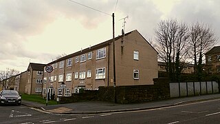
Pudsey Lowtown railway station is a closed railway station in Pudsey, in the former West Riding of Yorkshire, located about 5 mi (8 km) west of Leeds station. It served the eastern parts of the town of Pudsey.

Holme Beck is a watercourse in the Tong ward of the City of Bradford, West Yorkshire, England. It drains a shallow valley east of the watershed between Bradford and Leeds. Holme Beck begins in the village with no evidence of any continuation on the other side of the canal or motorway. Holme Beck is the main carrier for village drainage, it runs beneath the West Coast Main Line and then through the large marsh area of Holme Moss before joining the River Bela.
Flushdyke was a Great Northern Railway station on Wakefield Road in Flushdyke, West Yorkshire. The station originally opened on the north side of Wakefield Road on 7 April 1862, was renamed Flushdyke when the later Ossett station opened two years later, and at some date moved to the south side of the road bridge. It was closed from 5 May 1941. Steps from the road led to two side platforms, each with a shelter.
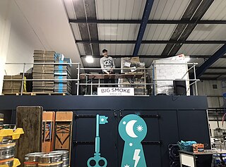
Lower Green is a residential and commercial area within Esher, in Surrey, England, on the banks of the River Ember and River Mole. The area has many businesses, most of them in the commercial complex comprising Sandown Industrial Complex and Royal Mills.

Newlay is a suburb of Horsforth, in West Yorkshire, England. Originally a hamlet, it is now part of Horsforth parish in the City of Leeds District, and has its own conservation area. Newlay is situated on the Leeds and Liverpool Canal and the River Aire, some 5 miles (8 km) north west of Leeds city centre.
