Klein, Montana

Last updated
Klein, Montana
CDP
Musselshell County Montana Incorporated and Unincorporated areas Klein Highlighted.svg
Location of Klein, Montana
Coordinates: 46°24′10″N108°32′54″W / 46.40278°N 108.54833°W / 46.40278; -108.54833 Coordinates: 46°24′10″N108°32′54″W / 46.40278°N 108.54833°W / 46.40278; -108.54833
Country United States
State Montana
County Musselshell
Area
[1]
  Total12.85 sq mi (33.28 km2)
  Land12.85 sq mi (33.28 km2)
  Water0.00 sq mi (0.00 km2)
Elevation
3,284 ft (1,001 m)
Population
 (2020)
  Total163
  Density12.68/sq mi (4.90/km2)
Time zone UTC-7 (Mountain (MST))
  Summer (DST) UTC-6 (MDT)
ZIP code
59072
Area code 406
FIPS code 30-41050
GNIS feature ID0773097

Klein is a census-designated place (CDP) in Musselshell County, Montana, United States. The population was 188 at the 2000 census.

Contents

Geography

Klein is located at 46°24′10″N108°32′54″W / 46.40278°N 108.54833°W / 46.40278; -108.54833 (46.402844, -108.548378). [2] According to the United States Census Bureau, the CDP has a total area of 12.9 square miles (33 km2), all of it land.

History

The Klein CDP boundary was designed in or after 1980 because

Communities

The Klein CDP includes the village of Klein, for which it was named.

Demographics

Historical population
CensusPop.
2000 188
2020 163
U.S. Decennial Census [3]

As of the census [4] of 2000, there were 188 people, 69 households, and 52 families residing in the CDP. The population density was 14.6 people per square mile (5.6/km2). There were 90 housing units at an average density of 7.0/sq mi (2.7/km2). The racial makeup of the CDP was 95.21% White, 3.19% Native American, 1.06% Pacific Islander, and 0.53% from two or more races. Hispanic or Latino of any race were 1.06% of the population.

There were 69 households, out of which 30.4% had children under the age of 18 living with them, 65.2% were married couples living together, 7.2% had a female householder with no husband present, and 24.6% were non-families. 18.8% of all households were made up of individuals, and 11.6% had someone living alone who was 65 years of age or older. The average household size was 2.72 and the average family size was 3.12.

In the CDP, the population was spread out, with 21.8% under the age of 18, 5.9% from 18 to 24, 21.8% from 25 to 44, 37.8% from 45 to 64, and 12.8% who were 65 years of age or older. The median age was 45 years. For every 100 females, there were 111.2 males. For every 100 females age 18 and over, there were 113.0 males.

The median income for a household in the CDP was $39,792, and the median income for a family was $38,542. Males had a median income of $29,000 versus $18,750 for females. The per capita income for the CDP was $15,522. About 14.0% of families and 11.6% of the population were below the poverty line, including 50.0% of those under the age of eighteen and none of those 65 or over.

Related Research Articles

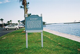
<span class="mw-page-title-main">Bayport, Florida</span> Census-designated place in Florida, United States

Bayport is an unincorporated community and census-designated place (CDP) in Hernando County, Florida, United States. The population was 43 at the 2010 census.

<span class="mw-page-title-main">Mission Bay, Florida</span> Unincorporated place in Florida, United States

Mission Bay was a census-designated place (CDP) located in an unincorporated area west of Boca Raton in Palm Beach County, Florida, United States. The population was 3,066 at the 2000 census.

<span class="mw-page-title-main">Camp Three, Montana</span> CDP in Montana, United States

Camp Three is a census-designated place (CDP) in Musselshell County, Montana, United States. The population was 138 at the 2000 census.

<span class="mw-page-title-main">Musselshell, Montana</span> CDP in Montana, United States

Musselshell is an unincorporated village in Musselshell County, Montana, United States. It is also the namesake of a census designated place (CDP) which incorporates the village. The population of the village is unknown, but the population of the entire CDP was 60 at the 2010 census and 2000 census. The village is located near the Musselshell River.

<span class="mw-page-title-main">Brimhall Nizhoni, New Mexico</span> Census-designated place in McKinley County, New Mexico, United States

Brimhall Nizhoni is a census-designated place (CDP) in McKinley County, New Mexico, United States. The population was 199 at the 2010 census. The Navajo Coyote Canyon Chapter House is located in Brimhall.

<span class="mw-page-title-main">Nakaibito, New Mexico</span> CDP in New Mexico, United States

Nakaibito is a census-designated place (CDP) in McKinley County, New Mexico, United States. The population was 455 at the 2000 census.

<span class="mw-page-title-main">Twin Lakes, New Mexico</span> CDP in New Mexico, United States

Twin Lakes is a census-designated place (CDP) in McKinley County, New Mexico, United States. The population was 1,069 at the 2000 census.

Napi Headquarters is a census-designated place (CDP) in San Juan County, New Mexico, United States. The population was 706 at the 2000 census.

<span class="mw-page-title-main">Sanostee, New Mexico</span> CDP in New Mexico, United States

Sanostee is a census-designated place (CDP) in San Juan County, New Mexico, United States. The population was 429 at the 2000 census. It is part of the Farmington Metropolitan Statistical Area.

<span class="mw-page-title-main">Northville, Suffolk County, New York</span> Place in New York, United States

Northville is a hamlet and census-designated place (CDP) in the Town of Riverhead in Suffolk County, on Long Island, in New York, United States. The CDP population was 1,340 at the 2010 census. Between 1921 and 1930, it was an incorporated village known originally as the Incorporated Village of Sound Avenue, and from 1927 to 1930 as the Incorporated Village of Northville.
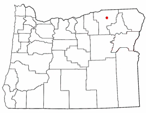
<span class="mw-page-title-main">Kirkpatrick, Oregon</span> Unincorporated community in the state of Oregon, United States

Kirkpatrick is a census-designated place (CDP) in Umatilla County, Oregon, United States. The population was 172 at the 2000 census. It is part of the Pendleton–Hermiston Micropolitan Statistical Area.

<span class="mw-page-title-main">Woodbourne, Pennsylvania</span> Census-designated place in Pennsylvania, United States

Woodbourne is a census-designated place (CDP) in Bucks County, Pennsylvania, United States. The population was 3,851 at the 2010 census.
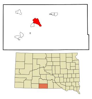
<span class="mw-page-title-main">Rosebud, South Dakota</span> CDP in South Dakota, United States

Rosebud also Sicanġu is a census-designated place (CDP) in Todd County, South Dakota, United States. The population was 1,455 at the 2020 census.

<span class="mw-page-title-main">Highland, Washington</span> Unincorporated community in Washington, United States

Highland was a former unincorporated community and former census-designated place (CDP) in Benton County, Washington, United States. The population was 3,388 at the 2000 census. The area was not listed as a CDP for the 2010 census and the inhabited north end from S Olympia Street to Elliot Lake have since been added to Kennewick.

<span class="mw-page-title-main">Ahtanum, Washington</span> CDP in Washington, United States

Ahtanum is a census-designated place (CDP) in Yakima County, Washington. The population was 3,601 at the time of the 2010 census.

<span class="mw-page-title-main">Gilbert Creek, West Virginia</span> CDP in West Virginia, United States

Gilbert Creek is a census-designated place (CDP) in Mingo County, West Virginia, United States. The population was 1,090 at the 2010 census. The community takes its name from nearby Gilbert Creek.

Johnstown is a census-designated place (CDP) in Fremont County, Wyoming, United States. The population was 242 at the 2010 census.

<span class="mw-page-title-main">Ralston, Wyoming</span> CDP in Wyoming, United States

Ralston is a census-designated place (CDP) in Park County, Wyoming, United States. The population was 280 at the 2010 census.
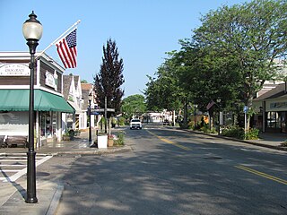
<span class="mw-page-title-main">Falmouth (CDP), Massachusetts</span> Census-designated place in Massachusetts, United States

Falmouth is a census-designated place (CDP) consisting of the primary settlement in the town of Falmouth in Barnstable County, Massachusetts, United States. The population of the CDP was 3,799 at the 2010 census, out of 31,532 in the town as a whole. It was named after Falmouth, Cornwall, England.

<span class="mw-page-title-main">Cheektowaga (CDP), New York</span> Census-designated place in New York, United States

Cheektowaga is a suburban community and census-designated place (CDP) in Erie County, New York, United States. The population was 75,178 at the 2010 census, making it the most populous census-designated place in New York. It is within the town of Cheektowaga. The CDP includes Buffalo Niagara International Airport.

References

  1. "ArcGIS REST Services Directory". United States Census Bureau. Retrieved September 5, 2022.
  2. "US Gazetteer files: 2010, 2000, and 1990". United States Census Bureau. 2011-02-12. Retrieved 2011-04-23.
  3. "Census of Population and Housing". Census.gov. Retrieved June 4, 2016.
  4. "U.S. Census website". United States Census Bureau . Retrieved 2008-01-31.