Roundup, Montana

Last updated

Roundup
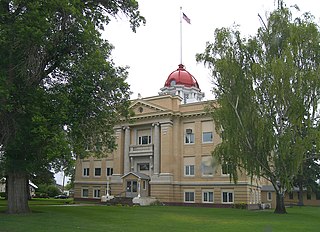
Musselshell county courthouse.jpg
Musselshell County Courthouse
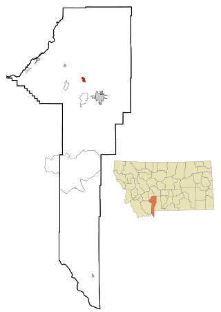
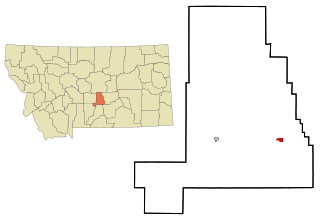
Musselshell County Montana Incorporated and Unincorporated areas Roundup Highlighted.svg
Location of Roundup, Montana
Coordinates: 46°26′54″N108°32′34″W / 46.44833°N 108.54278°W / 46.44833; -108.54278
CountryUnited States
State Montana
County Musselshell
Area
[1]
  Total1.29 sq mi (3.35 km2)
  Land1.29 sq mi (3.35 km2)
  Water0.00 sq mi (0.00 km2)
Elevation
3,215 ft (980 m)
Population
 (2020)
  Total1,742
  Density1,347.25/sq mi (520.10/km2)
Time zone UTC−7 (Mountain (MST))
  Summer (DST) UTC−6 (MDT)
ZIP codes
59072-59073
Area code 406
FIPS code 30-64525
GNIS feature ID0778772
Website www.roundupmontana.net

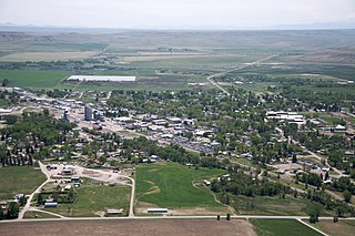
Roundup is a city in and the county seat of Musselshell County, Montana, United States. [2] The population was 1,742 during the 2020 census. [3]

Contents

The city was incorporated in 1909. [4] It has a Commissioner-Executive form of government. [4]

History

Roundup served as a place for cattlemen to "round up" their cattle along the Musselshell River. It was the trailhead in the Great Montana Centennial Cattle Drive [5] and now drives happen annually.

The post office opened in 1883. [6] In 1907, the Milwaukee Road reached Roundup.

From Hell to Breakfast in Old Montana, by Leland Blanchard, tells the story of pioneers who lived and worked in Roundup in the early 1900s. [7]

Geography

Roundup is located at 46°26′54″N108°32′34″W / 46.44833°N 108.54278°W / 46.44833; -108.54278 (46.448401, -108.542676). [8] According to the United States Census Bureau, the city has a total area of 1.34 square miles (3.47 km2), all land. [9]

The Musselshell River runs through the city. Roundup is bordered to the south by the Bull Mountains which rise from the great plains over a hundred miles east of the front range of the Rocky Mountains.

Climate

According to the Köppen Climate Classification system, Roundup has a cold semi-arid climate, abbreviated "BSk" on climate maps.

Climate data for Roundup, Montana, 19912020 normals, extremes 19142019
MonthJanFebMarAprMayJunJulAugSepOctNovDecYear
Record high °F (°C)70
(21)
75
(24)
82
(28)
91
(33)
100
(38)
106
(41)
111
(44)
108
(42)
102
(39)
95
(35)
77
(25)
70
(21)
111
(44)
Mean maximum °F (°C)58.2
(14.6)
61.9
(16.6)
70.3
(21.3)
80.4
(26.9)
87.4
(30.8)
96.0
(35.6)
100.1
(37.8)
98.8
(37.1)
93.3
(34.1)
82.0
(27.8)
67.6
(19.8)
57.1
(13.9)
101.6
(38.7)
Mean daily maximum °F (°C)37.2
(2.9)
40.7
(4.8)
50.6
(10.3)
59.9
(15.5)
69.1
(20.6)
78.3
(25.7)
88.9
(31.6)
87.9
(31.1)
76.9
(24.9)
60.9
(16.1)
46.6
(8.1)
37.2
(2.9)
61.2
(16.2)
Daily mean °F (°C)25.1
(−3.8)
27.8
(−2.3)
36.3
(2.4)
44.9
(7.2)
54.2
(12.3)
63.1
(17.3)
71.2
(21.8)
69.5
(20.8)
59.6
(15.3)
46.3
(7.9)
34.2
(1.2)
25.7
(−3.5)
46.5
(8.1)
Mean daily minimum °F (°C)13.1
(−10.5)
14.9
(−9.5)
22.1
(−5.5)
30.0
(−1.1)
39.3
(4.1)
47.8
(8.8)
53.5
(11.9)
51.1
(10.6)
42.4
(5.8)
31.7
(−0.2)
21.8
(−5.7)
14.2
(−9.9)
31.8
(−0.1)
Mean minimum °F (°C)−13.3
(−25.2)
−8.7
(−22.6)
−2.5
(−19.2)
17.7
(−7.9)
27.4
(−2.6)
37.1
(2.8)
44.9
(7.2)
41.6
(5.3)
28.8
(−1.8)
16.0
(−8.9)
0.4
(−17.6)
−12.5
(−24.7)
−24.3
(−31.3)
Record low °F (°C)−41
(−41)
−52
(−47)
−33
(−36)
−9
(−23)
10
(−12)
31
(−1)
36
(2)
30
(−1)
15
(−9)
−10
(−23)
−36
(−38)
−44
(−42)
−52
(−47)
Average precipitation inches (mm)0.37
(9.4)
0.42
(11)
0.71
(18)
1.71
(43)
2.55
(65)
2.89
(73)
1.70
(43)
1.21
(31)
1.20
(30)
1.22
(31)
0.49
(12)
0.41
(10)
14.88
(376.4)
Average snowfall inches (cm)5.2
(13)
3.9
(9.9)
4.4
(11)
1.4
(3.6)
0.1
(0.25)
0.0
(0.0)
0.0
(0.0)
0.0
(0.0)
0.0
(0.0)
1.0
(2.5)
2.8
(7.1)
5.6
(14)
24.4
(61.35)
Average precipitation days (≥ 0.01 in)4.03.65.17.710.010.67.05.15.36.93.94.573.7
Average snowy days (≥ 0.1 in)3.22.81.90.70.10.00.00.00.00.51.73.414.3
Source 1: NOAA [10]
Source 2: National Weather Service (mean maxima and minima 1981–2010) [11]

Demographics

Historical population
CensusPop.Note
1910 1,513
1920 2,43460.9%
1930 2,5775.9%
1940 2,6442.6%
1950 2,8568.0%
1960 2,842−0.5%
1970 2,116−25.5%
1980 2,1190.1%
1990 1,808−14.7%
2000 1,9316.8%
2010 1,788−7.4%
2020 1,742−2.6%
U.S. Decennial Census [12] [3]

2010 census

As of the census [13] of 2010, there were 1,788 people, 814 households, and 445 families residing in the city. The population density was 1,334.3 inhabitants per square mile (515.2/km2). There were 973 housing units at an average density of 726.1 per square mile (280.3/km2). The racial makeup of the city was 95.7% White, 0.3% African American, 1.3% Native American, 0.1% Asian, 0.2% from other races, and 2.4% from two or more races. Hispanic or Latino people of any race were 4.1% of the population.

There were 814 households, of which 26.3% had children under the age of 18 living with them, 41.5% were married couples living together, 8.6% had a female householder with no husband present, 4.5% had a male householder with no wife present, and 45.3% were non-families. 40.5% of all households were made up of individuals, and 18.2% had someone living alone who was 65 years of age or older. The average household size was 2.17 and the average family size was 2.94.

The median age in the city was 43.6 years. 23.7% of residents were under the age of 18; 6.5% were between the ages of 18 and 24; 21.2% were from 25 to 44; 31.6% were from 45 to 64; and 16.8% were 65 years of age or older. The gender makeup of the city was 48.0% male and 52.0% female.

2000 census

As of the census [14] of 2000, there were 1,931 people, 833 households, and 498 families residing in the city. The population density was 1,437.8 inhabitants per square mile (555.1/km2). There were 978 housing units at an average density of 728.2 per square mile (281.2/km2). The racial makeup of the city was 97.05% White, 0.16% African American, 0.78% Native American, 0.10% Asian, 0.47% from other races, and 1.45% from two or more races. Hispanic or Latino people of any race were 2.74% of the population.

There were 833 households, out of which 29.2% had children under the age of 18 living with them, 47.9% were married couples living together, 8.9% had a female householder with no husband present, and 40.1% were non-families. 36.7% of all households were made up of individuals, and 19.7% had someone living alone who was 65 years of age or older. The average household size was 2.25 and the average family size was 2.96.

In the city, the population was spread out, with 25.0% under the age of 18, 6.2% from 18 to 24, 24.3% from 25 to 44, 22.6% from 45 to 64, and 21.9% who were 65 years of age or older. The median age was 42 years. For every 100 females there were 87.3 males. For every 100 females age 18 and over, there were 85.6 males.

The median income for a household in the city was $23,144, and the median income for a family was $31,129. Males had a median income of $25,875 versus $17,011 for females. The per capita income for the city was $15,123. About 13.7% of families and 20.3% of the population were below the poverty line, including 27.4% of those under age 18 and 14.7% of those age 65 or over.

Economy

The area has coal mines, which combined with the agriculture, maintain the economy of the town. [4]

Roundup is a hub in Amazon.com's supply chain with a growing industry of prep centers, or businesses that specialize in packing goods to meet the requirements of Amazon's highly automated warehouses. [15]

Arts and culture

The Musselshell Valley Historical Museum highlights the early settlement of the area. Signal Peak Energy largely funded a coal exhibit. [16] Several recreated locations, such as a hospital, general store, and school, allow visitors to experience life as it was.

Roundup School-Community Library is a public library which serves the area. [17]

Parks and recreation

The Mussellshell River on the southern side of town provides the opportunity for fishing. Fish in the river include brown trout, smallmouth bass, and catfish. [18] Other activities are floating the river or harvesting the mussels the river is named for.

Hunting options are plentiful. The area has an abundance of whitetail and mule deer, antelope, and gamebirds. [19] The large number of animals can become a safety hazard, so an annual archery-only hunt is authorized in and around the town after the usual hunting season. [20] [21]

Education

Roundup School District educates students from kindergarten through 12th grade. [22] Roundup High School's team name is the Panthers. [23] In the 2021-2022 school year, 174 students were enrolled in the high school. [24]

Media

The local newspaper is the Roundup Record-Tribune. [25] It is published weekly and serves Musselshell County and the neighboring counties.

There are two radio stations licensed in Roundup. KQLJ-LP is a religious channel [26] affiliated with Three Angels Broadcasting Network. KXEM [27] is also a religious channel. It is part of Your Network of Praise.

Infrastructure

U.S. Route 87 passes through the town from north to south while U.S. Route 12 travels east to west.

Roundup Airport is a public use airport located two miles (4 km) north of town. [28]

Notable people

Related Research Articles

<span class="mw-page-title-main">Yellowstone County, Montana</span> County in Montana, United States

Yellowstone County is the most populous county in the U.S. state of Montana. As of the 2020 census, the population was 164,731. Its county seat is Billings, the state's most populous city. Like the nearby park, Yellowstone County is named after the Yellowstone River which roughly bisects the county, flowing southwest to northeast. The river, in turn, was named for the yellow sandstone cliffs in what is now Yellowstone County.

<span class="mw-page-title-main">Musselshell County, Montana</span> County in Montana, United States

Musselshell County is a county in south-central Montana. As of the 2020 census, the population was 4,730. Its county seat is Roundup.

<span class="mw-page-title-main">Townsend, Montana</span> City in Montana, United States

Townsend is a city in and the county seat of Broadwater County, Montana, United States. The population was 1,787 at the 2020 census.
<span class="mw-page-title-main">Belgrade, Montana</span> City in Montana, United States

Belgrade is a city in Gallatin County, Montana, United States. The population was 10,460 at the 2020 census. Belgrade is part of the Bozeman, MT Micropolitan Statistical Area. It is the most populous city in Montana that is not a county seat.
<span class="mw-page-title-main">Lavina, Montana</span> Town in Montana, United States

Lavina is a town in Golden Valley County, Montana, United States. The population was 136 at the 2020 census. The town is situated on the north bank of the Musselshell River.

<span class="mw-page-title-main">Ryegate, Montana</span> Town in Montana, United States

Ryegate is a town in, and the county seat of, Golden Valley County, Montana, United States. The population was 223 at the 2020 census. Ryegate is situated on the north bank of the Musselshell River.

<span class="mw-page-title-main">Alberton, Montana</span> Town in Montana, United States

Alberton is a town in Mineral County, Montana, United States. The population was 452 at the 2020 census. Alberton was the location of a major chlorine chemical release in 1996. It is the home of Northwest Indian Bible School, a Bible-training institution founded and operated by the Allegheny Wesleyan Methodist Connection.

<span class="mw-page-title-main">Camp Three, Montana</span> CDP in Montana, United States

Camp Three is a census-designated place (CDP) in Musselshell County, Montana, United States. The population was 138 at the 2000 census.

<span class="mw-page-title-main">Klein, Montana</span> CDP in Montana, United States

Klein is a census-designated place (CDP) in Musselshell County, Montana, United States. The population was 163 at the 2020 census.

<span class="mw-page-title-main">Melstone, Montana</span> Town in Montana, United States

Melstone is a rural small town in far eastern Musselshell County, Montana, United States, along U.S. Route 12. The population was 126 at the 2020 census. The town was established in 1908 as a base for operating crews on the Chicago, Milwaukee, St. Paul and Pacific Railroad, then under construction in Montana. Although the railroad was abandoned in 1980, Melstone survives as a community center for farmers and ranchers in the lower Musselshell River valley.

<span class="mw-page-title-main">Musselshell, Montana</span> CDP in Montana, United States

Musselshell is an unincorporated village in Musselshell County, Montana, United States. It is also the namesake of a census designated place (CDP) which incorporates the village. The population of the village is unknown, but the population of the entire CDP was 60 at the 2010 census. The village is located near the Musselshell River.

<span class="mw-page-title-main">Winnett, Montana</span> Town in Montana, United States

Winnett is a town in and the county seat of Petroleum County, Montana, United States. The population was 188 at the 2020 census.

<span class="mw-page-title-main">Malta, Montana</span> City in Montana, United States

Malta is a city in, and the county seat of, Phillips County, Montana, United States, located at the intersection of U.S. Routes 2 and 191. The population was 1,860 at the 2020 census.
<span class="mw-page-title-main">Sidney, Montana</span> City in Montana, United States

Sidney is a city in and the county seat of Richland County, Montana, United States, less than 10 mi (16 km) west of the North Dakota border. The population was 6,346 at the 2020 census. The city lies along the Yellowstone River and is in proximity to the badlands of the Dakotas. Sidney is approximately midway between Glendive, Montana and Williston, North Dakota.

<span class="mw-page-title-main">Forsyth, Montana</span> City in Montana, United States

Forsyth is a city in and the county seat of Rosebud County, Montana, United States. The population was 1,647 at the 2020 census. Forsyth was established in 1876 as the first settlement on the Yellowstone River, and in 1882 residents named the town after General James William Forsyth who commanded Fort Maginnis, Montana during the Indian Wars and the 7th Cavalry at the Wounded Knee Massacre. The town has long been a transportation nexus, starting with steamboats on the river and progressing to the Northern Pacific Railway and Interstate 94.
<span class="mw-page-title-main">Choteau, Montana</span> City in Montana, United States

Choteau is a city in and the county seat of Teton County, Montana, United States. The population was 1,721 at the 2020 census.

<span class="mw-page-title-main">Harlowton, Montana</span> City in and county seat of Wheatland County, Montana, United States

Harlowton is a city in and the county seat of Wheatland County, Montana, United States. The population was 955 at the 2020 census.

<span class="mw-page-title-main">Judith Gap, Montana</span> City in Wheatland County, Montana, United States

Judith Gap is a city in Wheatland County, Montana, United States. The population was 110 at the 2020 census.

<span class="mw-page-title-main">Hobson, Montana</span> City in Montana, United States

Hobson is a city in Judith Basin County, Montana, United States. The population was 179 at the 2020 census.

<span class="mw-page-title-main">Petroleum County, Montana</span> County in Montana, United States

Petroleum County is a county in the U.S. state of Montana. As of the 2020 census, the population was 496, making it the least populous county in Montana and the eighth-least populous in the United States. Its county seat is Winnett. The county's area was partitioned from Fergus County in 1925 to become the last of Montana's 56 counties to be organized.

References

  1. "ArcGIS REST Services Directory". United States Census Bureau. Retrieved September 5, 2022.
  2. "Find a County". National Association of Counties. Retrieved June 7, 2011.
  3. 1 2 "U.S. Census website". United States Census Bureau . Retrieved November 2, 2021.
  4. 1 2 3 "Visitors". City of Roundup. Retrieved September 7, 2023.
  5. Chamber of Commerce. "Welcome". Archived from the original on December 18, 2011. Retrieved November 18, 2011.
  6. "Roundup". Montana Place Names Companion. Montana Historical Society. Retrieved April 9, 2021.
  7. Blanchard, Leland (September 18, 2017). From Hell to Breakfast in Old Montana: A True Saga. ISBN   978-1548434175.
  8. "US Gazetteer files: 2010, 2000, and 1990". United States Census Bureau. February 12, 2011. Retrieved April 23, 2011.
  9. "US Gazetteer files 2010". United States Census Bureau. Archived from the original on February 20, 2011. Retrieved December 18, 2012.
  10. "U.S. Climate Normals Quick Access". National Oceanic and Atmospheric Administration. Retrieved August 7, 2022.
  11. "NOAA Online Weather Data". National Weather Service. Retrieved August 7, 2022.
  12. "Census of Population and Housing". Census.gov. Retrieved June 4, 2015.
  13. "U.S. Census website". United States Census Bureau . Retrieved December 18, 2012.
  14. "U.S. Census website". United States Census Bureau . Retrieved January 31, 2008.
  15. Dzieza, Josh (November 14, 2019). "Why thousands of Amazon packages converge on a tiny Montana town". The Verge. Retrieved November 15, 2019.
  16. "Home page". Musselshell Valley Historical Museum. Retrieved September 7, 2023.
  17. "Roundup School-Community Library". Montana State Library. Retrieved April 13, 2021.
  18. "Musselshell River". Big Sky Fishing.Com. Retrieved September 7, 2023.
  19. "Block Management:Region 5". Montana Fish, Wildlife, and Parks. Retrieved September 7, 2023.
  20. Fish, Wildlife & Parks (September 2, 2022). "Roundup deer archery tags go on sale Oct. 5". Billings Gazette. Retrieved September 7, 2023.
  21. "2019 FWP hails Roundup Urban Deer Hunt as success". City of Roundup. Retrieved September 7, 2023.
  22. "Roundup School District". Roundup School District. Retrieved April 13, 2021.
  23. "Member Schools". Montana High School Association. Retrieved April 19, 2021.
  24. "Roundup H S". National Center for Education Statistics. Retrieved October 25, 2023.
  25. "News". Roundup Record Tribune & Winnett Times. Retrieved September 7, 2023.
  26. "KQLJ-LP". FCC. Retrieved September 7, 2023.
  27. "KXEM". FCC. Retrieved September 7, 2023.
  28. "RPX(KRPX) Roundup". FAA. Retrieved September 7, 2023.