Knife River, Montana

Last updated
Knife River, Montana
Former CDP
Richland County Montana Incorporated and Unincorporated areas Knife River Highlighted.svg
Location of Knife River, Montana
Coordinates: 47°27′13″N104°20′42″W / 47.45361°N 104.34500°W / 47.45361; -104.34500 Coordinates: 47°27′13″N104°20′42″W / 47.45361°N 104.34500°W / 47.45361; -104.34500
Country United States
State Montana
County Richland
Area
  Total3.4 sq mi (8.9 km2)
  Land3.4 sq mi (8.9 km2)
  Water0.0 sq mi (0.0 km2)
Elevation
1,991 ft (607 m)
Population
 (2010) [1]
  Total320
  Density86.2/sq mi (33.3/km2)
Time zone UTC-7 (Mountain (MST))
  Summer (DST) UTC-6 (MDT)
Area code 406
FIPS code 30-41087
GNIS feature ID1853183

Knife River was a census-designated place (CDP) in Richland County, Montana, United States. The population was 320 at the 2010 census. [1] The CDP primarily consisted of the unincorporated community of Savage. The Knife River CDP was not recorded at the 2020 census; instead, a smaller CDP named "Savage", comprising only the built-up portion of the town, was listed. [2]

Contents

Geography

The Knife River CDP was located at 47°27′13″N104°20′42″W / 47.45361°N 104.34500°W / 47.45361; -104.34500 (47.453610, -104.344938), [3] comprising the community of Savage and agricultural areas to the east and west. The CDP was on the west side of the Yellowstone River.

According to the United States Census Bureau, the CDP has a total area of 3.5 square miles (9.1 km2), all land.

Demographics

Historical population
CensusPop.Note
2000 297
2010 3207.7%
U.S. Decennial Census

As of the census [4] of 2000, there were 297 people, 125 households, and 79 families residing in the CDP. The population density was 86.2 inhabitants per square mile (33.3/km2). There were 145 housing units at an average density of 42.1 per square mile (16.3/km2). The racial makeup of the CDP was 96.97% White, 1.35% Native American, 0.67% from other races, and 1.01% from two or more races. Hispanic or Latino of any race were 4.04% of the population.

There were 125 households, out of which 31.2% had children under the age of 18 living with them, 52.0% were married couples living together, 7.2% had a female householder with no husband present, and 36.8% were non-families. 36.0% of all households were made up of individuals, and 19.2% had someone living alone who was 65 years of age or older. The average household size was 2.38 and the average family size was 3.09.

In the CDP, the population was spread out, with 26.9% under the age of 18, 6.4% from 18 to 24, 24.2% from 25 to 44, 25.6% from 45 to 64, and 16.8% who were 65 years of age or older. The median age was 40 years. For every 100 females, there were 104.8 males. For every 100 females age 18 and over, there were 102.8 males.

The median income for a household in the CDP was $29,792, and the median income for a family was $32,750. Males had a median income of $27,083 versus $19,375 for females. The per capita income for the CDP was $11,865. About 10.1% of families and 15.8% of the population were below the poverty line, including 16.5% of those under the age of eighteen and 24.4% of those 65 or over.

Related Research Articles

<span class="mw-page-title-main">Mesa, California</span> Census-designated place in California, United States

Mesa is a census-designated place (CDP) in Inyo County, California, United States. The population was 251 at the 2010 census, up from 214 at the 2000 census.

<span class="mw-page-title-main">Olympia Heights, Florida</span> Census-designated place in Florida, United States

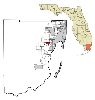
Olympia Heights is a census-designated place in Miami-Dade County, Florida, United States. The population was 12,873 at the 2020 census.

<span class="mw-page-title-main">Boca Del Mar, Florida</span> Unincorporated place in Florida, United States

Boca Del Mar was a census-designated place (CDP) in an unincorporated area near Boca Raton in Palm Beach County, Florida, United States. The population was 21,832 at the 2000 census. While it is not officially in the City of Boca Raton, the community is often classified under its umbrella term.

<span class="mw-page-title-main">Frenchtown-Rumbly, Maryland</span> CDP in Maryland, United States

Frenchtown-Rumbly is a census-designated place in Somerset County, Maryland, United States. The population was 96 at the 2000 census. It is included in the Salisbury, Maryland-Delaware Metropolitan Statistical Area.

<span class="mw-page-title-main">Black Eagle, Montana</span> CDP in Montana, United States

Black Eagle is a census-designated place (CDP) in Cascade County, Montana, United States. The population was 904 at the 2010 census. It is a suburb of Great Falls.

<span class="mw-page-title-main">Ulm, Montana</span> CDP in Montana, United States

Ulm is a census-designated place (CDP) in Cascade County, Montana, United States. It was originally a large ranch owned by Indiana-born cattleman William Ulm. The population was 738 at the 2010 census. It is part of the Great Falls, Montana Metropolitan Statistical Area.

<span class="mw-page-title-main">West Glendive, Montana</span> Census-designated place in Montana, United States

West Glendive is a census-designated place (CDP) in Dawson County, Montana, United States. The population was 1,998 at the 2020 census.

<span class="mw-page-title-main">Kirtland, New Mexico</span> Town in New Mexico, United States

Kirtland is a town, made up of part of the former census-designated place (CDP) of the same name in San Juan County, New Mexico, United States. The population of the former CDP was 6,190 at the 2000 census. It is part of the Farmington Metropolitan Statistical Area.

<span class="mw-page-title-main">Glide, Oregon</span> Census-designated place in Oregon, United States

Glide is a census-designated place (CDP) in Douglas County, Oregon, United States. The population was 1,795 at the 2010 census.

Seven Oaks is a census-designated place (CDP) in Lexington County, South Carolina, United States, 8 miles (13 km) northwest of downtown Columbia, the state capital. The population of the CDP was 15,144 at the 2010 census. It is part of the Columbia Metropolitan Statistical Area.

<span class="mw-page-title-main">Milam, Texas</span> CDP in Texas, United States

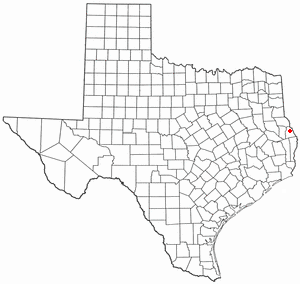
Milam is a census-designated place (CDP) in Sabine County, Texas, United States. It is located along the Sabine River at the junction of Highway 87 and Highway 21. The population was 1,355 at the 2020 census. Milam is the largest city in Sabine County.

<span class="mw-page-title-main">Maple Heights-Lake Desire, Washington</span> Census-designated place in Washington, United States

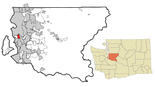
Maple Heights-Lake Desire is a census-designated place (CDP) in King County, Washington, United States. At the 2010 census, the population was 3,152.

<span class="mw-page-title-main">Riverton-Boulevard Park, Washington</span> Former CDP in Washington, United States

Riverton-Boulevard Park is a former census-designated place (CDP) in King County, Washington, United States. The population was 11,188 at the 2000 census. For the 2010 census, the CDP was separated into the Riverton and Boulevard Park CDPs, with part of the area now being in the city of Tukwila.

<span class="mw-page-title-main">Easton, Washington</span> Census-designated place in Washington, United States

Easton is an unincorporated community and census-designated place (CDP) in Kittitas County, Washington, United States. The population was 478 at the 2010 census.

<span class="mw-page-title-main">Otis Orchards-East Farms, Washington</span> CDP in Washington, United States

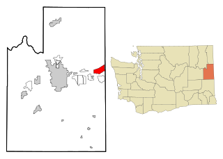
Otis Orchards-East Farms is a census-designated place (CDP) in Spokane County, Washington, United States, near the county's border with Idaho. The population was 6,299 at the 2020 census. The CDP includes the unincorporated communities of Otis Orchards and East Farms. Otis Orchards contains the bulk of the businesses of the community.

<span class="mw-page-title-main">Ranchettes, Wyoming</span> Census-designated place in Wyoming, United States

Ranchettes is a census-designated place (CDP) in Laramie County, Wyoming, United States. It is part of the Cheyenne, Wyoming Metropolitan Statistical Area. The population was 5,798 at the 2010 census.

<span class="mw-page-title-main">Elbow Lake, Becker County, Minnesota</span> Census-designated place in Minnesota, US

Elbow Lake is a census-designated place in Becker and Clearwater counties in Minnesota, United States. Its population was 95 at the 2010 census.

<span class="mw-page-title-main">Fox Lake, Montana</span> CDP in Montana, United States

Fox Lake is a census-designated place (CDP) in Richland County, Montana, United States. The population was 158 at the 2010 census.

<span class="mw-page-title-main">Fort Kent (CDP), Maine</span> Census-designated place in Maine, United States

Fort Kent is a census-designated place (CDP) that comprises the main village in the town of Fort Kent in Aroostook County, Maine. In 2010 Fort Kent's population was 2,488 of 4,097 for the entire town.

<span class="mw-page-title-main">Madawaska (CDP), Maine</span> Census-designated place in Maine, United States

Madawaska is a census-designated place (CDP) comprising the main village within the town of Madawaska in Aroostook County, Maine, United States. The population of the CDP was 2,967 at the 2010 census, out of a population of 4,035 for the entire town.

References

  1. 1 2 "2010 Census Redistricting Data (Public Law 94-171) Summary File". American FactFinder. United States Census Bureau . Retrieved 2 May 2011.[ dead link ]
  2. "Knife River Census Designated Place". Geographic Names Information System . United States Geological Survey, United States Department of the Interior.
  3. "US Gazetteer files: 2010, 2000, and 1990". United States Census Bureau. 2011-02-12. Retrieved 2011-04-23.
  4. "U.S. Census website". United States Census Bureau . Retrieved 2008-01-31.