Hassan is a city and district headquarter of Hassan district in Karnataka state of India.

Kaduru, also known as Kadur, is a town in the district and a taluk in Chikmagalur district, in Karnataka. It is located at 13.553345°N 76.011260°E in the rain shadow region of western ghats in the Malenadu region. Most of the taluk is dry, unlike much of the district. Kadur is known for areca nut and also coconut production.

Kushalanagar or Kushalanagara is a city located in the Kodagu district of the Indian state of Karnataka. Surrounded by Kaveri river, it is the gateway to Kodagu district. It also serves as the headquarters of Kushalanagar Taluk. By population, Kushalanagar is the second largest town in Kodagu district after Madikeri and the fastest developing town in the district. Kushalnagar is an important commercial centre in Kodagu.

Holenarasipura is a town and taluk in Hassan district of Karnataka. The town is situated on the banks of the Hemavati, one of the tributaries of the Kaveri.
Arkalgud, also known as Arakalagudu is a panchayat town and is one among the eight taluks of Hassan district in the state of Karnataka, India. It is situated 30 km from Hassan, 181 km from Mangalore and 195 km from Bangalore. The river Hemavati forms the entire northern boundary of the Taluk; river Kaveri runs through a portion of the south. It is well connected by road to many towns and cities of Karnataka. Hassan Junction railway station is the nearest major railway station and Kannur International Airport is the nearest airport at 150 kilometres.

Sakleshpur, also known as Sakleshpura or Sakleshapura, is a hill station town and headquarters of Sakleshpur taluk and one of the two Sub-divisional headquarters in Hassan district in the Indian state of Karnataka.

Channarayapatna is a town and Taluk headquarters in Hassan district of Karnataka, India. It lies on the Bangalore-Mangalore National Highway-75 in Karnataka, India. Jain pilgrimage Shravanabelagola is a famous site in the taluk. Channarayapatna has major railway connection from Bangalore to Mangalore, Karwar, and Mysore.
Adavad, also spelt Adawad or Adwad, is a village in the Chopda Tehsil of Jalgaon District, Maharashtra, India. It is situated at the southern base of the Satpura Hills, about 30 kilometres northwest of the district seat Jalgaon, and 13 kilometres east of the subdistrict seat Chopda. As of the year 2011, it has a total population of 24,357.
Nitte is a village in Karkala Taluk, Udupi District, Karnataka, India. It is located on the way from Padubidri to Karkala, about 26 kilometres southeast of the district capital Udupi, and 7 kilometres southwest of the taluka capital Karkala. In the year 2011, the village is home to 12,354 inhabitants.

Wandoor is a town in Nilambur Taluk, Malappuram District, Kerala, India. It is located on the southeast of Chaliyar River, about 24 kilometres northeast of the district seat Malappuram, and 8 km south of the taluk seat Nilambur. In the year 2011, the town has a population of 50,973.

Vazhikkadavu is a village in Nilambur taluk of Malappuram district, Kerala, India. As of 2011, it has total population of 47,322.
Thevalakkara is a village in the Karunagappally Taluk, Kollam District of the state of Kerala, India. It is located near the coast of the Indian Ocean, about 13 kilometres north of the district capital Kollam, and 7 kilometres southeast of the subdistrict capital Karunagappally. It contains a Devi temple along with a church and a mosque. The kadappa at Thevalakara is where ship masts (kadappa) were made for centuries. In 2011, it has a total population of 42,977.The name thevalakkara came from Devalokakkara which means the land of gods because the place had many worship places of different religions.
Chinchali is a village in Raybag Taluk, Belagavi District, Karnataka, India. It is located near the state boundary with Maharashtra, approximately 84 kilometres north of the district seat Belgaum, and 10 kilometres northeast of the taluk seat Raibag. In the year 2011, the village has a population of 18,986.
Mohare is a village in Bailhongal Taluk, Belagavi District of Karnataka, India. It is located near the state border with Maharashtra, about 26 kilometres east of the district seat Belgaum, and 16 kilometres northwest of the taluk seat Bailhongal. As of 2011, it has a total population of 2,365.
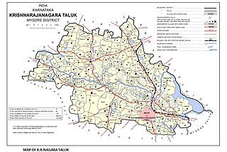
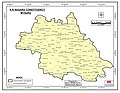
Saligrama is a new sub-district of Mysore district, situated on the northern bank of the river Cauvery [Kaveri]. This place is esteemed as sacred by the Shri Vaishnavas on account of its having been the residence of Sri Ramanujacharya. It is the headquarters of Saligrama Taluk. It was established as a new taluk carving out of K.R.Nagar taluk with effect from 31.12.2020 and become ninth taluk of Mysore district of Karnataka, India.
Pimpalgaon Baswant is a town in Niphad Taluk, Nashik District, Maharashtra, India. It is located to the north of Kadva River, about 28 kilometres northeast of the district capital Nashik, and 16 kilometres northwest of the taluk capital Niphad. In the year 2011, it is home to 41,559 inhabitants.
Sarti is a village in Dhar Kalan Tehsil, Pathankot District, Punjab, India. It is located 55 kilometres northeast of its district capital Pathankot, and 8 kilometres north of Dhar Kalan. As of the year 2011, its population is 3,960.
Badavanahalli is a village within Madhugiri Taluk, Tumakuru District, Karnataka, India. It is located at 37 kilometres north of the district seat Tumkur, and 16 kilometres west of the subdistrict seat Madhugiri. In the year 2011, it has a total population of 4,332.
Parham is a village in Jasrana Tehsil, Firozabad District, Uttar Pradesh, India. As of the year 2011, it has a population of 19,642.
Morai is a village in Ambattur Taluk, Tiruvallur District, Tamil Nadu, India. It is located in the western suburb of Chennai, about 23 kilometres away from the city center. As of 2011, it had a total population of 10,873.