Saligrama, Mysore

Last updated

Saligrama, Mysore
Town
Krishnarajanagara (Taluk) 2011.jpg
Krishnarajanagara Taluk boundary before creation of Saligrama Taluk
India Karnataka location map.svg
Red pog.svg
Location in Karnataka, India
India location map.svg
Red pog.svg
Saligrama, Mysore (India)
Asia laea location map.svg
Red pog.svg
Saligrama, Mysore (Asia)
World location map (equirectangular 180).svg
Red pog.svg
Saligrama, Mysore (Earth)
Coordinates: 12°33′42″N76°15′48″E / 12.561715°N 76.263292°E / 12.561715; 76.263292
Country Flag of India.svg  India
State Karnataka
District Mysuru
Saligramam1096 CE
Founded by Sri Ramanujacharya
Government
  BodyTown Panchayath
Area
  Total14.69 km2 (5.67 sq mi)
Elevation
788 m (2,585 ft)
Population
 (2011 [1] )
  Total15,123 [2]
Languages
  Official Kannada
Time zone UTC+5:30 (IST)
PIN
571 604
Telephone code+91-8223 [08223]
ISO 3166 code IN-KA
Vehicle registration KA-45
Website saligramatown.mrc.gov.in
Saligrama, Mysore
Krishnarajanagara Taluk boundary same as Assembly Constituency as per 2011 Census before creation of Saligrama Taluk Krishnarajanagara (Taluk) Vidhana Sabha Constituency.jpg
Krishnarajanagara Taluk boundary same as Assembly Constituency as per 2011 Census before creation of Saligrama Taluk

Saligrama is a new sub-district of Mysore district, situated on the northern bank of the river Cauvery [Kaveri]. This place is esteemed as sacred by the Shri Vaishnavas on account of its having been the residence of Sri Ramanujacharya. It is the headquarters of Saligrama Taluk. It was established as a new taluk carving out of K.R.Nagar taluk with effect from 31.12.2020 and become ninth taluk of Mysore district of Karnataka, India.

Contents

A number of religious sites, famous old temples - including Sri Yoga Narasimha Swamy Temple, Sri Ramanuja Sripada Teertham, Sri Jyothirmaheswara Swamy Temple, Jain Basadis, and an Ashram are located in the town.

History

Swamy Ramanuja arrived in Karnataka where the local tribals received him in this place. The local people who were averse to Swamy Ramanuja conspired a plan to do away with him. Swamy Ramanuja learning their evil intentions ordered Mudaliandan Swamy to place his feet in the drinking water pond in that area now called Saligrama. At Saligrama, by partaking this Sripada theertham, the minds of the evildoers changed and they fell at Swamy Ramanuja lotus feet seeking forgiveness. Such was the greatness of our Mudaliandan Swamy.

When persecuted by the Chola king Kulottunga, Ramanujacharya is said to have fled the Chola country and first stayed at Vahnipushkarini (the place now known as 'Mirle') from where he moved on to Saligrama.

Etymology

Swamy Ramanuja named this place as "Saligramam" which is near Melkote. Even today this pond is maintained by the archakas who ensures that no intruder pollutes the pond by locking the gate. There is a small temple opposite to this pond in which Swamy Ramanuja's Thiruvadi chuvadugal are worshipped. There is also a deity of Swamy Ramanuja in Sesharoopa near the garbagriha.

Demographics

Population

According to census data released in 2011 by the Government of Karnataka, total area of Saligrama is spread across 1109.5 hectares with a total population of 11836 persons [Male - 5869 and Female - 5967] and 2976 households with an average of 4 persons per household.

Gender Wise Population

  Female (50.413%)
  Male (49.586%)

Literacy

As per the report the total literacy rate is 71.93% [with Male - 77.33% and Female - 66.59%]. Comparing it with the previous census data, the total literacy rate has increased by 6% with 4% increase in the male and 7% increase in the female literacy rate.

Growth in population

Presently, there is a 0.5% increase in the total population of the village as it was about 12000 before 10 years. The rate of growth in female population has gone up by 2.9% and male population has decreased by -1.9%. So, the rate of population growth in female is 4.8% higher compared to their counterpart.

Sex ratio

According to the recent census, there are 1017 females per 1000 males. The overall sex ratio has gone up by 47 females per 1000 males during the period of 10 years. The Child sex ratio here has also increased by 170 girls per 1000 boys at the same duration. For the age group of below 6 years, there are 1060 girls per 1000 boys.

Work profile

Out of total population, 41% are engaged either in main work or in marginal works - 62% male [55% full time and 7% part time] and 20% female [14% are full time and 7% are marginal] are working.

Land usage

Different types of land usage
Types of land useArea (in hectares)
Current Fallows8.2
Net Area Sown890.9
Total Irrigated Land Area541.5
Total Un-irrigated Land Area349.4
Canals510
Wells/Tube-wells31.5

Education

There is a public library.

Higher Primary school

Government First grade college

Temples

 Digambar Jain basadi
 basadi)

Postal and Courier Services

A public Post-office is situated and there are many private courier services available here, also, e-market product delivery services are rendered on a daily basis.

Transportation

SH-85, SH-108 and SH-120 passes through Saligrama town and frequent bus facility is available to Mysore. A public bus stand along with the private facilities such as - buses, taxies, auto-rickshaws, which makes transportation connectivity easier. There is no railway connectivity to Saligrama. The nearest Railway station is Krishnarajanagara [24 kms]. Saligrama is located equidistant from Mysuru Junction railway station and Hassan Junction railway station (approx.60 kms). Nearest major airports are Kannur International Airport, Kerala and Kempegowda International Airport, located at 150 kms and 210 kms, respectively.

Healthcare

A government hospital and many private clinics are situated. Also, there are 7 Medicine shops.

Law & Order

There is a Police-Station located to maintain the law and order, it also covers the small neighboring villages.

Notable people

See also

Related Research Articles

<span class="mw-page-title-main">Bangalore Urban district</span> District of Karnataka in India

Bangalore Urban district is the most densely populated of the thirty-one districts that comprise the Indian state of Karnataka. It is surrounded by the Bangalore Rural district on the east and north, the Ramanagara district on the west and the Krishnagiri district of Tamil Nadu on the south. Bangalore Urban district came into being in 1986, with the partition of the erstwhile Bangalore district into Bangalore Urban and Bangalore Rural districts. Bangalore Urban has three taluks : Bangalore City, Yelahanka and Anekal. It has seventeen hoblies, 872 villages, eleven rural habitations, five towns, one tier-three city and one tier-one city, administered by ninety-six Village Panchayats , ninety-seven Taluk Panchayats , five Town Municipal Councils (Purasabes), one City Municipal Council (Nagarasabe) and one City Corporation .

<span class="mw-page-title-main">Bantwal</span> Suburb in Dakshina Kannada, Karnataka, India

Bantwal is a suburb of Mangalore in Dakshina Kannada district, Karnataka, India, and the headquarters of Bantwal taluk. It is located 25 km (16 mi) East of Mangalore city center. BC Road-Kaikamba of Bantwal is one of the fastest developing areas in Dakshina Kannada district of Karnataka.

<span class="mw-page-title-main">Arsikere</span> City in Karnataka, India

Arsikere is a city and taluka in the Hassan district in the state of Karnataka, India. It is the second largest city in Hassan district, demographically. Arsikere city municipal council consists of 35 wards. This region is known for its coconut production and is also called Kalpataru Nadu. Arsikere Junction is a major railway junction in the South Western Railway which links Mangalore and Mysore to North Karnataka and a central place for tourists who visit nearby places that do not have rail access, such as Belur, Halebidu and Shravanabelagola, Harnahalli, and Kodimata.

<span class="mw-page-title-main">Hassan district</span> District of Karnataka in India

Hassan is one of the 31 districts of Karnataka, India. The district headquarter is Hassan. It was carved out from Mysore district in the year 1866, during the Commissioner's Rule of Mysore (1831-81).

Mulabagilu is a town and administrative center of Mulabagilu taluk, in the Kolar district in the state of Karnataka, India. The town is situated on the National Highway 75 and is the easternmost town of the state.

<span class="mw-page-title-main">Chunchanakatte Falls</span>

Chunchanakatte Falls is a waterfall on the Kaveri River, near the village of Chunchanakatte in saligrama taluk of Mysore district, Karnataka, India. Water cascades from a height of about 20 meters. It is in the Western Ghats. Here the river falls in two small cascades before joining again to flow as one.

<span class="mw-page-title-main">Dharwad district</span> District of Karnataka in India

Dharwad or Dharawada is an administrative district of the state of Karnataka in southern India. The administrative headquarters of the district is the city of Dharwad, also known as Dharwar. Dharwad is located 425 km northwest of Bangalore and 421 km southeast of Pune, on the main highway between Chennai and Pune, the National Highway 4 (NH4).

<span class="mw-page-title-main">Holenarasipura</span> Town in Karnataka, India

Holenarasipura is a town and taluk in Hassan district of Karnataka. The town is situated on the banks of the Hemavati, one of the tributaries of the Kaveri.

<span class="mw-page-title-main">Melukote</span> Village in Karnataka, India

Melukote in Pandavapura taluk of Mandya district, Karnataka, in southern India, is one of the sacred places in Karnataka.It is built on rocky hills, known as Yadugiri, Yaadavagiri or Yadushaila, overlooking the Cauvery valley. Melukote is about 51 km from Mysore and 133 km (83 mi) from Bangalore.

<span class="mw-page-title-main">Heggadadevanakote</span> Town in Karnataka, India

Heggadadevanakote or H.D.Kote is a town and a taluk headquarters in Mysore district in the Indian state of Karnataka. Kakana kote forest lies in Heggadadevana kote taluk. H.D Kote city is divided into 13 wards for which elections are held every 5 years.

<span class="mw-page-title-main">Hindupur</span> City in Andhra Pradesh, India

Hindupuram is a city in Sri Sathya Sai district of the Indian state of Andhra Pradesh. It is located to the edge of the Andhra–Karnataka border and is the headquarters of Hindupuram mandalam. Hindupuram is the biggest Parliamentary Constituency in the newly formed District Sri Sathya Sai. It is located about 67 km from district headquarters Puttaparthi, 100 km from Bengaluru the capital of Karnataka, 95 km From Kadiri.

Tarikere is a taluk in the Chikkamagaluru district in the state of Karnataka of India. The headquarters of the taluk is a town of the same name. It is popularly known as gateway of Malnad because the Malnad area starts from here. The town's name is derived from the number of water tanks which surround it.

<span class="mw-page-title-main">Turuvekere</span> Town in Karnataka, India

Turuvekere is a panchayat town and Taluk in Tumakuru district in the Indian state of Karnataka.

<span class="mw-page-title-main">Tourism in Karnataka</span> Overview of tourism in Karnataka, India

Karnataka, the sixth largest state in India, has been ranked as the third most popular state in the country for tourism in 2014. It is home to 507 of the 3600 centrally protected monuments in India, second only to Uttar Pradesh. The State Directorate of Archaeology and Museums protects an additional 752 monuments and another 25,000 monuments are yet to receive protection.

<span class="mw-page-title-main">Krishnarajanagara</span> Town in Karnataka, India

Krishnarajanagara is a town in Mysore district in the Indian state of Karnataka. It is also the administrative center of Krishnarajanagara Taluk.

<span class="mw-page-title-main">Jainism in Karnataka</span> Religion of Jainism in the Indian state of Karnataka

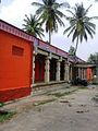
Karnataka, a state in South India has a long association with Jainism, a religion which enjoyed patronage of major historic kingdoms in the state such as the Rastrakuta Dynasty, Western Ganga, Kadamba and Chalukya dynasties and the Hoysala Empire. Today the state is home to a number of Jain monuments, such as temples, Gommata statues and stambhas.

<span class="mw-page-title-main">Sathyagala</span> Village in Karnataka, India

Sathegala is a village in the southern state of Karnataka, India. It is located in the Kollegal taluk of Chamarajanagar district.

<span class="mw-page-title-main">Karkala</span> Town in Karnataka, India

Karkala, also known as Karla in Tulu language, is a town and the headquarters of Karkala taluk in the Udupi district of Karnataka, India. Located about 60 km from Mangalore in the Tulu Nadu region of the state, it lies near the foothills of the Western Ghats. Karkala has a number of natural and historical landmarks, and is a major tourist and transit destination due to its strategic location along the way to Hebri, Sringeri, Kalasa, Horanadu, Udupi, Kollur, Subrahmanya and Dharmasthala.

Mirle is a village in the southern state of Karnataka, India. It is located in the Saligrama taluk of Mysore district.

<span class="mw-page-title-main">Vontikoppal</span> Place in Karnataka, India

Vontikoppal or Vani Vilas Mohalla is one of the busiest suburbs of Mysore city.

References

  1. "Census Data Handbook 2011" (PDF). Retrieved 1 September 2023.
  2. "Town Panchayath Saligrama" . Retrieved 1 September 2023.