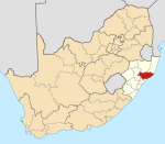
KwaZulu-Natal is a province of South Africa that was created in 1994 when the government merged the Zulu bantustan of KwaZulu and Natal Province.
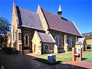
Pietermaritzburg is the capital and second-largest city in the province of KwaZulu-Natal, South Africa after Durban. It was named in 1838 and is currently governed by the Msunduzi Local Municipality. The town was named in Zulu after King Dingane's royal homestead uMgungundlovu. Pietermaritzburg is popularly called Maritzburg in Afrikaans and is often informally abbreviated to PMB. It is a regionally important industrial hub, producing aluminium, timber and dairy products, as well as the main economic hub of uMgungundlovu District Municipality. The public sector is a major employer in the city due to local, district and provincial government offices located here.

Empangeni is a town in KwaZulu-Natal, South Africa. It is approximately 157 kilometres north of Durban, in hilly countryside, overlooking a flat coastal plain and the major harbour town of Richards Bay 16 kilometres away. The N2 freeway runs east from Empangeni intersecting John Ross Highway (R34) which connects Empangeni and Richards Bay.
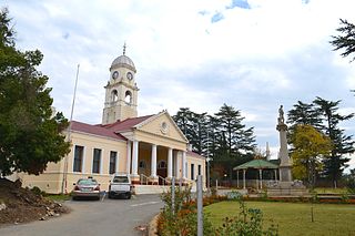
Kokstad is a town in the Harry Gwala District Municipality of KwaZulu-Natal Province, South Africa. Kokstad is named after the Griqua chief Adam Kok III who settled here in 1863. Kokstad is the capital town of the East Griqualand region, as it is also the biggest town in this region. It was built around Mount Currie, a local mountain range, by the city's founder Adam Kok III, for whom the town is named. Stad is the Dutch and Afrikaans word for "city".
KwaDukuza, previously known as Stanger, is a town in KwaZulu-Natal, South Africa. In 2006, the municipal name was changed to KwaDukuza, but the Zulu people in the area called it "Dukuza" well before then.

Margate is a coastal resort town in the KwaZulu-Natal province, about 20 kilometres south-west of Port Shepstone and 127 kilometres south-west of Durban. The river which flows into the sea at Margate is called "Nkhongweni" (place of entreaty) as the original inhabitants of the area were reputed to be so mean resulting in travellers begging for hospitality.

Port Shepstone is a large town situated on the mouth of the Mzimkhulu River, the largest river on the KwaZulu-Natal South Coast of South Africa. It is located halfway between Hibberdene and Margate and is positioned 120 km south of Durban. It serves as the administrative, educational, industrial and commercial centre for southern Natal.
Umzinto is a town, located in the South Coast of KwaZulu-Natal, South Africa, approximately 67 kilometres (42 mi) south-west of Durban. It was a sugarcane growing area and the town was set up as the centre for a sugar mill.
Hilton is a small town that lies between Howick and Pietemaritzburg in the province of KwaZulu-Natal, South Africa. In 1872 the Reverend William Orde Newnham opened Hilton College on a large estate 7.8km north of the town, which is now one of South Africa's leading private schools.
Inanda or eNanda is a township in KwaZulu-Natal, South Africa that is situated 21 km north-west of Durban. It forms part of eThekwini, the Greater Durban Metropolitan Municipality. Populated primarily by Zulu-speaking Black Africans, Inanda is the home of John Langalibalele Dube, first President of the African National Congress (ANC), a former residence and base of operations of Mahatma Gandhi, and the birthplace of the syncretic Nazareth Baptist Church

Verulam is a town 24 kilometres north of Durban in KwaZulu-Natal, South Africa and forms part of the eThekwini Metropolitan Municipality, governing the Greater Durban metropolitan area.

Umlazi is a township in KwaZulu-Natal, South Africa, located south-west of Durban. Organisationally and administratively it forms part of the eThekwini Metropolitan Municipality and its South Municipal Planning Region.

AFL South Africa is the governing body and federation for Australian rules football in South Africa. Its name is due to its formal affiliation in 2004 to the AFL Commission the game's world governing body.

KwaMashu is a township 12 kilometres (7.5 mi) north of Durban, South Africa. The name honours Sir Marshall Campbell and means Place of Marshall. KwaMashu is bordered by Newlands East to the south, Newlands West to the west, Ntuzuma to the north, Phoenix to the north-east, Mount Edgecombe to the east and Durban North to the south-east.
Phindiwe Dlamini-Sangweni is a South African attorney and businesswoman. She is currently a member of the African National Congress and is Chairwoman of Purple Tree Holdings, a private company. Dlamini-Sangweni is a Principal Princess of the Nhlangwini royal family, Princess of the Zulu Royal Family and is a cousin of Mswati III, King of Swaziland. She has assets estimated at US$30 million from various investments and shareholdings on the New York Stock Exchange and Johannesburg Stock Exchange.

Mtwalume, also known as Umtalumi, is a settlement in Ugu District Municipality in the KwaZulu-Natal province of South Africa.
Impendle is a town in Umgungundlovu District Municipality in the KwaZulu-Natal province of South Africa.
Nquthu is a town in Umzinyathi District Municipality in the KwaZulu-Natal province of South Africa.
Thamsanqa Sangweni is a South African football (soccer) midfielder who last played for TS Sporting.

Amandawe also known as Amandawe Mission, or often informally abbreviated as A.M.A or A.M is a small township in the KwaZulu-Natal South Coast region of South Africa. The area is mostly populated with Black Africans.