La Paloma, Texas

Last updated

La Paloma, Texas
TXMap-doton-LaPaloma.PNG
Location of La Paloma, Texas
Cameron County LaPaloma.svg
Coordinates: 26°2′55″N97°40′1″W / 26.04861°N 97.66694°W / 26.04861; -97.66694
Country United States
State Texas
County Cameron
Area
  Total2.2 sq mi (5.6 km2)
  Land2.2 sq mi (5.6 km2)
  Water0.0 sq mi (0.0 km2)
Elevation
49 ft (15 m)
Population
 (2020)
  Total3,218
  Density1,500/sq mi (570/km2)
Time zone UTC-6 (Central (CST))
  Summer (DST) UTC-5 (CDT)
ZIP code
78586
Area code 956
FIPS code 48-41416 [1]
GNIS feature ID1374420 [2]

La Paloma is a census-designated place (CDP) in Cameron County, Texas, United States. The population was 2,903 at the 2010 census, [3] up from 354 at the 2000 census, when it was drawn to cover a much smaller area. By the 2020 census, the population further increased to 3,218. It is part of the Brownsville Harlingen Metropolitan Statistical Area. La Paloma means "the dove" in Spanish.

Contents

Geography

La Paloma is located in southwestern Cameron County at 26°2′55″N97°40′1″W / 26.04861°N 97.66694°W / 26.04861; -97.66694 (26.048605, -97.667017). [4] It is on the north side of U.S. Route 281, 16 miles (26 km) northwest of the center of Brownsville and 5 miles (8 km) east of Los Indios. It is less than one mile north of the Rio Grande, the Mexico–United States border.

According to the United States Census Bureau, the La Paloma CDP has a total area of 2.2 square miles (5.6 km2), all land. [3]

Demographics

Historical population
CensusPop.Note
2000 354
2010 2,903720.1%
2020 3,21810.9%
US Decennial Census [4]
2020 Census [5]

As of the census [1] of 2010, there were 2,903 people, 93 households, and 83 families residing in the CDP. The population density was 1,371.4 inhabitants per square mile (529.5/km2). There were 108 housing units at an average density of 418.4 per square mile (161.5/km2). The racial makeup of the CDP was 38.14% White, 55.65% from other races, and 6.21% from two or more races. Hispanic or Latino of any race were 92.09% of the population.

There were 93 households, out of which 48.4% had children under the age of 18 living with them, 71.0% were married couples living together, 10.8% had a female householder with no husband present, and 9.7% were non-families. 7.5% of all households were made up of individuals, and 4.3% had someone living alone who was 65 years of age or older. The average household size was 3.81 and the average family size was 4.01.

In the CDP, the population was spread out, with 35.0% under the age of 18, 12.7% from 18 to 24, 26.6% from 25 to 44, 16.7% from 45 to 64, and 9.0% who were 65 years of age or older. The median age was 26 years. For every 100 females, there were 102.3 males. For every 100 females age 18 and over, there were 93.3 males.

The median income for a household in the CDP was $12,162, and the median income for a family was $12,162. Males had a median income of $11,912 versus $0 for females. The per capita income for the CDP was $5,354. About 54.8% of families and 65.2% of the population were below the poverty line, including 91.2% of those under age 18 and none of those age 65 or over.

Education

La Paloma is served by the San Benito Consolidated Independent School District.

In addition, South Texas Independent School District operates magnet schools that serve the community.

La Paloma is mentioned in the Hank Snow adaptation of the Geoff Mack song "I've Been Everywhere", which was later covered by more than 130 artists, including Johnny Cash.

Related Research Articles

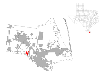
Arroyo Alto is a neighborhood of the city of La Feria in Cameron County, in the U.S. state of Texas. Annexed by the city in 2004, Arroyo Alto was a census-designated place (CDP) at the 2000 census, at which time it had a population of 320. It is part of the Brownsville–Harlingen Metropolitan Statistical Area.

<span class="mw-page-title-main">Arroyo Colorado Estates, Texas</span> CDP in Texas, United States

Arroyo Colorado Estates is a census-designated place (CDP) in Cameron County, in the U.S. state of Texas. The population was 997 at the 2010 census. It is part of the Brownsville–Harlingen Metropolitan Statistical Area.

<span class="mw-page-title-main">Arroyo Gardens-La Tina Ranch, Texas</span> Former census-designated place in Texas, United States

Arroyo Gardens-La Tina Ranch was a census-designated place (CDP) in Cameron County, Texas, United States. The population was 732 at the 2000 census. For the 2010 census it was split into the Arroyo Gardens and La Tina Ranch CDPs. The communities are part of the Brownsville–Harlingen Metropolitan Statistical Area.

<span class="mw-page-title-main">Bixby, Texas</span> CDP in Texas, United States

Bixby is a census-designated place (CDP) in Cameron County, Texas, United States. The population was 352 at the 2020 census. It is part of the Brownsville–Harlingen Metropolitan Statistical Area.

<span class="mw-page-title-main">Bluetown-Iglesia Antigua, Texas</span> Former CDP in Texas, United States

Bluetown-Iglesia Antigua was a census-designated place (CDP) in Cameron County, Texas, United States. The population was 692 at the 2000 census. For the 2010 census the area was split into two CDPs, Bluetown and Iglesia Antigua. The communities are part of the Brownsville–Harlingen Metropolitan Statistical Area.

<span class="mw-page-title-main">Cameron Park, Texas</span> CDP in Texas, United States

Cameron Park is a census-designated place (CDP) in Cameron County, Texas, United States. The population was 6,099 at the 2020 census. It is part of the Brownsville–Harlingen Metropolitan Statistical Area.

<span class="mw-page-title-main">Encantada-Ranchito-El Calaboz, Texas</span> Census-designated place in Texas, United States

Encantada-Ranchito-El Calaboz, also known as El Calaboz Rancheria in the San Pedro de Carricitos Land Grant, is a census-designated place (CDP) in Cameron County, Texas, United States. The population was 1,981 at the 2020 census. It is part of the Brownsville–Harlingen Metropolitan Statistical Area.

<span class="mw-page-title-main">Grand Acres, Texas</span> Census-designated place in Texas, United States

Grand Acres is a census-designated place (CDP) in Cameron County, Texas, United States. The population was 49 at the 2010 census. It is part of the Brownsville–Harlingen Metropolitan Statistical Area.

<span class="mw-page-title-main">Green Valley Farms, Texas</span> Census-designated place in Texas, United States

Green Valley Farms is a census-designated place (CDP) in Cameron County, Texas, United States. The population was 655 at the 2020 census, down from 1,272 at the 2010 census. It is part of the Brownsville–Harlingen Metropolitan Statistical Area.

<span class="mw-page-title-main">La Feria North, Texas</span> Census-designated place in Texas, United States

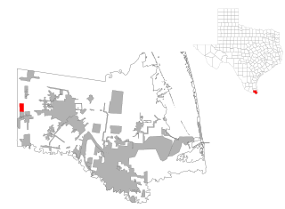
La Feria North is a census-designated place (CDP) in Cameron County, Texas, United States. The population was 225 at the 2020 census. It is part of the Brownsville–Harlingen Metropolitan Statistical Area.

<span class="mw-page-title-main">Ratamosa, Texas</span> Census-designated place in Texas, United States

Ratamosa is a census-designated place (CDP) in Cameron County, Texas, United States. The population was 197 at the 2020 census. It is part of the Brownsville–Harlingen Metropolitan Statistical Area.

<span class="mw-page-title-main">Reid Hope King, Texas</span> Census-designated place in Texas, United States

Reid Hope King is a census-designated place (CDP) in Cameron County, Texas, United States. The population was 667 at the 2020 census. It is part of the Brownsville–Harlingen Metropolitan Statistical Area.

<span class="mw-page-title-main">San Pedro, Texas</span> Census-designated place in Texas, United States

San Pedro is a census-designated place (CDP) in Cameron County, Texas, United States. The population was 442 at the 2020 census. It is part of the Brownsville–Harlingen Metropolitan Statistical Area.

<span class="mw-page-title-main">Santa Maria, Texas</span> Census-designated place in Texas, United States

Santa Maria is a census-designated place (CDP) in Cameron County, Texas, United States. The population was 651 at the 2020 census. It is part of the Brownsville–Harlingen Metropolitan Statistical Area.

<span class="mw-page-title-main">Solis, Texas</span> Census-designated place in Texas, United States

Solis is a census-designated place (CDP) in Cameron County, Texas, United States. The population was 722 at the 2020 census. It is part of the Brownsville–Harlingen Metropolitan Statistical Area.

<span class="mw-page-title-main">Tierra Bonita, Texas</span> Census-designated place in Texas, United States

Tierra Bonita is a census-designated place (CDP) in Cameron County, Texas, United States. The population was 179 at the 2020 census. It is part of the Brownsville–Harlingen Metropolitan Statistical Area.

<span class="mw-page-title-main">Villa del Sol, Texas</span> Census-designated place in Texas, United States

Villa del Sol is a census-designated place (CDP) in Cameron County, Texas, United States. The population was 153 at the 2020 census. It is part of the Brownsville–Harlingen Metropolitan Statistical Area.

<span class="mw-page-title-main">Villa Pancho, Texas</span> Census-designated place in Texas, United States

Villa Pancho is a census-designated place (CDP) in Cameron County, Texas, United States. The population was 467 at the 2020 census, up from 788 at the 2010 census. It is part of the Brownsville–Harlingen Metropolitan Statistical Area.

<span class="mw-page-title-main">La Paloma-Lost Creek, Texas</span> CDP in Texas, United States

La Paloma-Lost Creek is a census-designated place (CDP) in Nueces County, Texas, United States. The population was 1,359 at the 2020 census, significantly up from 408 at the 2010 census.

<span class="mw-page-title-main">Del Sol-Loma Linda, Texas</span> Former CDP in Texas, United States

Del Sol-Loma Linda is a census-designated place (CDP) in San Patricio County, Texas, United States. The population was 726 at the 2000 U.S. Census.

References

  1. 1 2 "U.S. Census website". United States Census Bureau . Retrieved January 31, 2008.
  2. "US Board on Geographic Names". United States Geological Survey. October 25, 2007. Retrieved January 31, 2008.
  3. 1 2 "Geographic Identifiers: 2010 Census Summary File 1 (G001): Las Palmas CDP, Texas". U.S. Census Bureau, American Factfinder. Archived from the original on February 13, 2020. Retrieved July 20, 2015.
  4. 1 2 "US Gazetteer files: 2010, 2000, and 1990". United States Census Bureau. February 12, 2011. Retrieved April 23, 2011.
  5. "Census Bureau profile: La Paloma, Texas". United States Census Bureau. May 2023. Retrieved May 17, 2024.