
The Island of Montreal is a large island in southwestern Quebec, Canada, that is the site of a number of municipalities, including most of the city of Montreal, and is the most populous island in Canada. It is the main island of the Hochelaga Archipelago at the confluence of the Saint Lawrence and Ottawa rivers.

Pierre Gaultier de Varennes, sieur de La Vérendrye was a French Canadian military officer, fur trader, and explorer. In the 1730s, he and his four sons explored the area west of Lake Superior and established trading posts there. They were part of a process that added Western Canada to the original New France territory that was centred along the Saint Lawrence basin.

The Saskatchewan River is a major river in Canada. It stretches about 550 kilometres (340 mi) from where it is formed by the joining of the North Saskatchewan River and South Saskatchewan River just east of Prince Albert, Saskatchewan, to Lake Winnipeg. It flows roughly eastward across Saskatchewan and Manitoba to empty into Lake Winnipeg. Through its tributaries the North Saskatchewan and South Saskatchewan, its watershed encompasses much of the prairie regions of Canada, stretching westward to the Rocky Mountains in Alberta and north-western Montana in the United States.
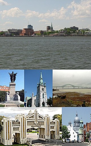
Trois-Rivières is a city in the Mauricie administrative region of Quebec, Canada, at the confluence of the Saint-Maurice and Saint Lawrence rivers, on the north shore of the Saint Lawrence River across from the city of Bécancour. It is part of the densely populated Quebec City–Windsor Corridor and is approximately halfway between Montreal and Quebec City. Trois-Rivières is the economic and cultural hub of the Mauricie region. The settlement was founded by French colonists on July 4, 1634, as the second permanent settlement in New France, after Quebec City in 1608.
The Rivière des Prairies, called the Back River in English, is a delta channel of the Ottawa River in southwestern Quebec, Canada. The Kanien'kehá:ka called it Skowanoti, meaning "River behind the island". The river separates the cities of Laval and Montreal.

The Assiniboine River is a 1,070-kilometre (660 mi) river that runs through the prairies of Western Canada in Saskatchewan and Manitoba. It is a tributary of the Red River. The Assiniboine is a typical meandering river with a single main channel embanked within a flat, shallow valley in some places and a steep valley in others. Its main tributaries are the Qu'Appelle, Souris, and Whitesand Rivers. For early history and exploration see Assiniboine River fur trade.
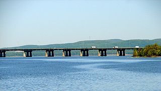
Autoroute 25 is an Autoroute in the Lanaudière region of Quebec. It is currently 49 km (30.4 mi) long and services the direct north of Montreal's Metropolitan Area. A-25 has one toll bridge, which is the first modern toll in the Montreal area and one of two overall in Quebec.
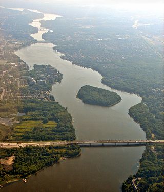
Lake of Two Mountains is part of the river delta widening of the Ottawa River in Quebec, Canada, at its confluence with the St. Lawrence River.
Rivière-des-Prairies–Pointe-aux-Trembles is a suburban borough (arrondissement) on the eastern tip of the city of Montreal, Quebec, Canada. It is located at the eastern end of the Island of Montreal.

St. Norbert is a bilingual neighbourhood and the southernmost suburb of Winnipeg, Manitoba, Canada. While outside the Perimeter Highway, it is still part of the city. As of the 2016 Census, the population of St. Norbert is 5,850.

The Assomption River is the most important waterway in the Lanaudière region of Quebec, Canada. It is over 200 kilometres (120 mi) long, and has a drainage basin (watershed) of 4,220 square kilometres (1,630 sq mi). Its source is the Mont Tremblant massif. Seven significant rivers flow into the Assomption before it flows into the Rivière des Prairies at Repentigny, Quebec.
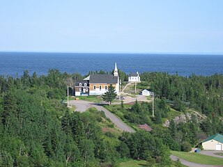
Rivière-Pentecôte is a village on the north shore of the Gulf of Saint Lawrence, part of the township of Port-Cartier.
The Vérendrye brothers were trappers, hunters, and explorers, who were possibly the first Europeans to cross the northern Great Plains and see the Rocky Mountains, during an expedition in 1742–1743. What little is known about their journey comes from a journal found in the French archives in 1851 and an inscribed lead plate commemorating the journey which was found buried near Pierre, South Dakota in 1913. Both the journal and plate are difficult to interpret. The journal states the trip may have been made by the "Chevalier Vérendrye and one of his brothers", who are otherwise unidentified. Most likely the Chevalier was Louis-Joseph Gaultier de La Vérendrye and the brother was François de La Vérendrye, but this remains uncertain. The mountains they saw during the expedition may have been the Big Horn Mountains of Wyoming, but could also have been the Black Hills or the Laramie Mountains.

The Saint-Augustin River is a salmon river in the Côte-Nord region of Quebec, Canada. It empties into the Gulf of Saint Lawrence.
This is a list of 78 federal electoral districts in the province of Quebec. New boundaries will be in effect for federal general elections called after April 22, 2024

