This is an incomplete list of rivers of Manitoba , a province of Canada.

This is an incomplete list of rivers of Manitoba , a province of Canada.
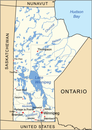
The entire province of Manitoba is within the Hudson Bay drainage basin:

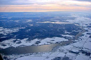
Lake Winnipeg is an extremely large, relatively shallow 24,514-square-kilometre (9,465 sq mi) lake in North America, in the province of Manitoba, Canada. Its southern end is about 55 kilometres (34 mi) north of the city of Winnipeg. Lake Winnipeg is Canada's sixth-largest freshwater lake and the third-largest freshwater lake contained entirely within Canada, but it is relatively shallow excluding a narrow 36 m (118 ft) deep channel between the northern and southern basins. It is the eleventh-largest freshwater lake on Earth. The lake's east side has pristine boreal forests and rivers that were in 2018 inscribed as Pimachiowin Aki, a UNESCO World Heritage Site. The lake is 416 km (258 mi) from north to south, with remote sandy beaches, large limestone cliffs, and many bat caves in some areas. Manitoba Hydro uses the lake as one of the largest reservoirs in the world. There are many islands, most of them undeveloped.

Lake Winnipegosis is a large (5,370 km2) lake in central North America, in Manitoba, Canada, some 300 km northwest of Winnipeg. It is Canada's eleventh-largest lake. An alternate spelling, once common but now rare, is Lake Winipigoos or simply 'Lake Winipigis'.

The Nelson River is a river of north-central North America, in the Canadian province of Manitoba. The river drains Lake Winnipeg and runs 644 kilometres (400 mi) before it ends in Hudson Bay. Its full length is 2,575 kilometres (1,600 mi), it has mean discharge of 2,370 cubic metres per second (84,000 cu ft/s), and has a drainage basin of 1,072,300 square kilometres (414,000 sq mi), of which 180,000 square kilometres (69,000 sq mi) is in the United States.

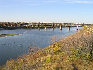
The Saskatchewan River is a major river in Canada. It stretches about 550 kilometres (340 mi) from where it is formed by the joining together of the North Saskatchewan River and South Saskatchewan River just east of Prince Albert, Saskatchewan, to Lake Winnipeg. It flows roughly eastward across Saskatchewan and Manitoba to empty into Lake Winnipeg. Through its tributaries the North Saskatchewan and South Saskatchewan, its watershed encompasses much of the prairie regions of Canada, stretching westward to the Rocky Mountains in Alberta and north-western Montana in the United States.

The Assiniboine River is a 1,070-kilometre (660 mi) river that runs through the prairies of Western Canada in Saskatchewan and Manitoba. It is a tributary of the Red River. The Assiniboine is a typical meandering river with a single main channel embanked within a flat, shallow valley in some places and a steep valley in others. Its main tributaries are the Qu'Appelle, Souris, and Whitesand Rivers. For early history and exploration see Assiniboine River fur trade.

The Souris River or Mouse River is a river in central North America. Approximately 435 miles (700 km) in length, it drains about 23,600 square miles (61,100 km2) in Canada and the United States.

The Winnipeg River is a Canadian river that flows roughly northwest from Lake of the Woods in the province of Ontario to Lake Winnipeg in Manitoba. This river is 235 kilometres (146 mi) long from the Norman Dam in Kenora to its mouth at Lake Winnipeg. Its watershed is 106,500 square kilometres (41,100 sq mi) in area, mainly in Canada. About 29,000 square kilometres (11,000 sq mi) of the watershed is in northern Minnesota, United States.

The Nelson River Hydroelectric Project refers to the construction of a series of dams and hydroelectric power plants on the Nelson River in Northern Manitoba, Canada. The project began to take shape in the late 1950s, with the planning and construction of the Kelsey dam and hydroelectric power station, and later was expanded to include the diversion of the upper Churchill River into the Nelson River and the transformation of Lake Winnipeg, the world's 11th largest freshwater lake, into a hydroelectric reservoir. The project is owned and operated by Manitoba Hydro, the electrical utility in the province.

The geography of Manitoba addresses the easternmost of the three prairie Canadian provinces, located in the longitudinal centre of Canada. Manitoba borders on Saskatchewan to the west, Ontario to the east, Nunavut to the north, and the American states of North Dakota and Minnesota to the south. Although the border with Saskatchewan appears straight on large-scale maps, it actually has many right-angle corners that give the appearance of a slanted line. In elevation, Manitoba ranges from sea level on Hudson Bay to 2727 ft (831 m) on top of Baldy Mountain. The northern sixty percent of the province is on the Canadian Shield. The northernmost regions of Manitoba lie permafrost, and a section of tundra bordering Hudson Bay.
The Manitoba Escarpment, or the Western Manitoba Uplands, are a range of hills along the Saskatchewan-Manitoba border. The eastern slopes of the range are considered to be a scarp. They were created by glacial scouring and formed the western shore of prehistoric Lake Agassiz.
The Sakāwithiniwak or Woodland Cree, are a Cree people, calling themselves Nîhithaw in their own dialect of the language. They are the largest indigenous group in northern Alberta and are an Algonquian people. Prior to the 18th century, their territory extended west of Hudson Bay, as far north as Churchill. Although in western Northern Saskatchewan and Manitoba, by the 18th century, they acted as middlemen in trade with western tribes. After acquiring guns through trade, they greatly expanded their territory and drove other tribes further west and north.
Touchwood Hills are a range of hills in the Canadian province of Saskatchewan. The hills are composed of the "Big" Touchwood Hills and the Little Touchwood Hills. Together they are referred to as the Touchwood Uplands. The hills are in the Prairie Pothole Region of North America, which extends throughout three Canadian provinces and five U.S. states, and within Palliser's Triangle and the Great Plains ecoregion of Canada.
The Manitoba Watershed District Program is a provincial-municipal partnership directed to the conservation and management of water and soil resources. There are 14 watershed districts including more than 130 municipalities covering almost all of the agricultural areas of Manitoba, Canada. The Province provides substantial funding and general guidance but the programs are developed and administered locally. The districts spend more than $8 million each year on a wide variety of conservation programs.

The Rat River is a tributary of the Red River of the North in southern Manitoba, Canada. It is part of the watershed of Hudson Bay.

This article covers the water based Canadian canoe routes used by early explorers of Canada with special emphasis on the fur trade.
Fur trading on the Assiniboine River and the general area west of Lake Winnipeg, in what is now Manitoba, Canada, began as early as 1731.
Goose River is a river in the Hudson Bay drainage basin in the Northern Region of Manitoba and Division No. 18 in Saskatchewan, Canada, approximately 19 kilometres (12 mi) south-east of Bakers Narrows.

Red Deer River is a river in the Canadian provinces of Saskatchewan and Manitoba. It has its source at Nut Lake in east central Saskatchewan and from there, it flows east towards Manitoba where it empties into Dawson Bay of Lake Winnipegosis. To the north of Red Deer's basin is the Saskatchewan River, to the south-west is the upper Assiniboine River, and to the south-east is Swan River.