
Jorethang is a major town in Namchi district in the Indian state of Sikkim. Jorethang lies on the bank of Rangeet River, which is a tributary of the Teesta River, on the way to Pelling from Darjeeling, Siliguri and Kalimpong.

Teesta River is a 414 km (257 mi) long river that rises in the Pauhunri Mountain of eastern Himalayas, flows through the Indian states of Sikkim and West Bengal and subsequently enters Bangladesh through Rangpur division. In Bangladesh, it falls into Brahmaputra River which after meeting some other major rivers of Bengal delta finally falls into the Bay of Bengal. It drains an area of 12,540 km2 (4,840 sq mi). In India, it flows through Mangan District, Gangtok District, Pakyong District, Kalimpong district, Darjeeling District, Jalpaiguri District, Cooch Behar districts and the cities of Rangpo, Jalpaiguri and Mekhliganj. In Bangladesh, it flows through Lalmonirhat District, Rangpur District, Kurigram District and Gaibandha District. It joins the Brahmaputra River at Phulchhari Upazila in Bangladesh. 305 km (190 mi) of the river lies in India and 109 km (68 mi) in Bangladesh. Teesta is the largest river of Sikkim and second largest river of West Bengal after the Ganges.

The Rangeet or Rangit is a tributary of the Teesta river, which is the largest river in the Indian state of Sikkim. The Rangeet river originates in the Himalayan mountains in West Sikkim district. The river also forms the boundary between Sikkim and Darjeeling district. A perennial river, it is fed by the melting snow of the Himalayas in early summer and the monsoon rains in June–September. It is popular among rafting enthusiasts owing to its turbulent waters. The river flows past the towns of Jorethang, Pelling and Legship. During its final few kilometres, it joins the Teesta River at a confluence known as Tribeni, which is a popular picnic spot. The Rangeet river has an NHPC hydropower plant with a capacity of 60 megawatts (80,000 hp) capacity in Sikkim.

Rangpo is a Municipal town in Pakyong district in the Indian state of Sikkim. The town borders West Bengal's Kalimpong district and is situated along the Teesta river and Rangpo River. It is the first town of Sikkim lying on National Highway 10 that links Siliguri to Gangtok. It is about 300 m above sea level with a sub-tropical climate. It is the 'Gateway to Sikkim' and all vehicles entering Sikkim have to stop at the Rangpo Police check-post. Foreign tourists require documents to enter Sikkim state and have to show them at the police check post.

Darjeeling District is the northernmost district of the state of West Bengal in eastern India in the foothills of the Himalayas. The district is famous for its hill station and Darjeeling tea. Darjeeling is the district headquarters.
Tumlong is a village in the Indian state of Sikkim in northeastern India. It is located in the Mangan sub division of North Sikkim district. it is on the bank of the Dik Chu river, a tributary of the Teesta River.

The Lachung River is a tributary of the Teesta River located in the East Indian state of Sikkim. It is a chief tributary of the Teesta, which is an important river in Sikkim along with Rangeet River. The village of Lachung is perched on the craggy bank of the river approximately 23 kilometres (14 mi) from Chungthang. It is at Chungthang where the Lachung and Lachen rivers converge and give rise to the Teesta. The river is 2,500 metres (8,200 ft) above sea level.

The Jaldhaka River (Pron:/ˌdʒælˈdɑːkə/), also known as Dichu, a tributary of Brahmaputra is a trans-boundary river flowing through India, Bhutan and Bangladesh with a length of 233 kilometres. It originates from the Bitang Lake at Kupup, Gangtok District, Sikkim, near the Jelep La pass below Dongkya Mountain Range. It flows through Pakyong District of Sikkim, India and then passes through forests of Samtse District of Bhutan where it flows for around 40 Kilometres and than re-enters India at Bindu, Kalimpong district. Further it passes through Neora Valley National Park, Chapramari Wildlife Sanctuary & Gorumara National Park in West Bengal alongwith cities and towns like Jhalong, Dhupguri, Falakata, Mathabhanga and flows through Kalimpong, Jalpaiguri and Cooch Behar districts in West Bengal, India. Than the river enters Bangladesh at Mogolhat, Lalmonirhat District of Rangpur Division. It is known as Dharla River in Bangladesh and flows through towns like Kolaghat, Phulbari and Kurigram City and Passes southwards until the Dharla debouches into the Brahmaputra River at Bagua Anantpur of Kurigram District. Due to the river's wandering over several international borders, only a small length of the river lies in Bangladesh and Bhutan and most of its path lies in India. In some places, this river is also known as Mansai river and Singhimari river.

Chungthang is a town in Mangan District in the Indian state of Sikkim. It is situated at the confluence of the Lachen and Lachung rivers, which combine to form the Teesta River. Located at a distance of 95 kilometres (59 mi) from the state capital Gangtok, the Indian Army has a major forward base with a medical centre in Chungthang.
Rangpo Chu is a tributary of the River Rangpo, a tributary of the Teesta River in the Indian state of Sikkim. It originates near the Jelep La pass in East Sikkim district. It feeds the high-altitude Lake Menmecho. The word chu means "little river" in Tibetan.

River Rangpo is a river in the Indian state of Sikkim. A tributary of the Teesta River, it originates from Menmecho Lake near Dzuluk and flows through Rongli and Pakyong subdivision villages in Pakyong District towards Rorathang, Kumrek and Rangpo. The river demarcates the border between Pakyong District of Sikkim and Kalimpong district of West Bengal from Rorathang to Rangpo. At the town of Rangpo the river joins river Teesta. River Rangpo is the third largest river of Sikkim after Teesta and Rangeet. Atal Setu Bridge the longest roadway bridge of sikkim lies over River Rangpo.
The Ranikhola is a river in Sikkim, India, that flows near the state capital Gangtok. It is a tributary of the Teesta River. The Mangar queen committed suicide on this river after the death of her husband at Mangarzong in 1642, so this river is named Ranikhola. Ranikhola originates from Himalayas and flows below Gangtok where it is joined by Ratey River and flows towards Ranipool where it is again joined by another river called Roro River, than the river borders villages of Gangtok Subdivision in Gangtok District and Pakyong Subdivision of Pakyong District. National Highway 10 runs parallel to Rani khola from Ranipool to Singtam and then the river ultimately flows into River Teesta at Singtam.

Singtam is a town which lies mostly in Gangtok District and partly in Pakyong District in the Indian state of Sikkim about 30 kilometres (19 mi) from the state capital Gangtok. The town lies on the banking of the rivers Teesta and Ranikhola, which join together just below the town. NH10 and NH510 meet in Singtam. The Indreni Bridge and Sherwani Bridge over the river Teesta are in the town. Singtam District Hospital, the district hospital of Pakyong District, lies at Golitar, Singtam.
Legship is a small town in west district of the Indian State of Sikkim. Legship is the gateway to West Sikkim. It is located on the main road connecting West Sikkim with the rest of the state, on the banks of river Rangit. The place is in fact a main crossing point of roads from Yuksam, Tashiding, Kewzing, Rabangla, Gangtok, Jorethang, Pelling, Gayzing and other places.
The Lhonak River is a tributary of the Teesta River in the Indian state of Sikkim.

Rangit Dam, which forms the headworks of the Rangit Hydroelectric Power Project Stage III, is a run-of-the-river hydroelectric power project on the Ranjit River, a major tributary of the Teesta River in the South Sikkim district of the Northeastern Indian state of Sikkim. The project's construction was completed in 1999. The project is fully functional since 2000. The project was built at a cost of Rs 4922.6 million. The average annual power generation from the 60 MW project is 340 GWh with firm power of 39 MW.
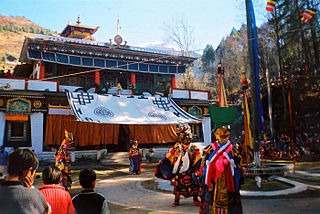
Lachung Monastery is a Nyingma Buddhist gompa in the Lachung Valley, Sikkim, northeastern India. It was established in 1880.

Mangan is a town and the headquarter of the district of Mangan District in the Indian state of Sikkim. The town lying near River Teesta is connected to the capital Gangtok by a metalled road. Mangan District is the largest district of Sikkim in terms of area. The town lies in the geographic south of the district. After the opening up of the district, Mangan has witnessed a spurt in its economy, mostly due to organic farming. The town opens up the Tibetan Plateau. Mangan also serves the towns of Lachung, Chungthang and Lachen in the far north. Owing to its elevation, the town enjoys a temperate climate.

Dikchu is a small town in the Gangtok District of the Indian state of Sikkim. The town lies at the confluence of the Dikchu River with the Teesta River and is the site of the 96 MW Dikchu River Hydroelectric Power Project as well as 510 MW Teesta V Hydroelectric Power Project. Dikchu is the last town of Gangtok District that lies on the North Sikkim Highway connecting Singtam to Chungthang, after crossing the town we enter Mangan District. Small market north of river Dikchu also lies on Mangan District.
Teesta Khangtse Glacier or Tista Khangtse Glacier is located in the north of Sikkim, India, in a region bordering Tibet. This valley glacier is the primary source of the Teesta River.
